Search
Items tagged with: OpenStreetMap
Unfortunately the #OpenStreetMap wiki is very slow today. We are fighting an aggressive web scraper bot. 10,000 of IPs involved. Randomised User-Agent. Ignoring robots.txt #aibot #ddos
Update: Fixed. We've been able to mitigate the bot traffic. #fail2ban
OpenStreetMap is the premier source of open geo data, allowing you to take control of your maps. Rather than relying on a handful of tech corporations based in USA, you can host your own maps.
Why not switch away from the handful of US tech companies, to your own maps today? 🙂
#OpenStreetMap
I'm excited to [re]introduce [Overpass] Ultra: https://www.openstreetmap.org/user/dpschep/diary/405539
#OpenStreetMap #gis #maplibre #geojson #gpx #kml #tcx #qlever #sparql #wikidata #rdf #ohsome
![🚀 [Re]Introducing Ultra v3 (née Overpass Ultra)](https://fika.grin.hu/photo/preview/600/460274)
🚀 [Re]Introducing Ultra v3 (née Overpass Ultra)
In January, I introduced Overpass Ultra v2 and then in June I provided some updates. Today Im excited to share that Overpass Ultra is now simply Ultra(v3) as it has evolved beyond simply being an Overpass client into a general purpose MapLibre GL JS …OpenStreetMap
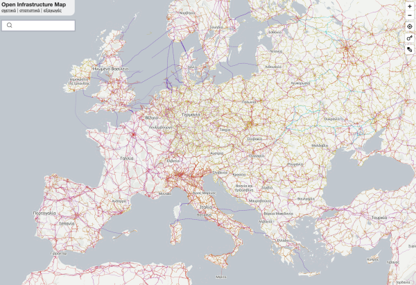
Translations in German, French, and Greek are mostly complete and now live (language is selected based on your browser language). The basemap labels are also now selected based on language.
If you want to translate to your language, you can create a new translation on Weblate!
https://hosted.weblate.org/engage/open-infrastructure-map/
Get involved in Open Infrastructure Map!
Open Infrastructure Map is being translated into 8 languages using Weblate. Join the translation or start translating your own project.Hosted Weblate
OpenStreetMap data powers The Washington Post's story about the size and territory of supermarket chains in USA.
OSM is more than a map, we're a database. Everyone (incl you!) gets the same full access to the data, for free. And if it's incorrect, you can fix it immediately. We love to see new and surprising uses of OSM data like this.
What will you create with OpenStreetMap?
https://www.washingtonpost.com/business/interactive/2024/grocery-store-owners-map-kroger-albertsons-merger/
#OpenStreetMap #OSM
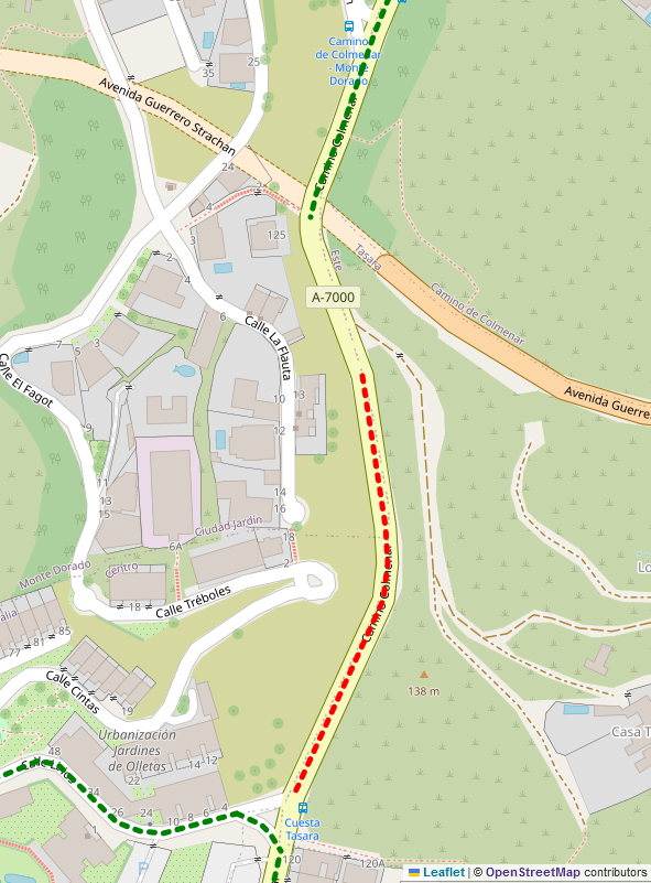
I'm looking forward to changing the OSM tagging on one of the most infamous stretches of "sidewalk=no" in this city.
This segment of Camino de Colmenar is only about 200m long, but requires pedestrians to walk through a narrow ravine on a busy road or in a drainage channel.
After nearly 20 years of campaigning by local residents, today's newspapers report that work has started to construct a sidewalk on one side.
El Camino del Colmenar deja atrás mucha inseguridad vial
«Esto era jugarse la vida; yo me metía dentro del canalón pero estaba lleno de porquería», recuerda Reme Jiménez.Alfonso Vázquez (La opinión de Málaga)
#openstreetmap #osm
I have used mapy.cz for walk/hike online planning but they started forcing ads and blocking adblockers, so it's time to move on.
Do you know any good OSM based walking path planner with stable, responsive and easy to use UI? I know several ones with clunky UI but mapy.cz was pretty smooth to use, maybe there are hidden gems around.
osmc coloring is extremely preferred...
Thanks!
📢What is the #OpenStreetMap Foundation again? 🤔
Nadaraj Saranya, OSM Sri Lanka community member and #OSMF members can answer your question!💡 🗺️
Join ✍️https://supporting.openstreetmap.org/#Membership-Categories
🎯Would you like to help us grow and diversify🌍🌏🌎 #OSMF members? 👉 https://blog.openstreetmap.org/2024/03/12/call-to-action-help-us-grow-and-diversify-osmf-membership/
Openstreetmap Austria will be taking part in the Graz Linux Days again this year. Come to our information stand, we look forward to talking to you.
As always, there will be a #josm workshop on Friday.
A wystarczy nie używać map google...
Na #openstreetmap taki numer nie przejdzie bo można sobie ustawić powiadomienie np przez rss o zmianach jakiegoś obszaru albo elementu i szybko ew. szkodnikom blokować konta.
Ich bin auf der Suche nach Leuten, die OpenStreetMap Hackathons oder -weekends in Deutschland organisieren, um Unterstützung anzubieten.
Weiß da jemand was oder kennt wen?
Über 🔁 oder Hinweise freue ich mich!
#OSM #OpenStreetMap #Hackweekend #Hackathon #Mapping #BoostWelcome
Ouch. A large OpenStreetMap group has been using a proprietary chat platform as a community space for ~10 yrs. Now they gotta pay a $80k/yr (or $10k??) for usage. 🤯😱😢
Slack (now Salesforce) now wants to charge @OpenStreetMapUS for all ~6k users on their server. 😢😢 Ouch.
This sort of bait & switch is why open, community owned platforms (like this!) are vital!
read more on the slack (while you still can??!): https://osmus.slack.com/archives/C029HV951/p1705438543546349
#OpenStreetMap #OSM #FreeSoftware #Cassandra
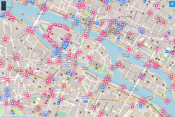
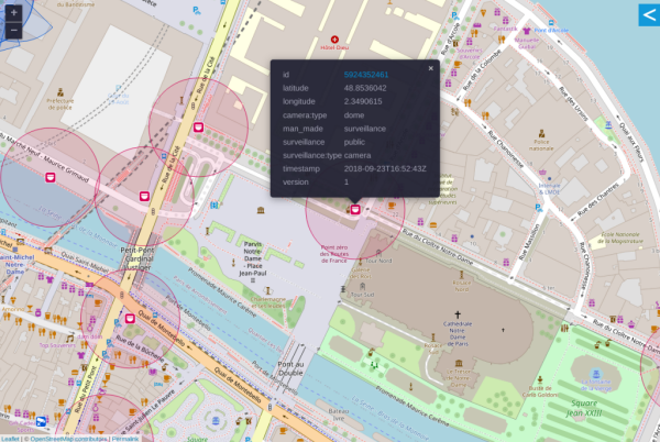
OpenStreetMap supports mapping surveillance cameras.
Cameras can be identified by location and type.
The area being observed can be disclosed.
Surveillance under Surveillance/https://sunders.uber.space is an OpenStreetMap instance focused on surveillance cameras, the data used is not visualized on the OpenStreetMap.org instance.
Website: https://www.openstreetmap.org
Mastodon: @openstreetmap
#OpenStreetMap #Surveillance #CCTV #Privacy #FacialRecognition #Tracking #BiometricData #VoicePrint #Gait
OpenStreetMap
OpenStreetMap is a map of the world, created by people like you and free to use under an open license.OpenStreetMap
wtf? Someone got banned from the #OpenStreetMap mailing lists for a week for saying “wtf”. The mods call it “an obscenity”.
🙄🙄🙄
There's currently a wave of bots trying to vandalize #OpenStreetMap by replacing names (and russian langauge names) with anti-russian slogans. The #OSM DWG has blocked 5,000+ accounts already
😢 This is not the way people!
e.g. <https://community.openstreetmap.org/t/how-about-limit-new-accounts/101656/49>
#Ukraine #Russia #RussianInvasion
How about limit new accounts?
In case people haven’t noticed, there’s another wave of vandalism ongoing. I’m in the process of blocking the accounts that I can identify (currently ~4500, but may increase), and a number of other people have reverted obviously problematic changese…OpenStreetMap Community Forum
The #OpenStreetMap Foundation spends, even with a slightly more ambitious budget this year than previously, less than %1 of what WMF/Wikipedia does, but is struggling to make ends meet.
There is no threat a la the infamous Wikipedia ads that the project will shut down, but without the funds activities will have to be cut back significantly.
If you consider OSM valuable consider https://supporting.openstreetmap.org/
🙄
<https://supporting.openstreetmap.org/>
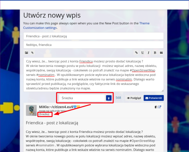
Friendica - post z lokalizacją
Czy wiesz, że... tworząc post z konta Friendica możesz prosto dodać lokalizację ?
W oknie tworzenia nowego postu, w polu lokalizacji możesz wpisać adres, nazwę obiektu, współrzędne, swoją lokalizację - cokolwiek co potrafi znaleźć na mapie #OpenStreetMap wyszukiwarka #nominatim . W opublikowanym poście wybrana lokalizacja będzie widoczna pod nazwą konta, które publikuje a link wskaże właśnie na serwis nominatim. Dlatego warto sprawdzić przed publikacją, na podglądzie, czy faktycznie link do wskazanego obiektu/adresu będzie znaleziony na mapie.
1. Docker containers (including kitchen sink)
2. Java based applications (brrr Java, brrr tomcat)
3. Old school compile yourself manual (make files are sometimes seen as unnecessary modernisms) (here’s a 1000 lines wiki page with a million options)
Rarely you see the here’s-the-Linux-distribution-of-choice-package (or Windows or MacOS)…
Beide Hashtags habe ich auch so abonniert.
Nun ist mir aufgefallen, dass bei den beiden abonnierten Hashtags plötzlich mehr Beiträge auftauchen. Eben seit ich das per RSS abonniert habe. Vergleiche ich das RSS und das Hashtag Abo, dann steht dort auch dieselbe Empfangs-Zeit.
Tauchen RSS Feeds somit auch automatisch auf Friendica/anonsys auf, wenn diese vorher noch nicht über einen Relay empfangen wurden?
!Friendica Support
We value openness in #OpenStreetMap. 🙂
OpenStreetMap (@openstreetmap@en.osm.town)
272 Posts, 1 Following, 5.97K Followers · OpenStreetMap is the free editable map of the whole world. It is made by people like youEn OSM Town | Mapstodon for OpenStreetMap
This place so far wins by being mapped three times.
But: currently (well as per the last hour) we are at 1'992'018 contributors to OSM (contributor as in actually made an edit).
New mapper influx has been at 12-13'000 the last couple of months so mid July is a good bet for 2'000'000. We went over 1'000'000 back in December 2017 so it will have taken 5 1/2 years for this step up. #OpenStreetMap
My version shows a very profiles (horse riding!), and apparently a way to import a profile. Is there anything for hiking?
#OpenStreetMap #OSM #maps #wandern
https://revert.monicz.dev/
announcement & chat: https://www.openstreetmap.org/user/NorthCrab/diary/400706
#OSM
NorthCrab's Diary | osm-revert: A faster and smarter way to revert changesets on OpenStreetMap | OpenStreetMap
OpenStreetMap is a map of the world, created by people like you and free to use under an open license.OpenStreetMap
🙄🙄🙄
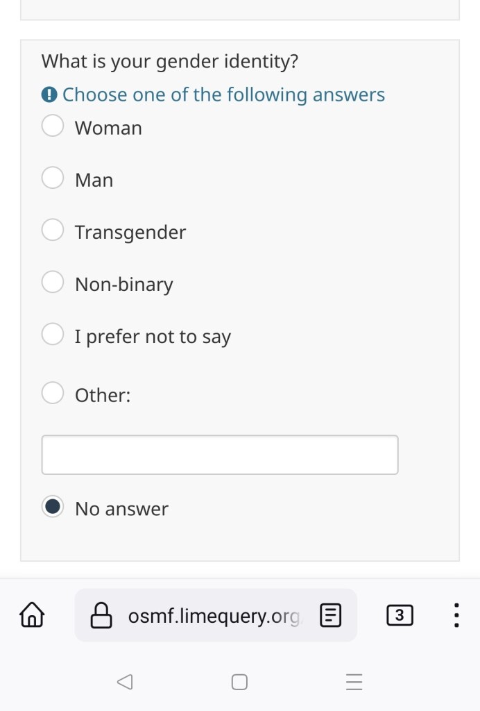
#OSM #gender #queer #trans #survey #TheCisAreAtItAgain
Just discovered the existence of StreetComplete, an mobile app that transforms #OpenStreetMap knowledge gaps into quests you can undertake yourself around where you are.
Unfortunately for me it's only on Android through the Google Play Store or the F-Droid repository.
 https://en.osm.town
Their official description: "An independent community of OpenStreetMap people on the Fediverse/Mastodon. Funding graciously provided by the OpenStreetMap Foundation."
You can find more map-themed servers at https://fedi.garden/tag/maps-and-geospatial
#FeaturedServer #Fediverse #OpenStreetMap #Mapping #Maps

En OSM Town | Mapstodon for OpenStreetMap
An independent, community of OpenStreetMap people on the Fediverse/Mastodon. Funding graciously provided by the OpenStreetMap Foundation.Mastodon hosted on en.osm.town

