Search
Items tagged with: art
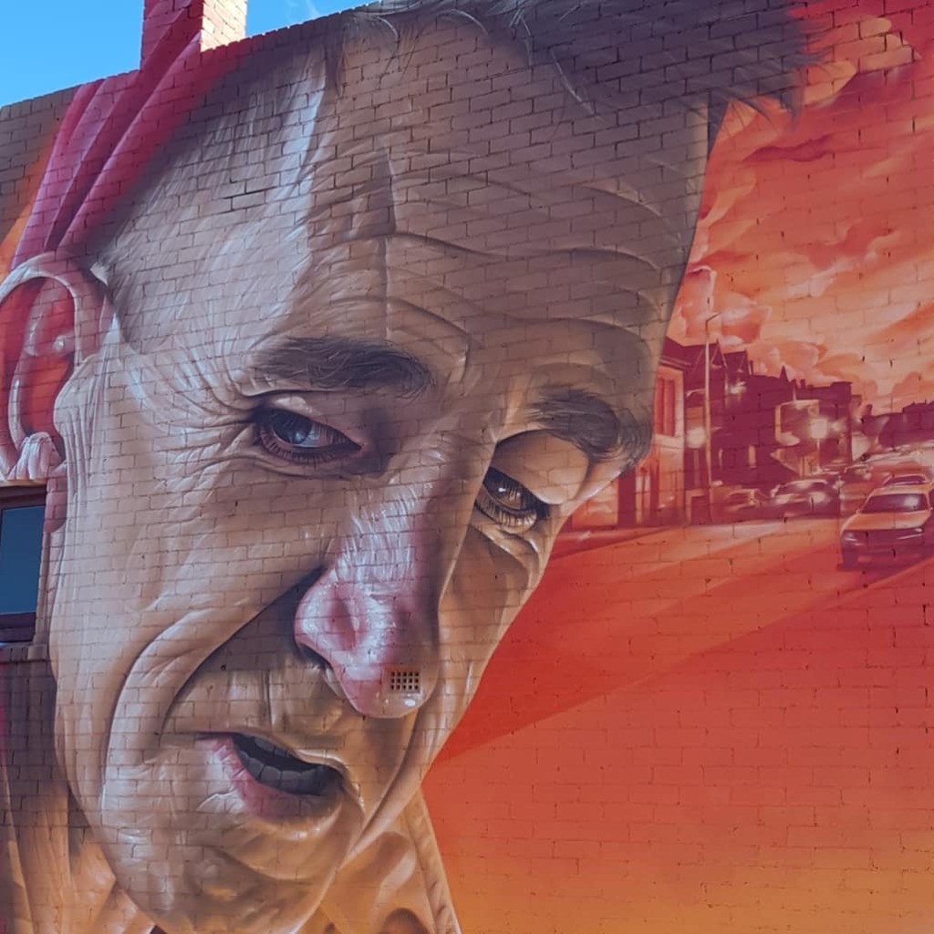
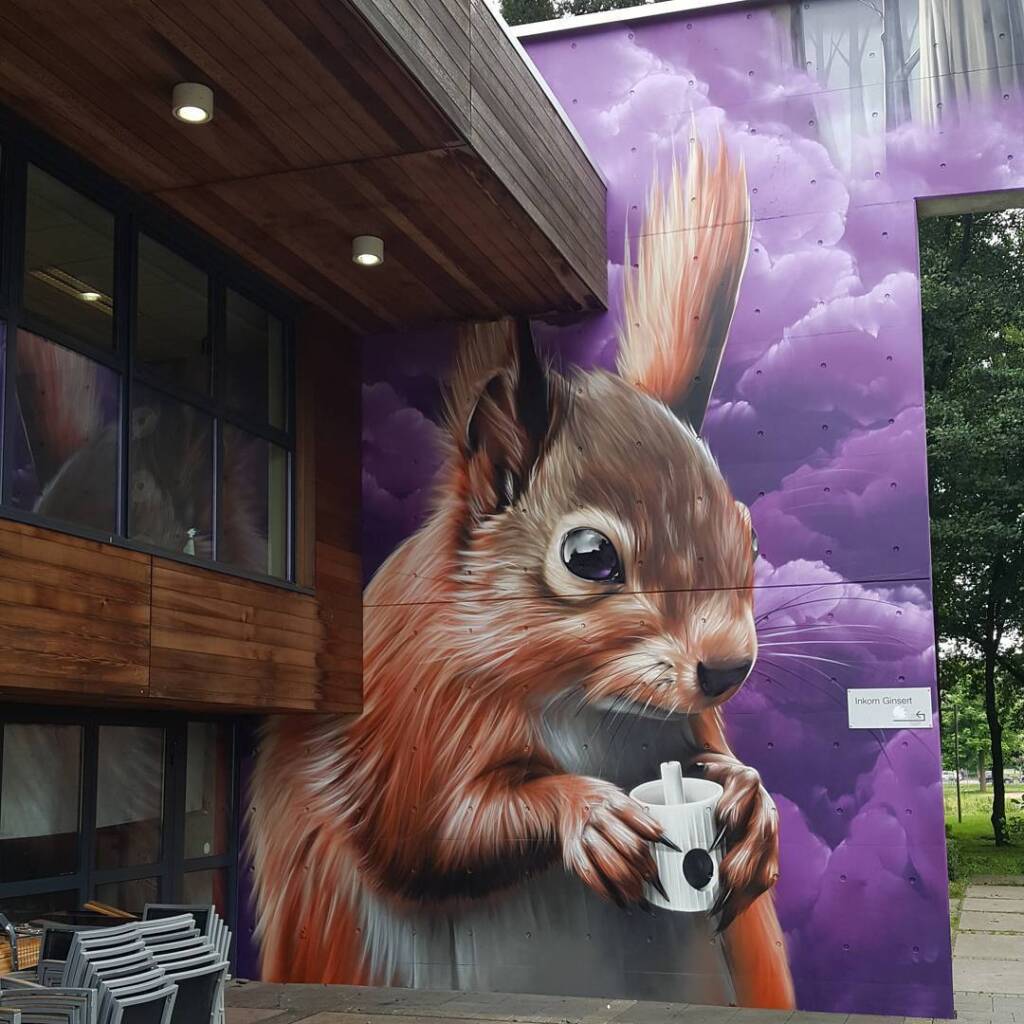
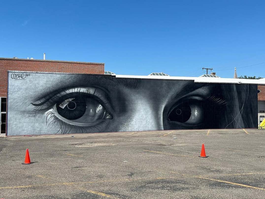
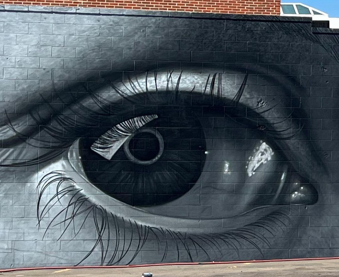
The eyes – Mural by Cobre in Great Falls, Montana, USA
Content warning: Street Artist Cobre By the Argentinian based muralist Cobre in Great Falls, Montana, USA for Arts Fest Montana curated by CAMER1sf. Cobre: It's so easy to get lost in his gaze, because I love his eyes. They are brown. Black coffee, without sugar… That cof


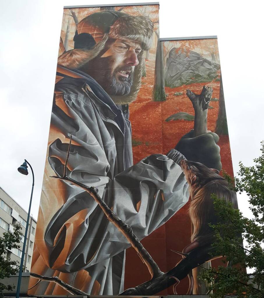
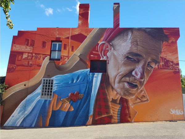
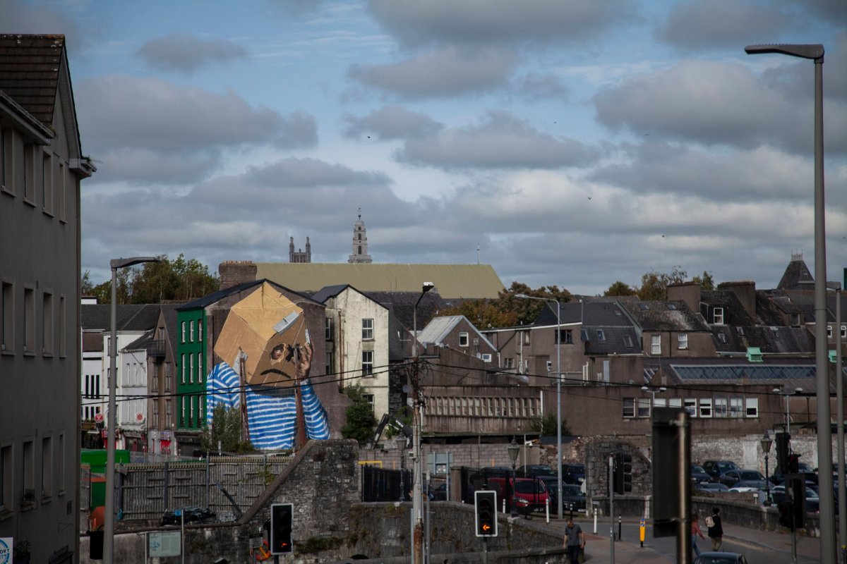
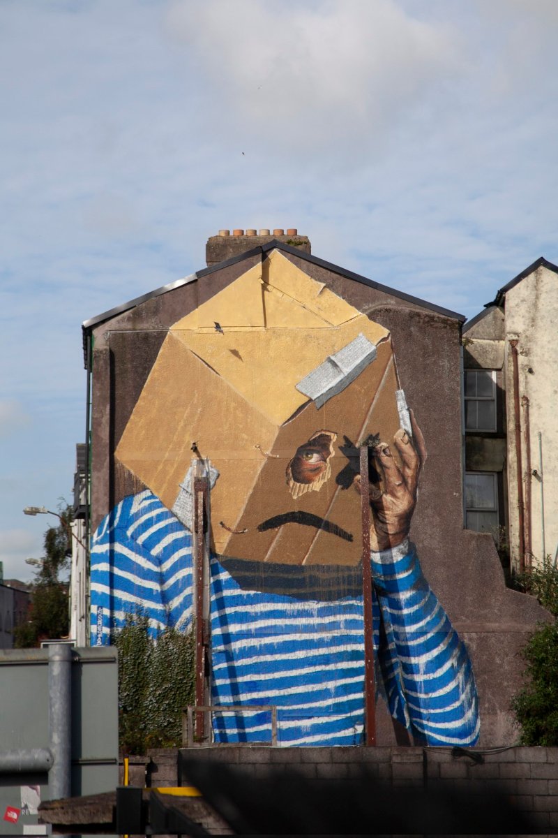
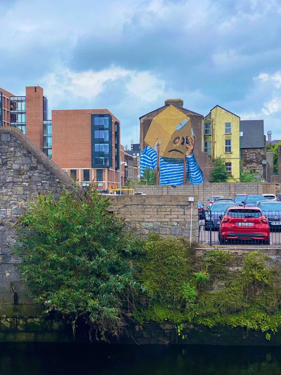
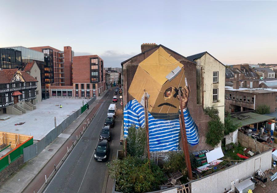
What is home? Mural on the housing crisis in Ireland
Content warning: Street Artist Asbestos By Asbestos for Ardú Street Art Project in Cork, Ireland. Asbestos: The piece is me asking ‘What is home?’. Do you have one, is it safe, can you afford it? Never as a country has our sense of what home means been more at threat. I p
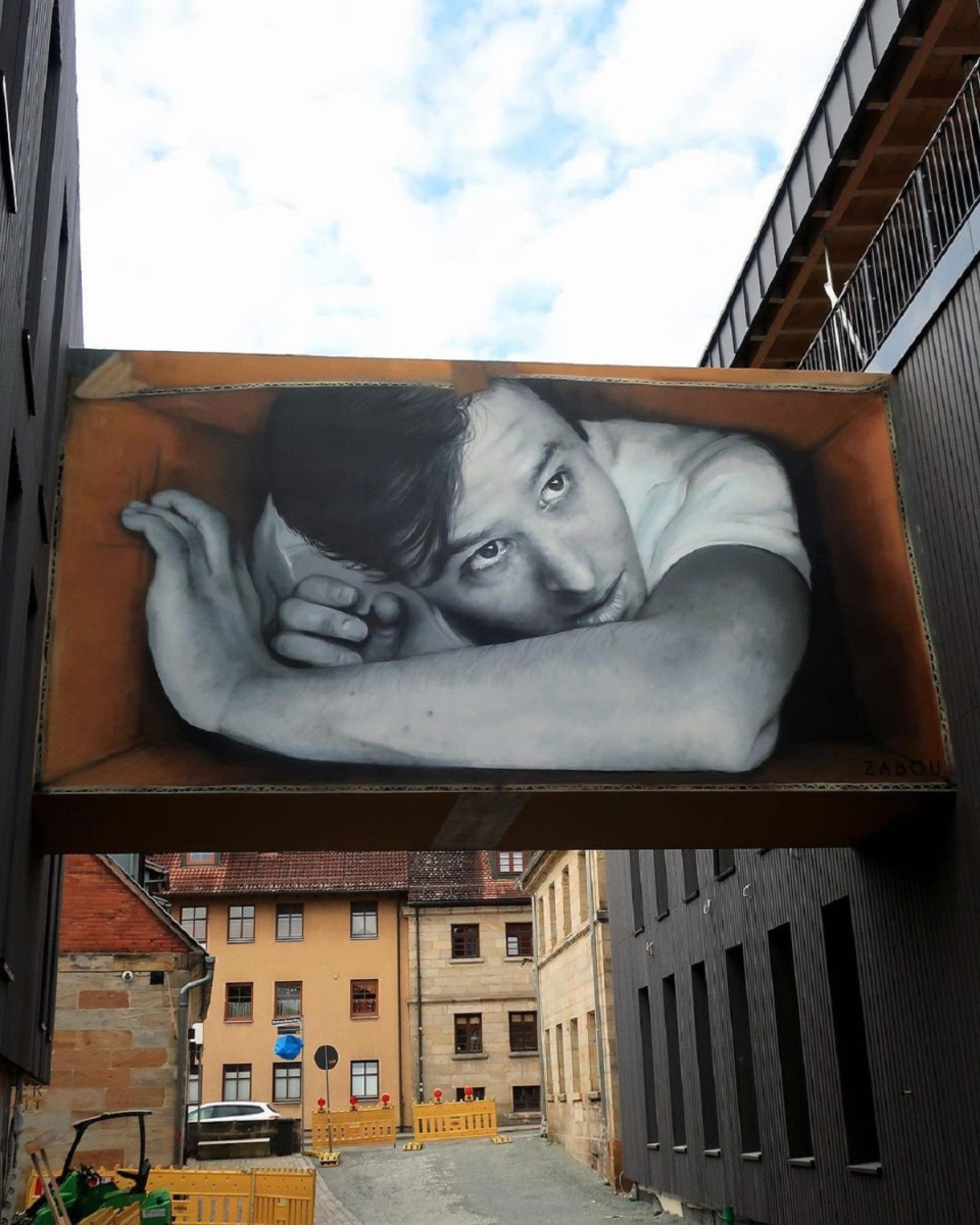
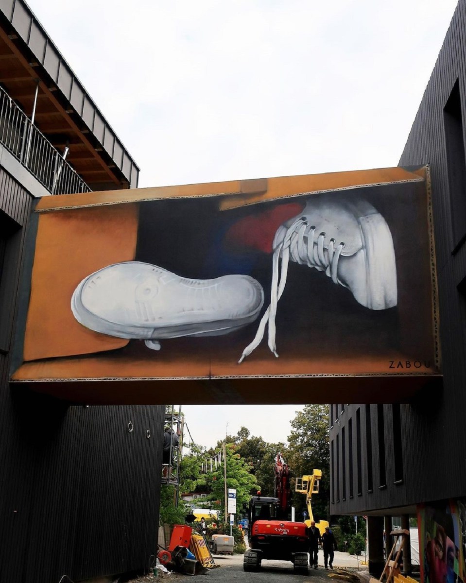
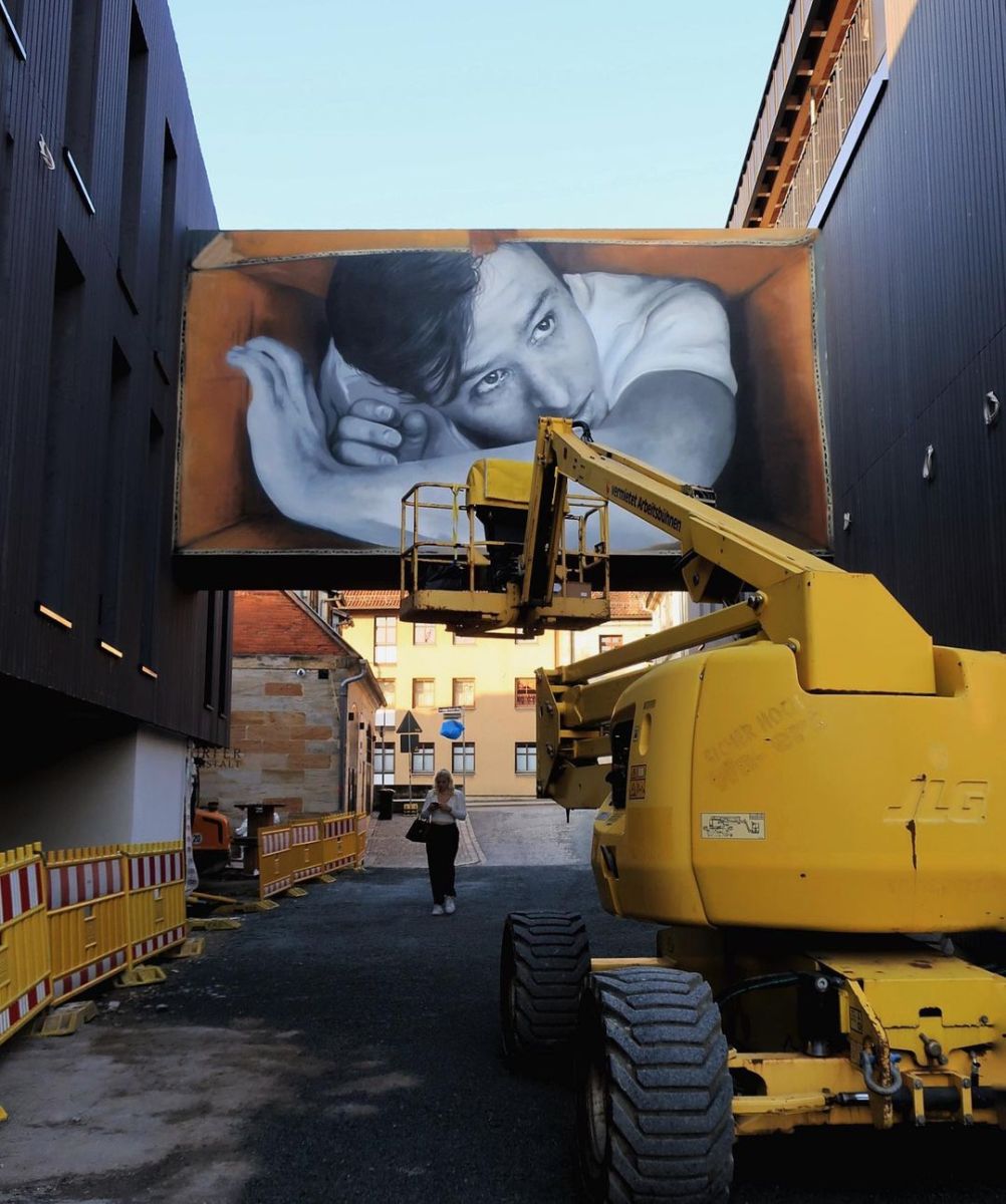
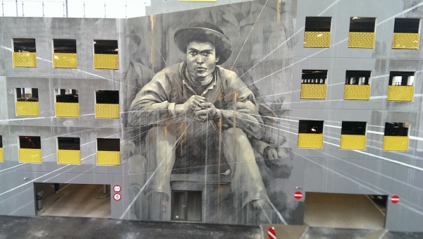
“The Box” street art by ZABOU in Bayreuth, Germany (12 photos)
Content warning: Street Artist ZABOU "The Box" by ZABOU in Bayreuth, Germany. Curated by HERA. More by ZABOU on Street Art Utopia. The building is still a construction site and will officially open in 2022 with more murals by tons of amazing artists. ZABOU: Sometimes you


HELL IS ROUND THE CORNER
Content warning: Photo by Barbara B Street Artist Bifido By Bifido at Viale Giosuè Carducci, 33 in Gambettola, Italy for Bosco – Urban Art Project. Bifido (direct translation): This wall belongs to an old abandoned tobacco factory. For years, people of all sexes and ages
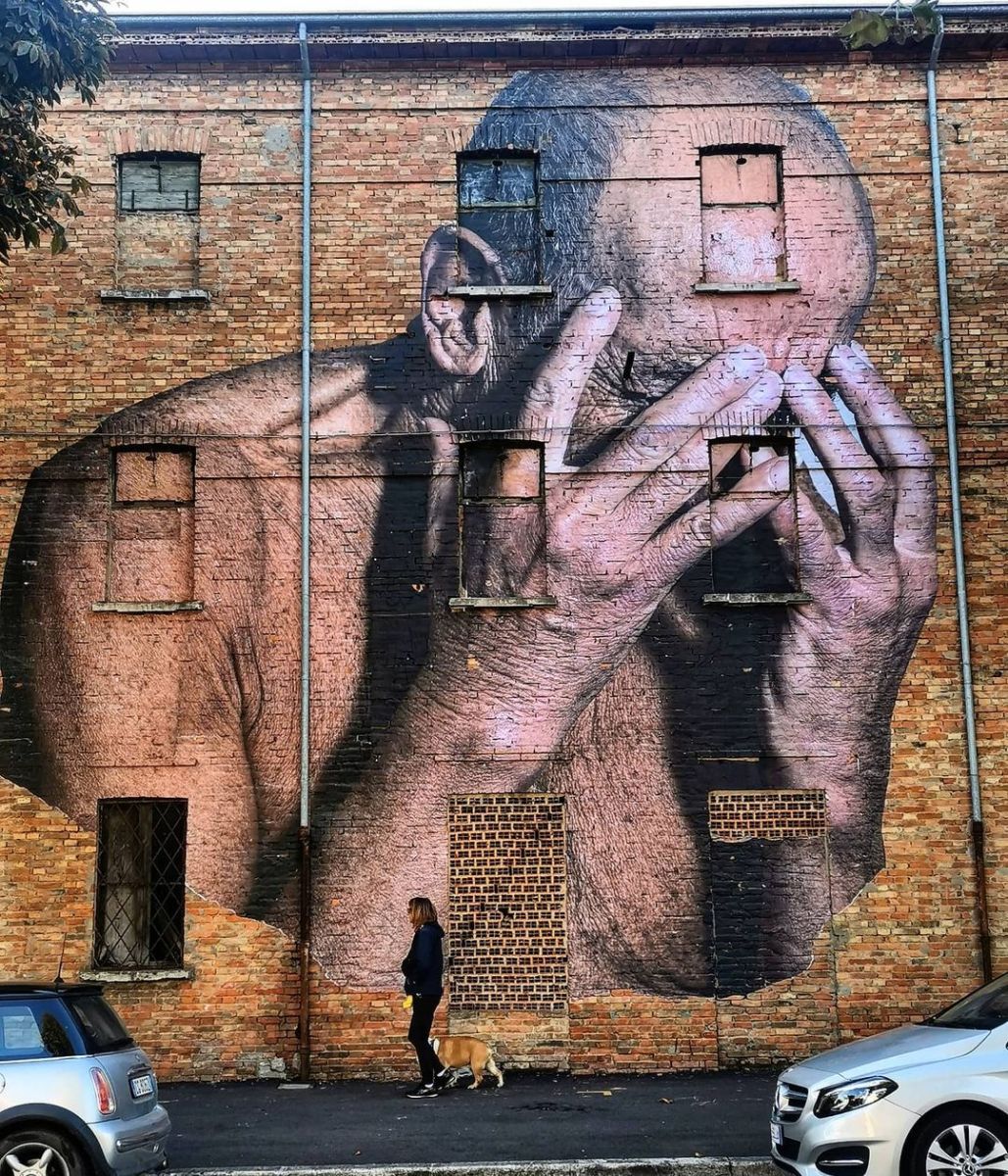 Photo by
 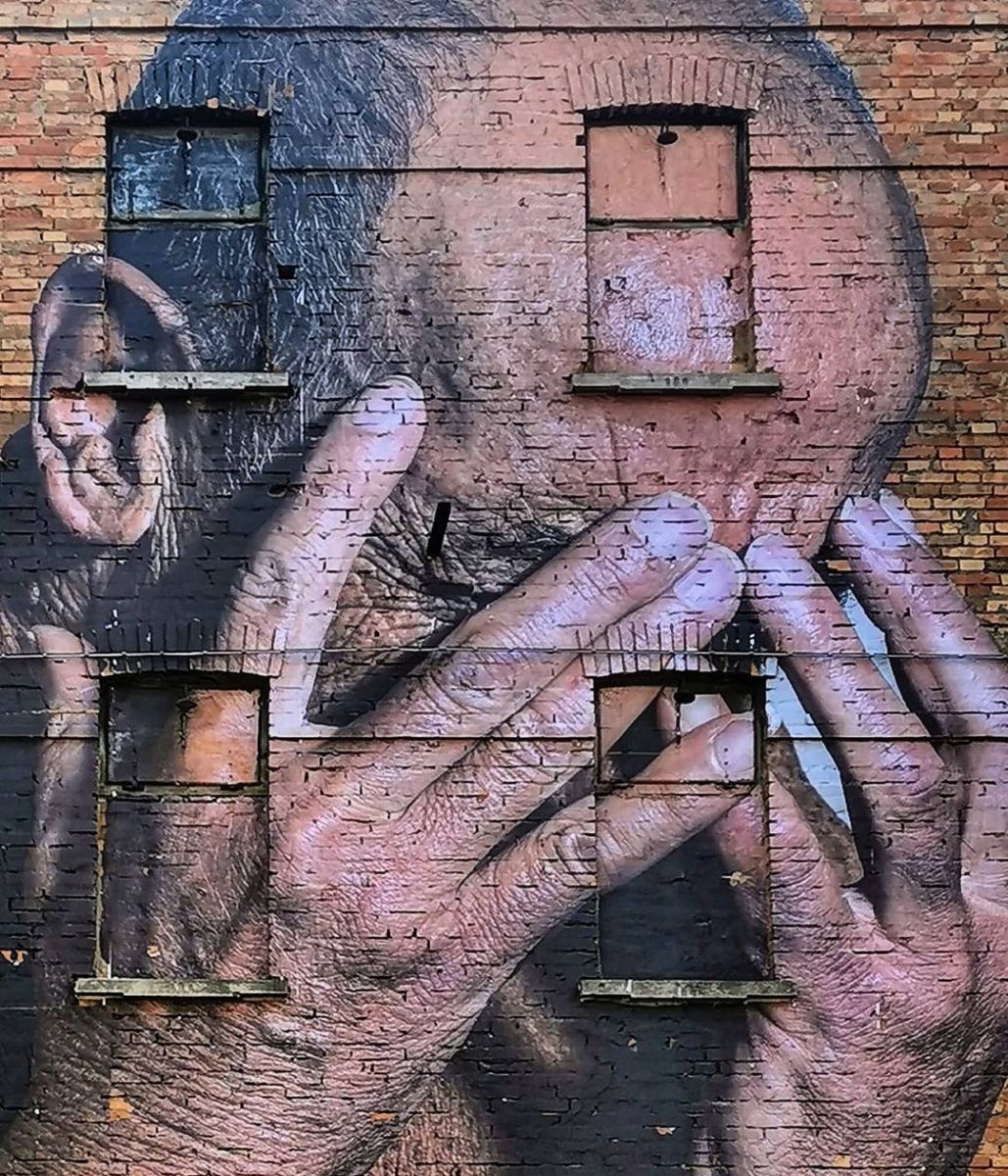 Photo by
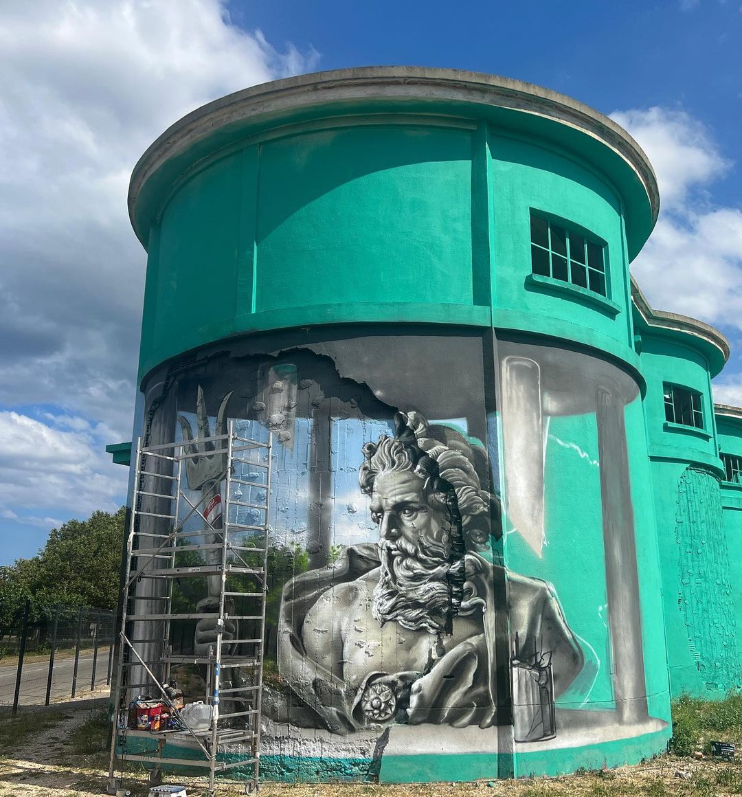
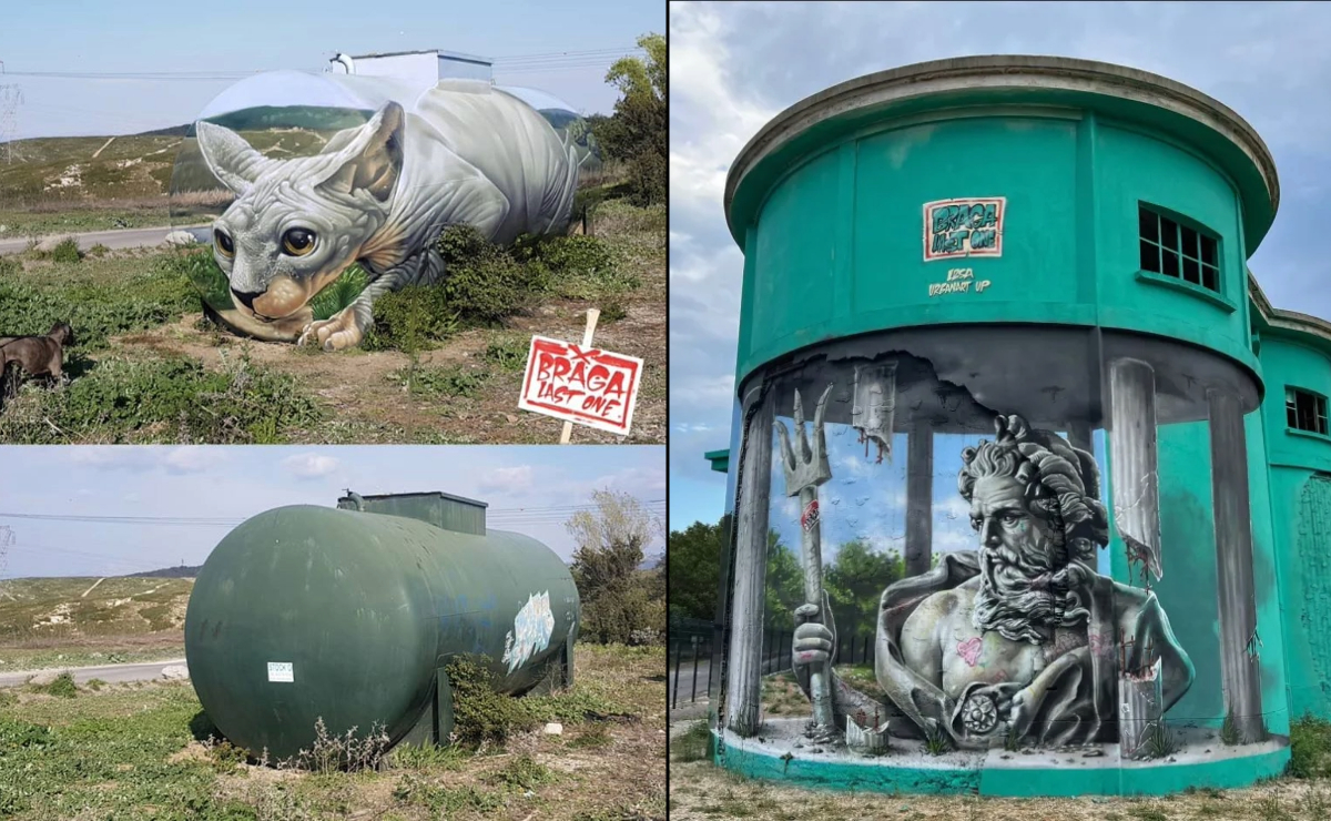
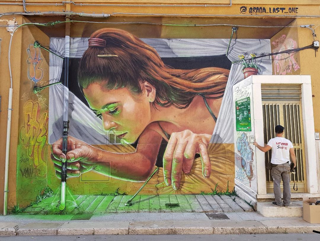
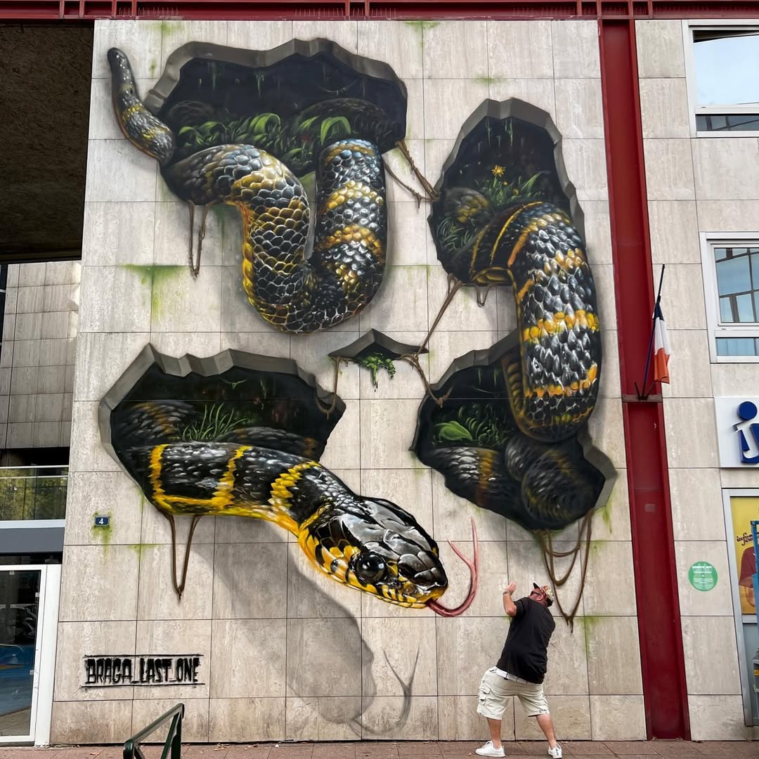
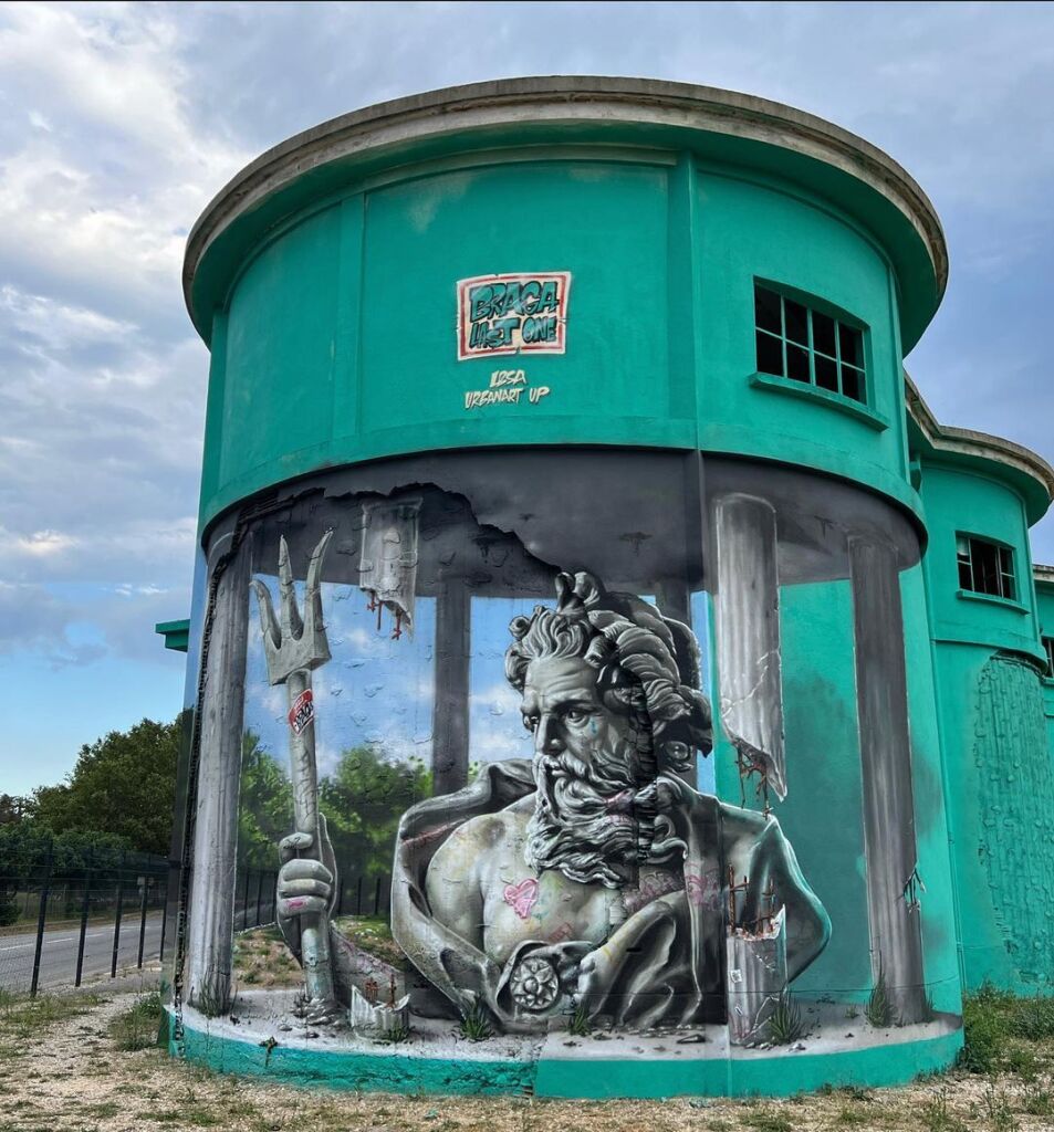
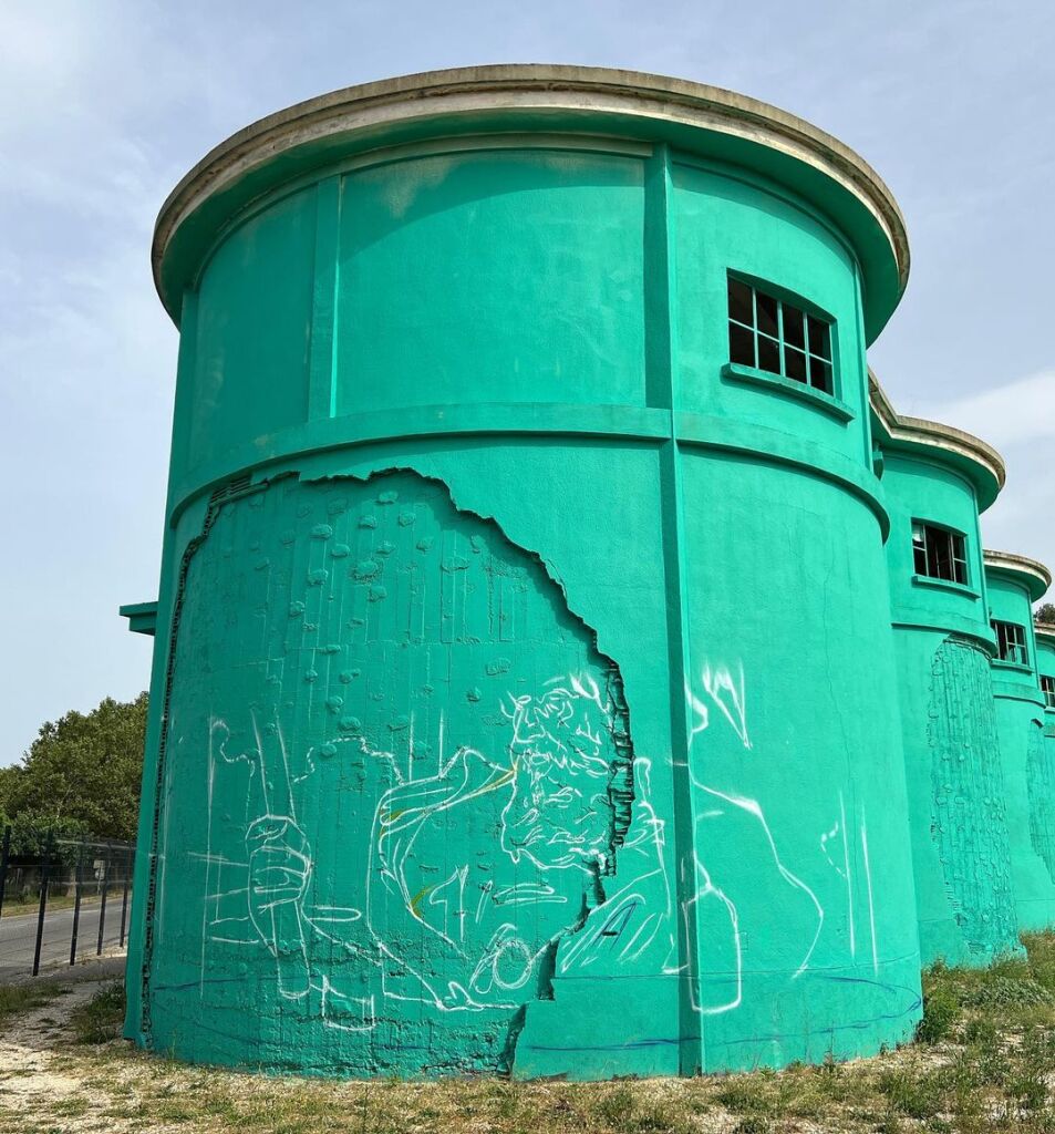
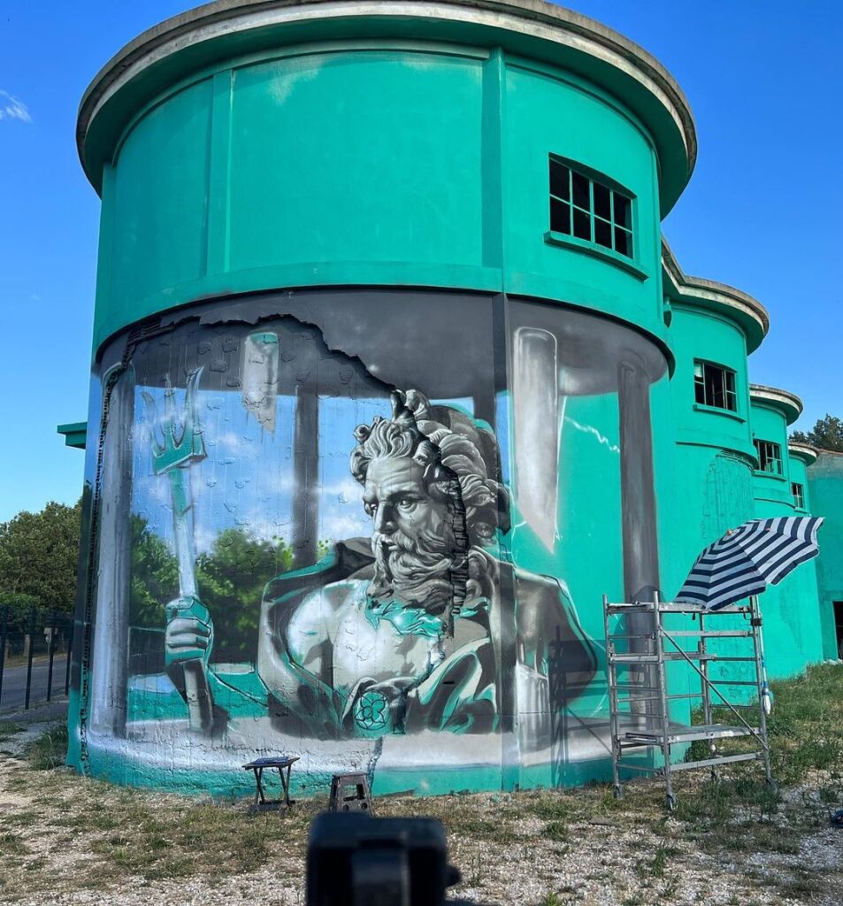
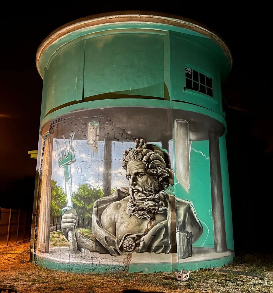
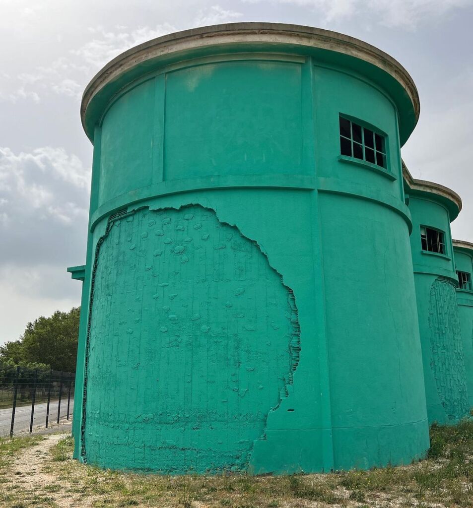
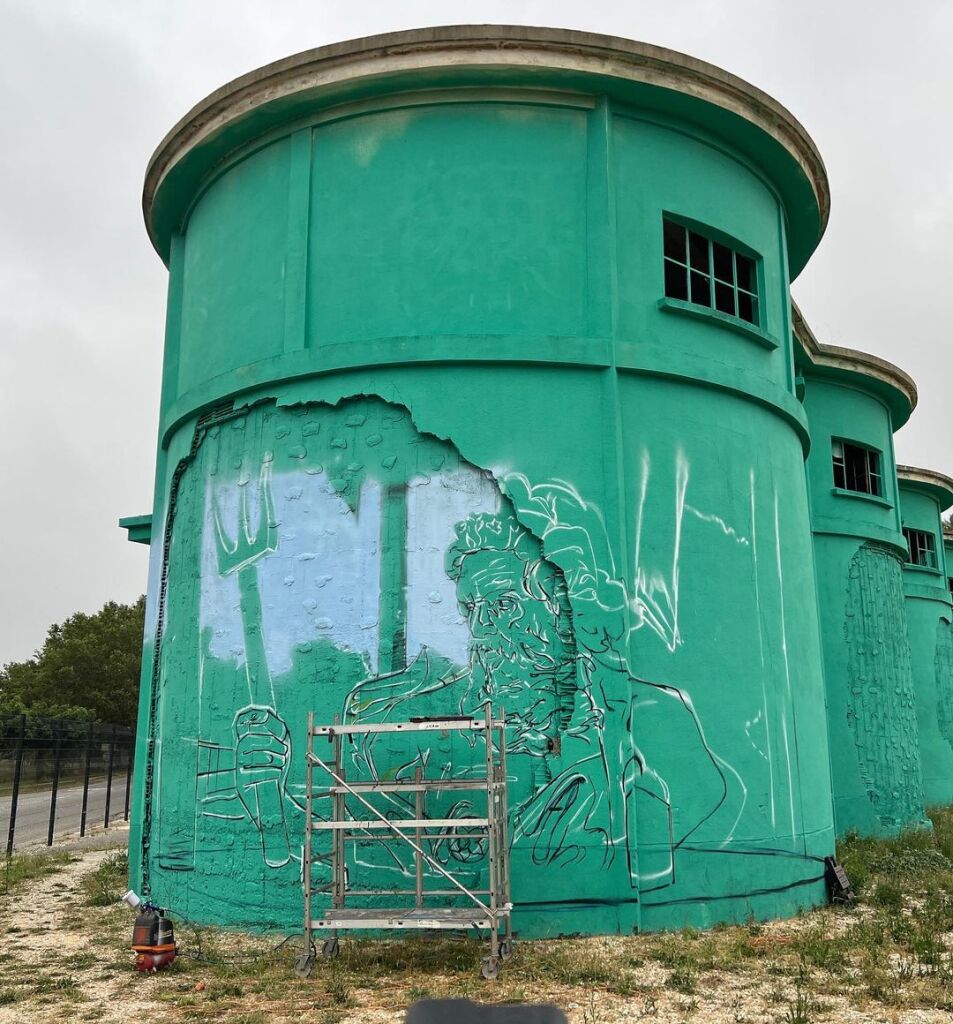
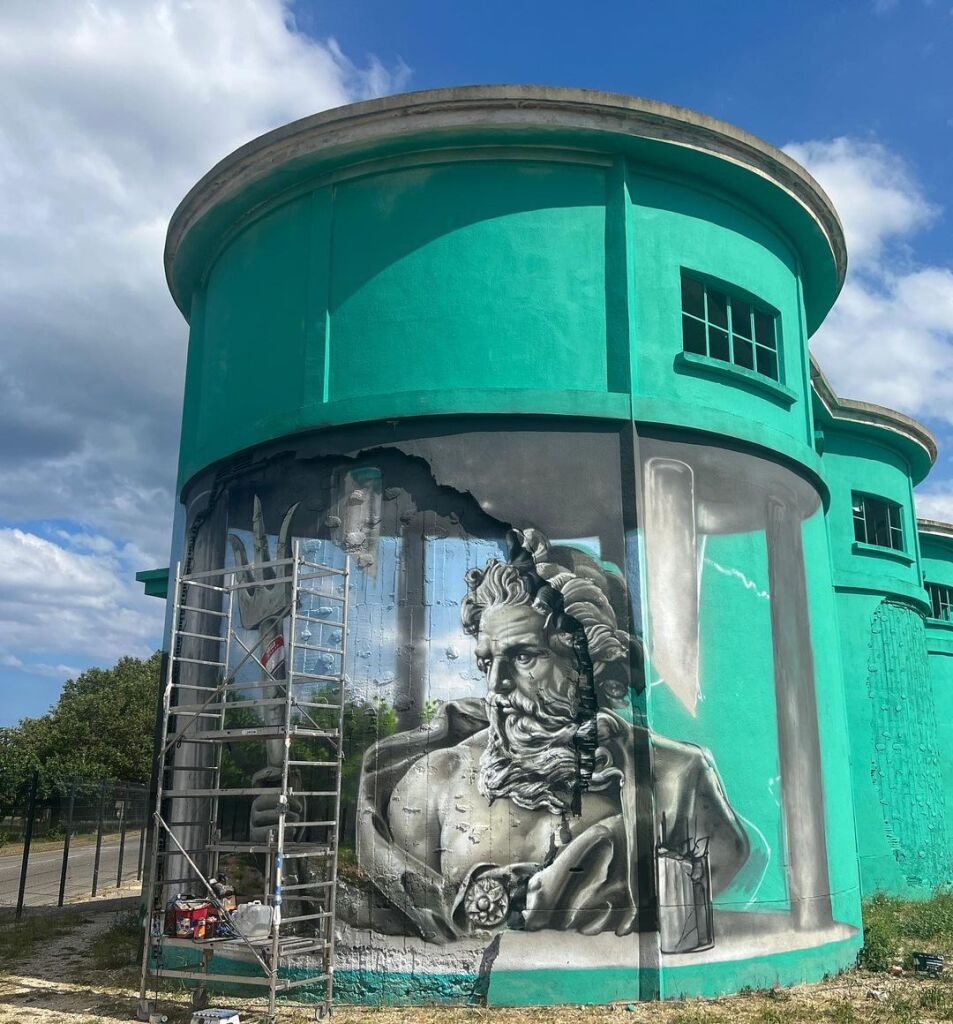
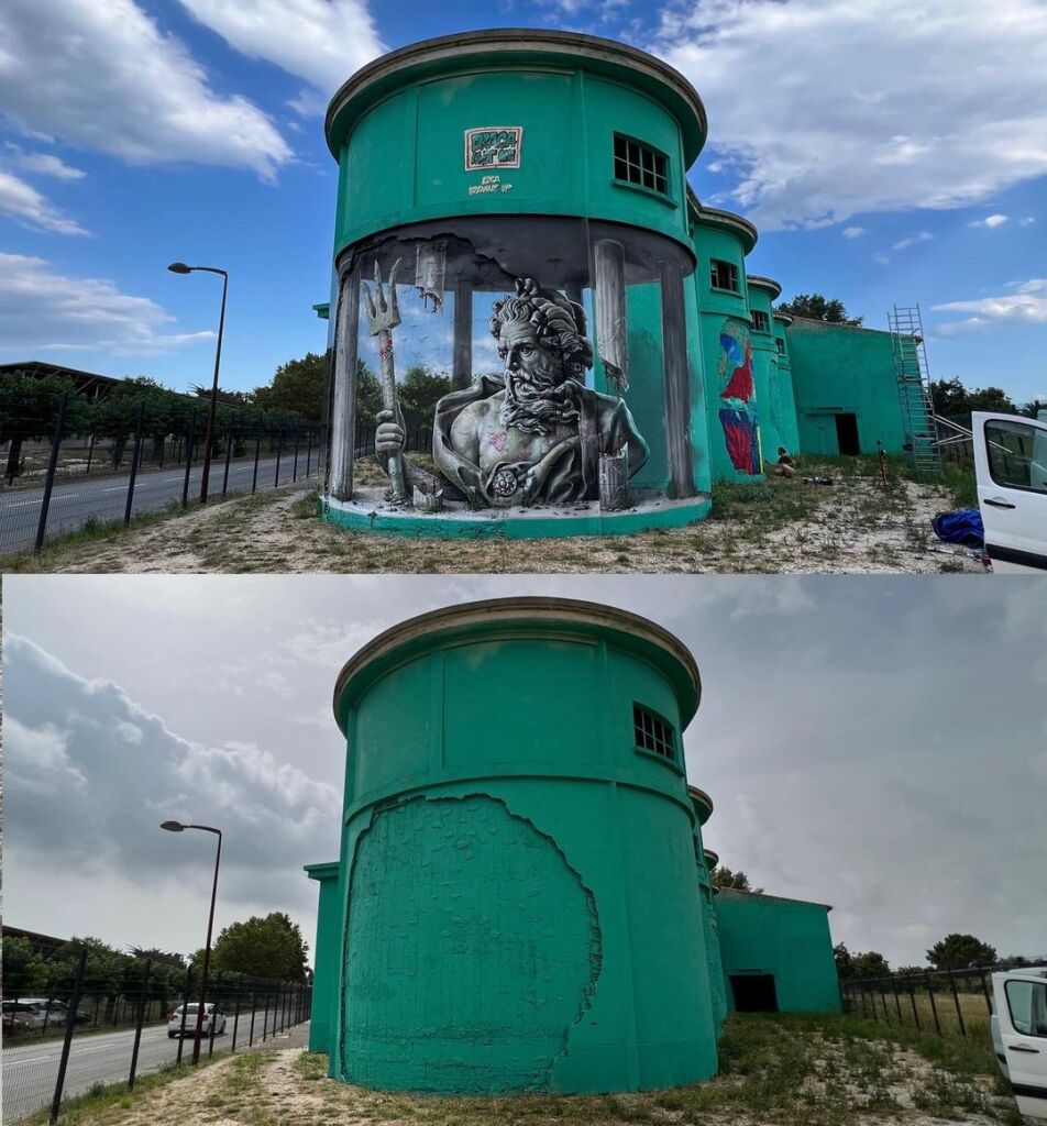
From Blank Wall to Masterpiece: The Stunning Creation of a Poseidon Mural in Torreilles
Content warning: Street Artist Braga Last One Anamorphosis mural on ancient Greek sculpture of Poseidon by Braga Last One in Torreilles, France for FESTIVAL LES BILLES S'AGITENT. In the heart of Torreilles, France, the urban landscape is transformed by a striking mural th


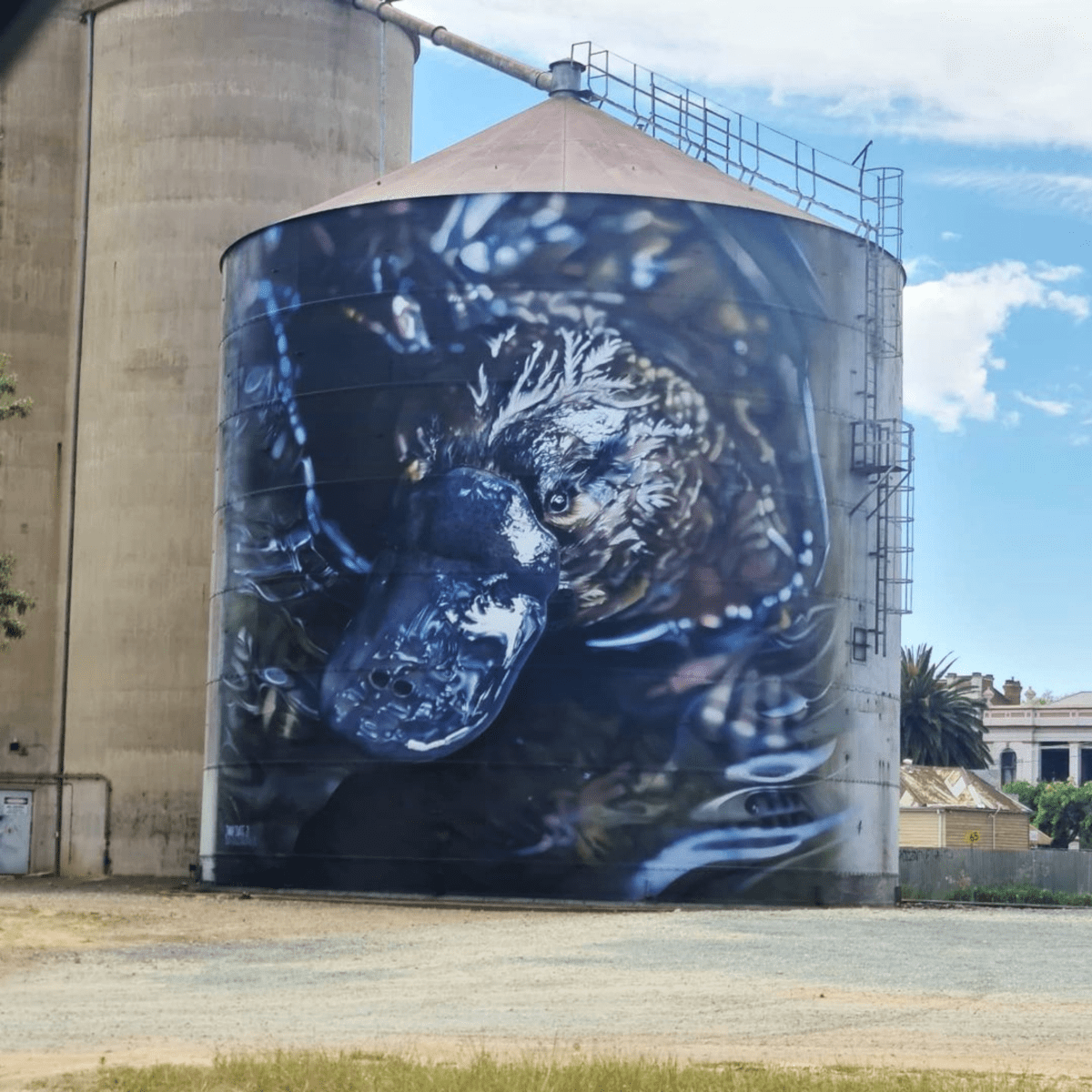
7 pics: Platypus – Mural by Jimmy Dvate in Rochester, Australia
Content warning: Photo by NATHANCCP Street Artist Jimmy Dvate By Jimmy Dvate in Rochester, Victoria, Australia. The mural is based on a photo by Pete Walsh / Hobart Rivulet Platypus. Jimmy Dvate: Recently spent 3 weeks back in awesome Rochester painting a third silo. So g
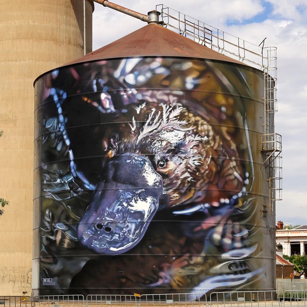 Photo by
 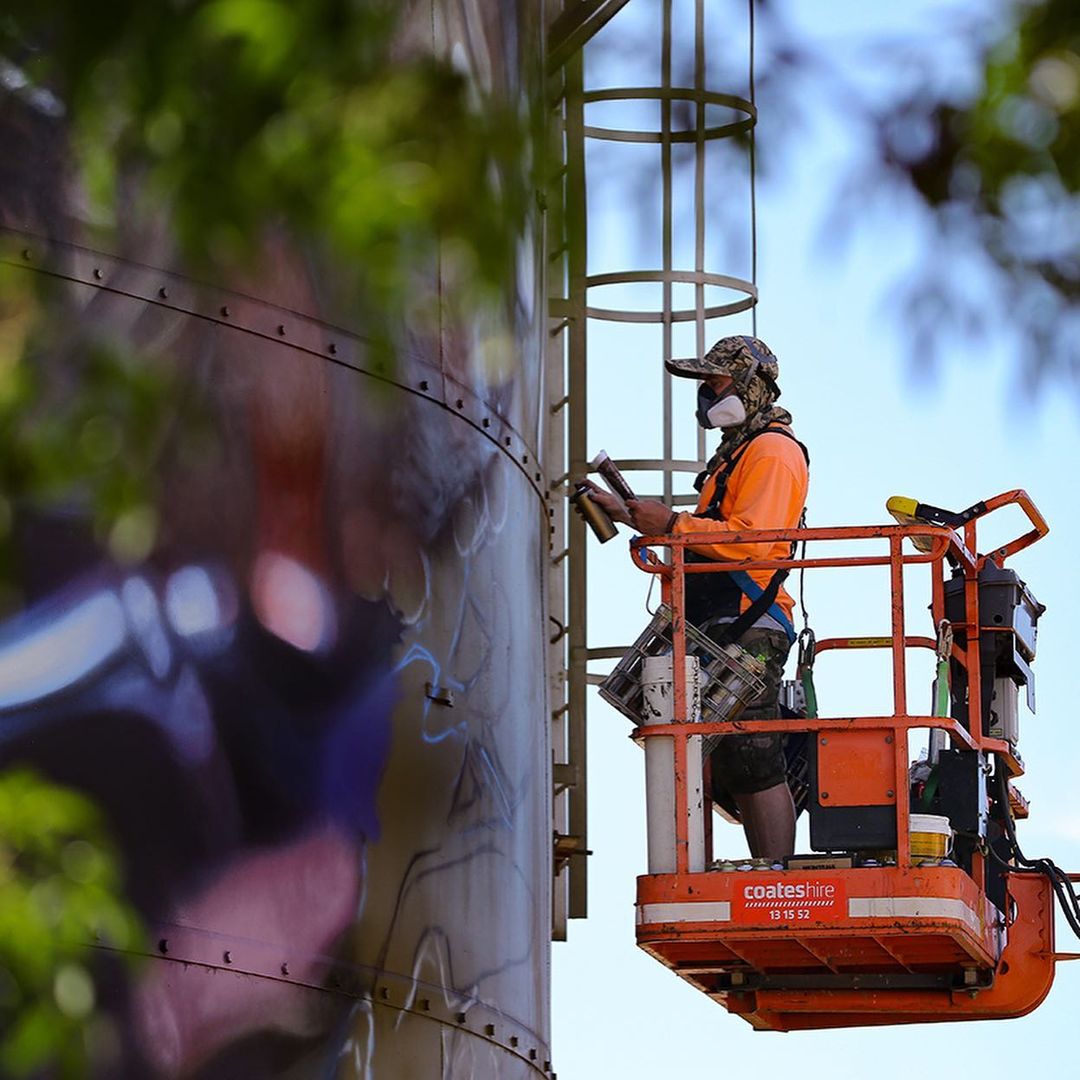 Photo by
 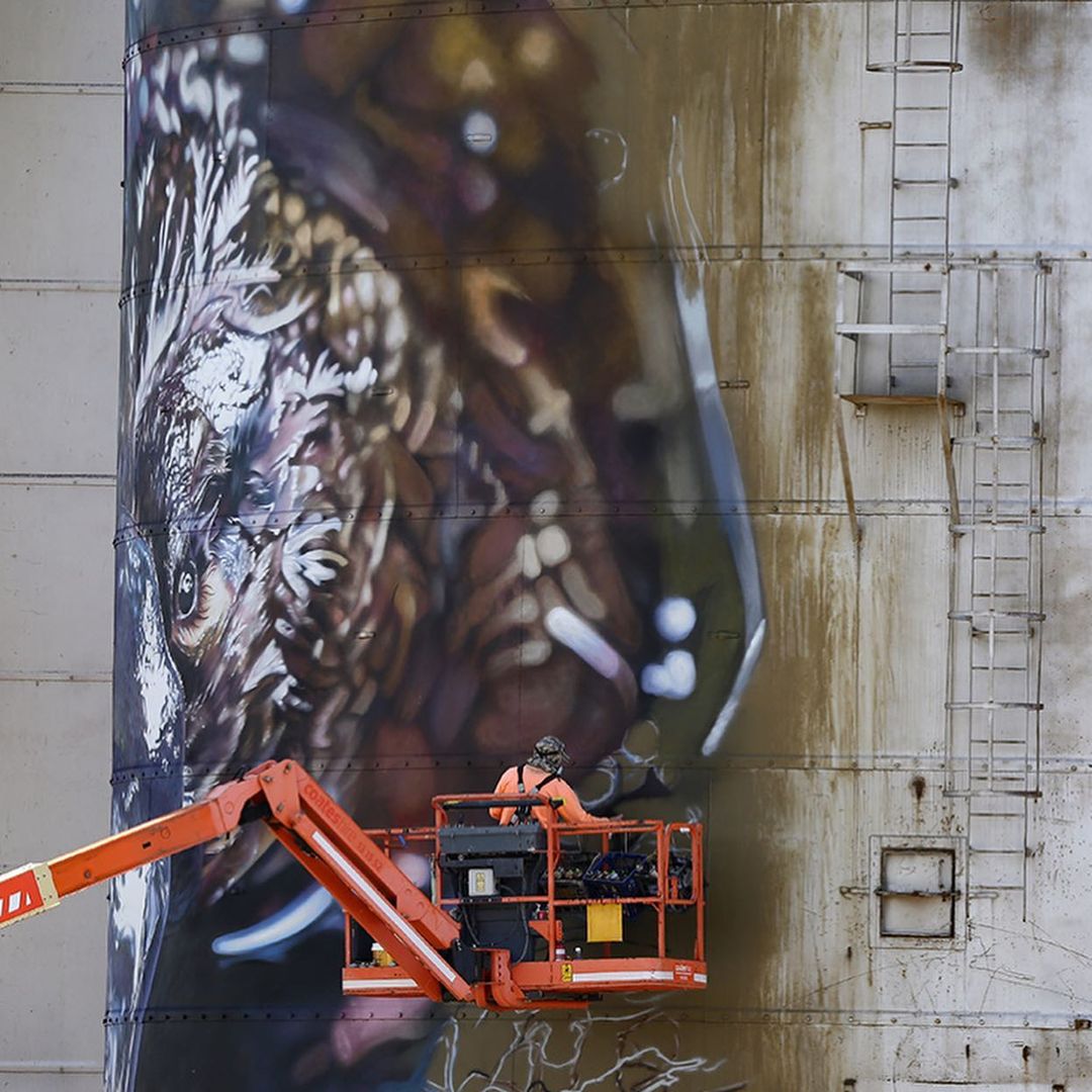 Photo by
 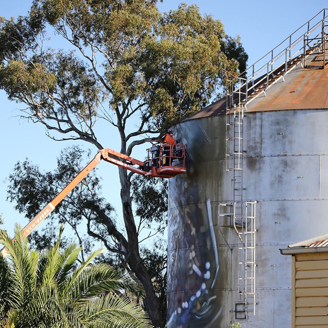 Photo by
 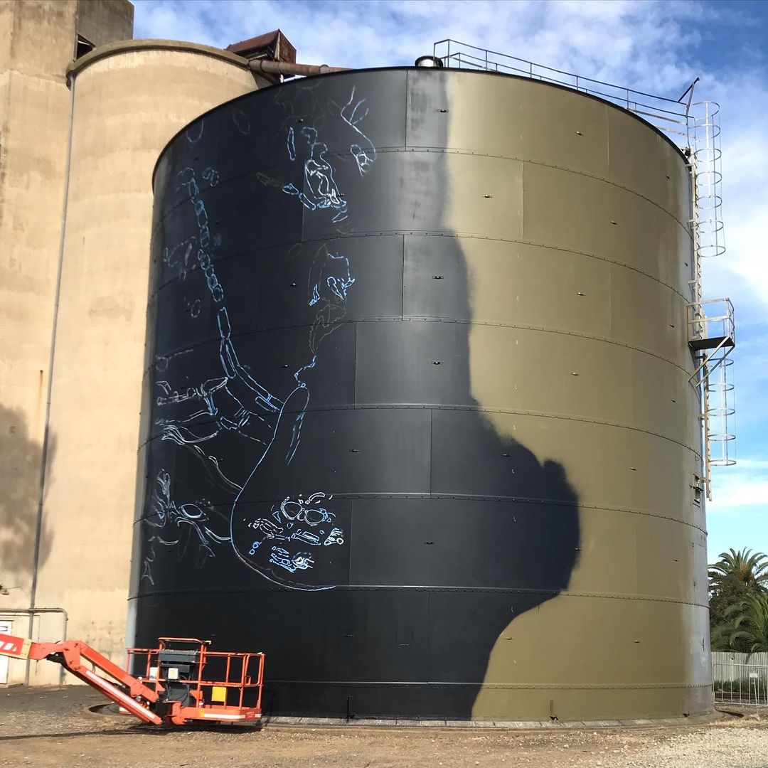 Photo by
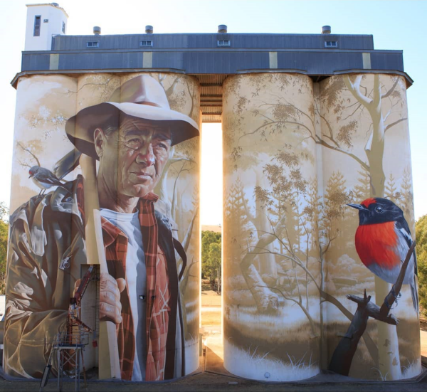
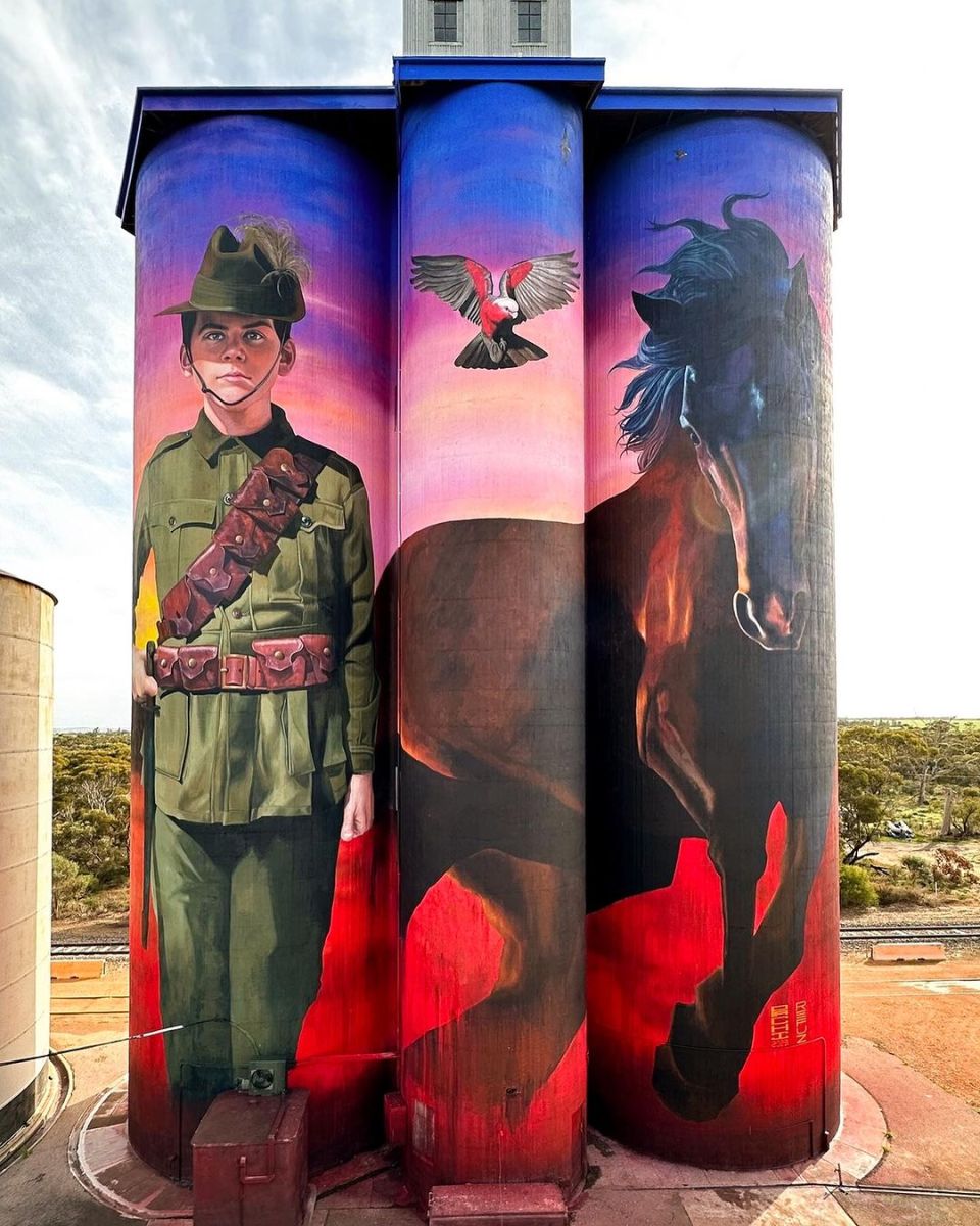
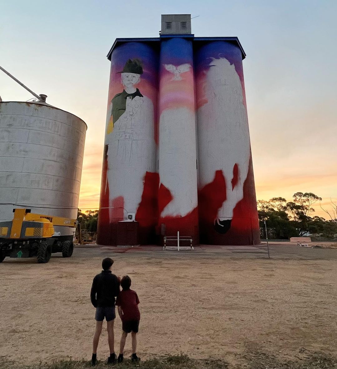
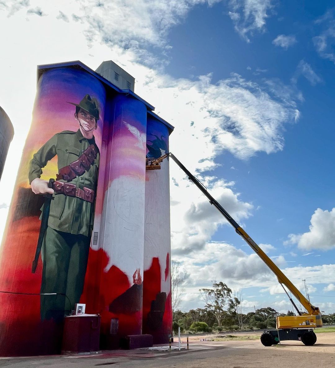
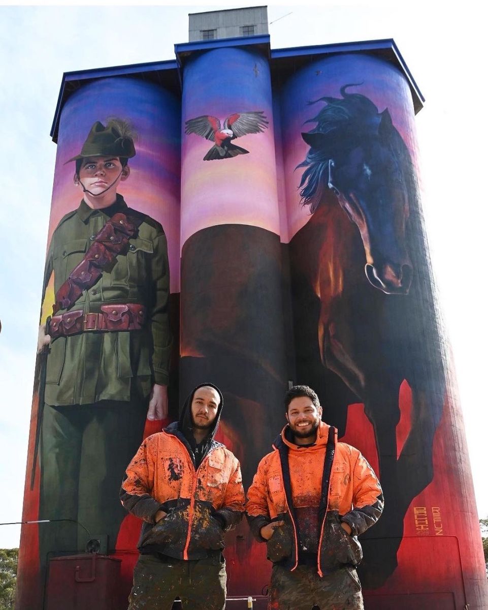
Tribute to Harold Thomas Bell – Silo Art by Julian Clavijo and Camilo Delgado in Walpeup, Australia
Content warning: Muralists Julian Clavijo and Camilo Delgado By Julian Clavijo (PACHI) and Camilo Delgado in Walpeup, Australia. About the mural: This Silo Mural pays tribute to Harold Thomas Bell, a local boy from Walpeup, a little town in the north west part of Victoria
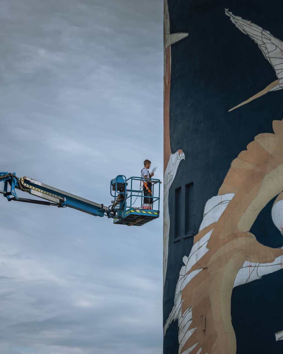
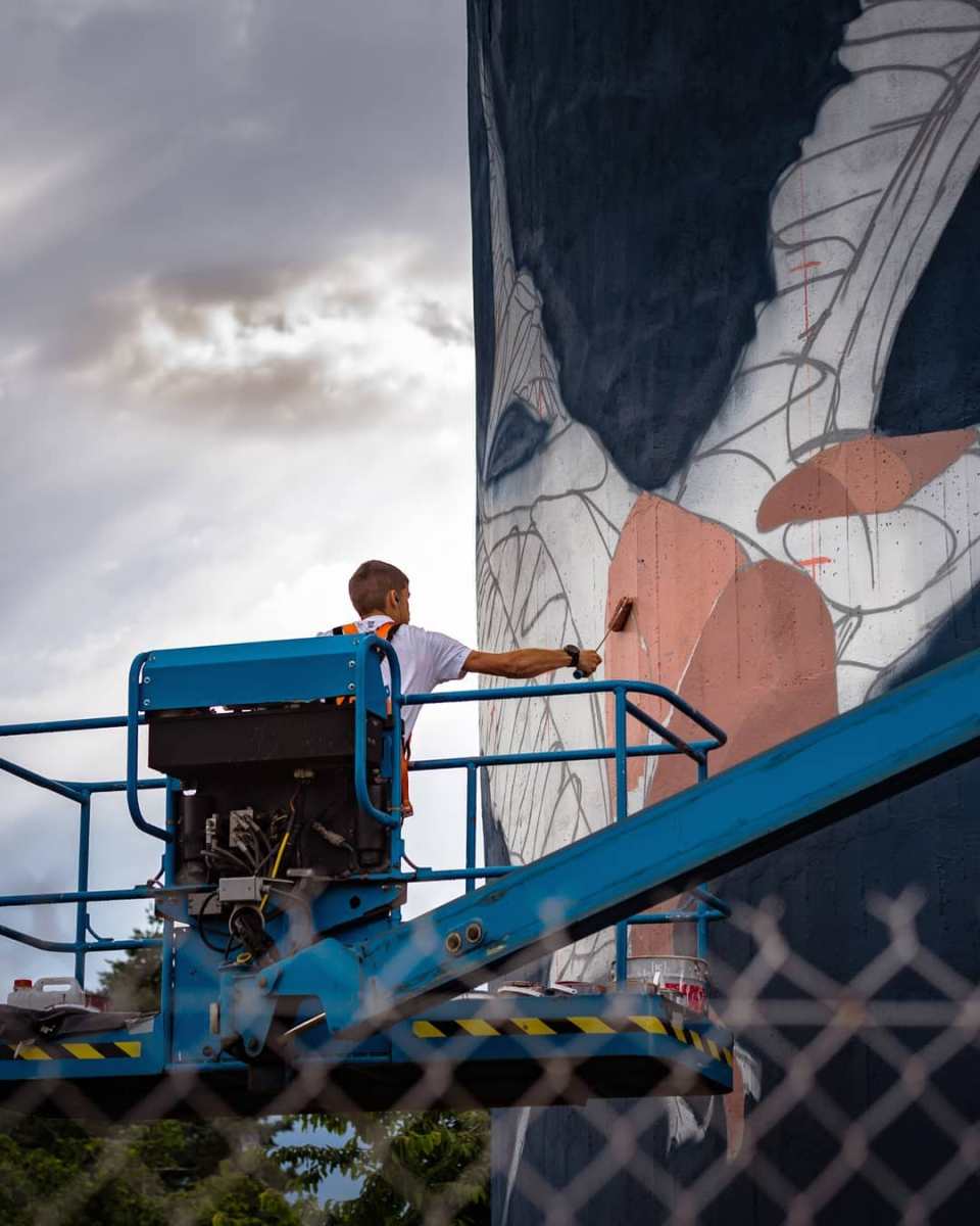
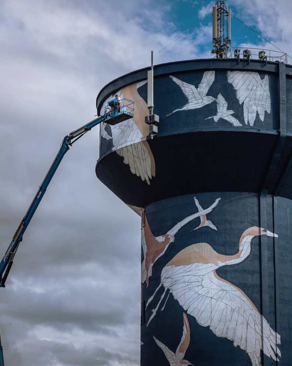
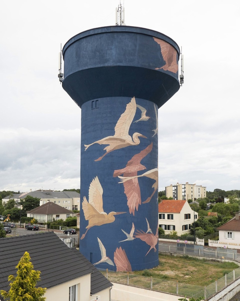
Agua del Loira – By Taquen in Gien, France (7 photos)
Content warning: Street Artist Taquen By Taquen in Gien, France. Photos by @fabe_co. Project curated by URBAN ART AGENCY (U2A) and managed by LaBel Valette. Taquen: Water has always been synonymous with life. The human being developed the first civilizations along great r


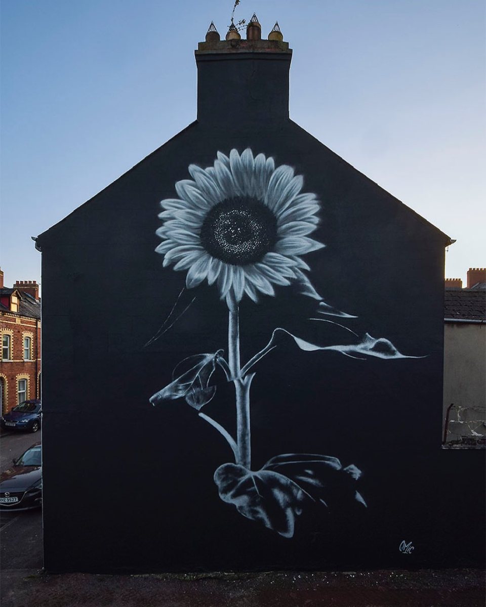
Sunflower Painted in solidarity with the people of Ukraine. By Emic in Belfast, Ireland
Content warning: Street Artist Emic By Emic in Belfast, Northern Ireland, UK. Comments: Sunflower Painted in solidarity with the people of Ukraine. By Emic in Belfast, Ireland https://t.co/GaXTrBERKI pic.twitter.com/WSmWFlPmrD— STREET ART UTOPIA: New Street Art and Graffi
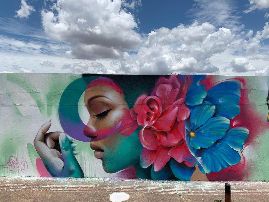
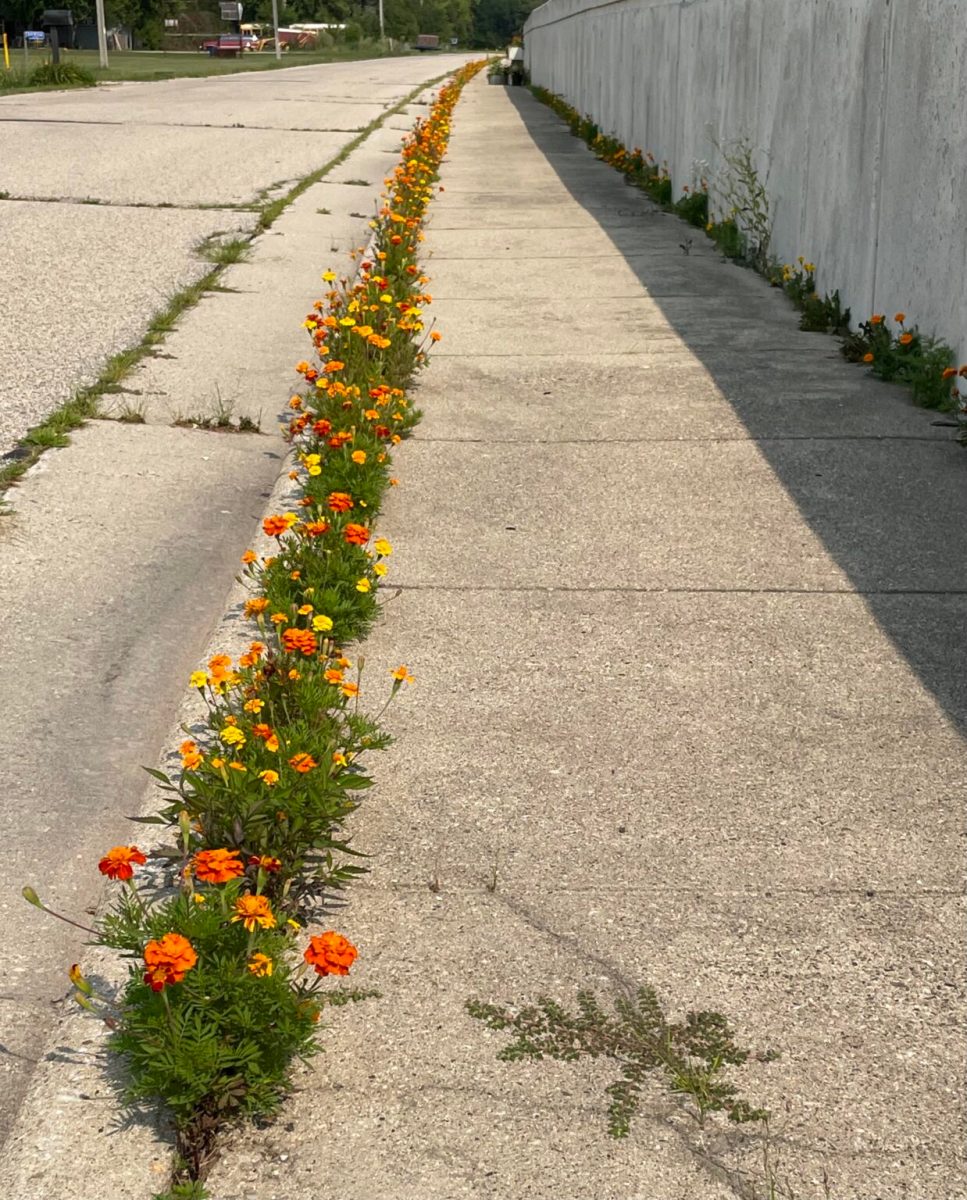
Mural by Hector Covarrubias in Ronse, Belgium
Content warning: Street Hector Covarrubias By Hector Covarrubias at Waatsbrugstraat 24 in Ronse, Belgium. Covarrubias’ vibrant mural in Ronse brings a burst of life to the cityscape, with rich marigolds and a serene butterfly complementing the thoughtful gaze of a woman.

Mural by CarãO Capstyle in Londrina, Brazil
Content warning: Street Artist CarãO Capstyle By CarãO Capstyle in Londrina, Brazil for CapStyle festival. Comments: pic.twitter.com/IJU3EwLf8M— STREET ART UTOPIA 🖼️ (@StreetArtUtopia) May 11, 2022
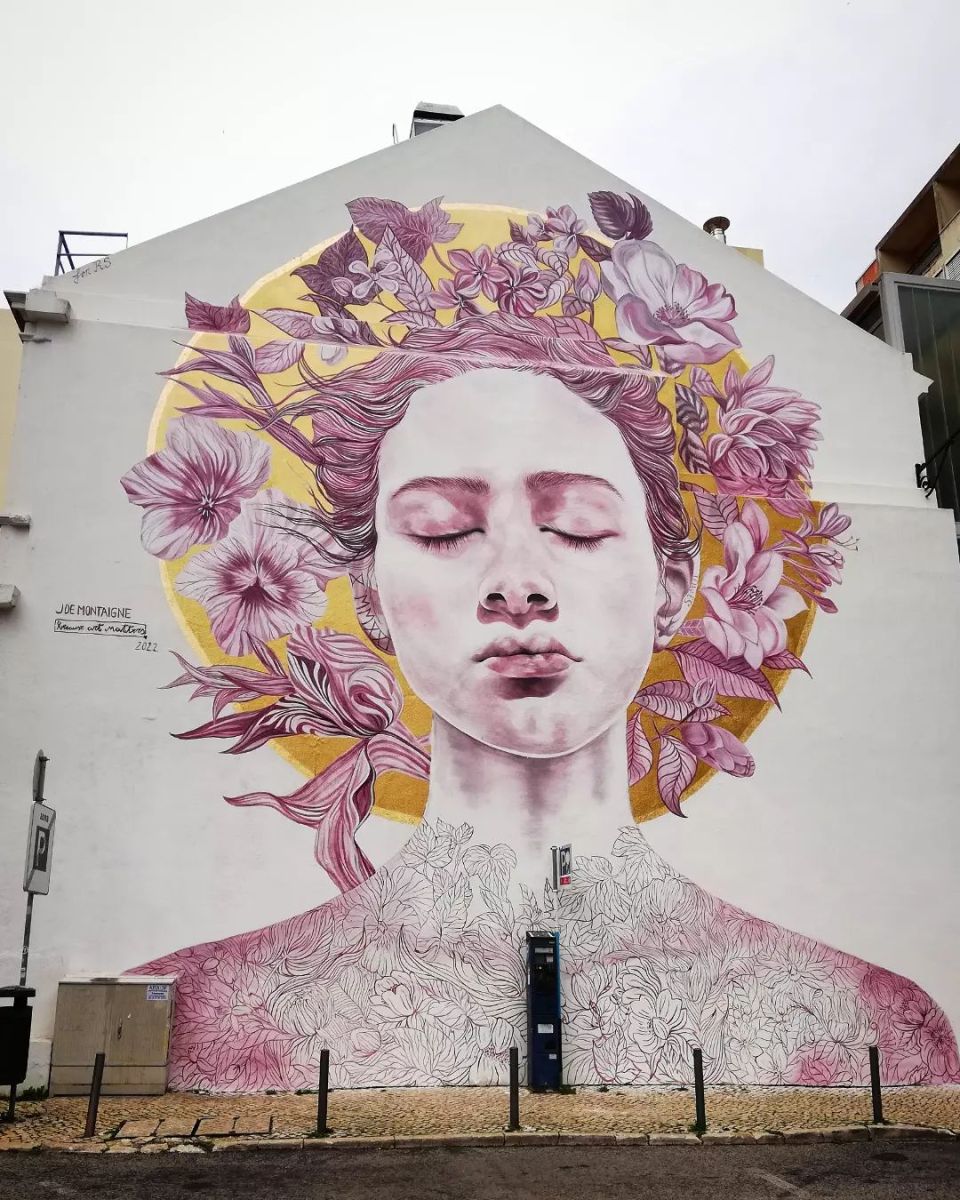
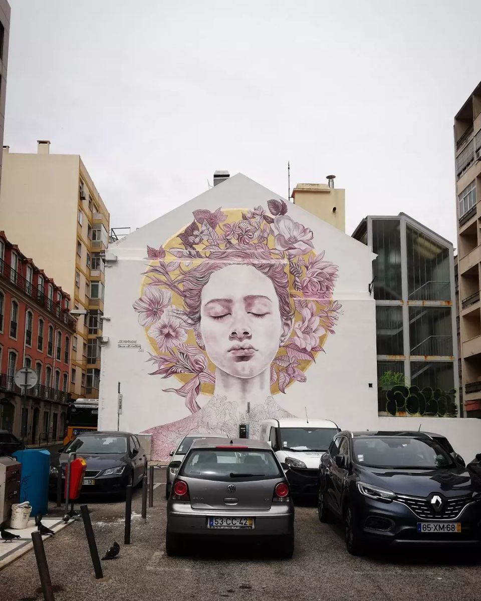
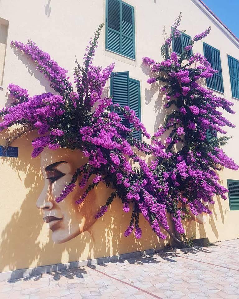
The language of flowers – Mural by Jacqueline de Montaigne in Lisbon, Portugal
Content warning: Street Artist Jacqueline de Montaigne By Jacqueline de Montaigne at Largo Hintze Ribeiro in Lisbon, Portugal for her solo show “The language of flowers”. Photo by Cores de Lisboa. Comments: By Jacqueline de Montaigne at Largo Hintze Ribeiro in Lisbon, Por
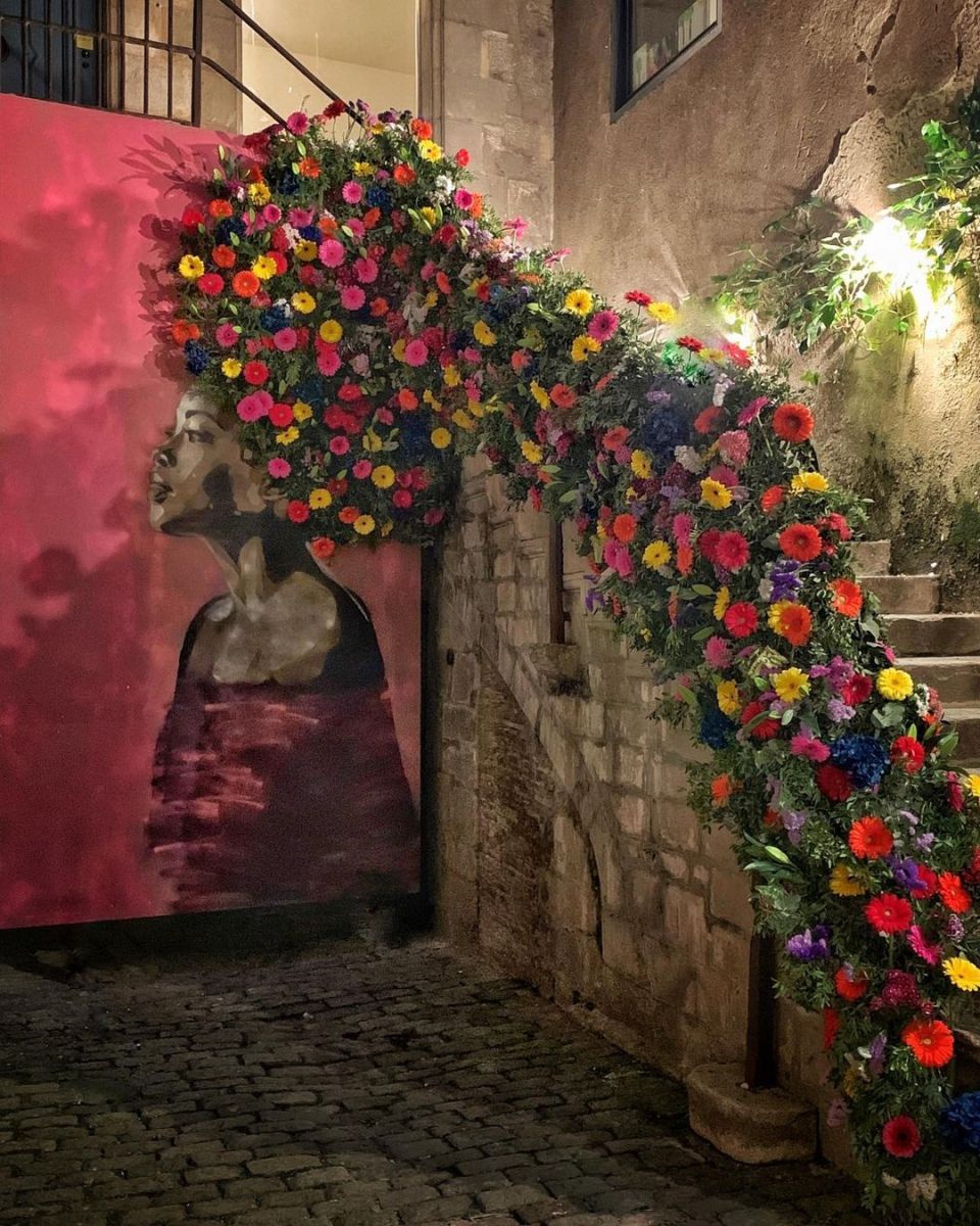
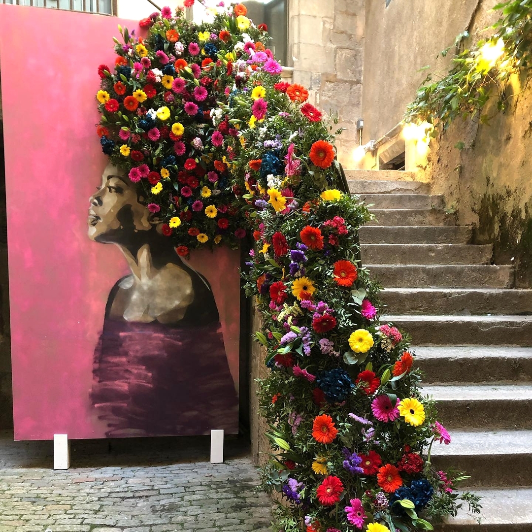
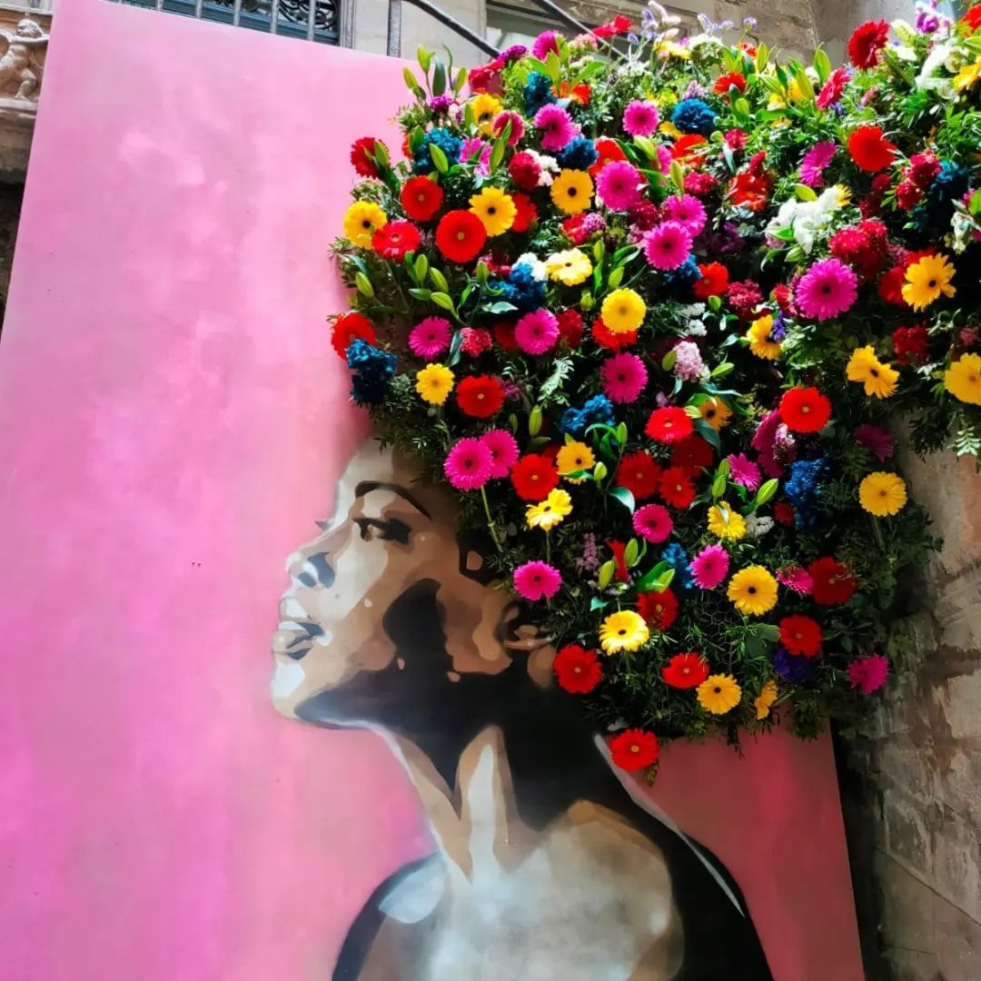
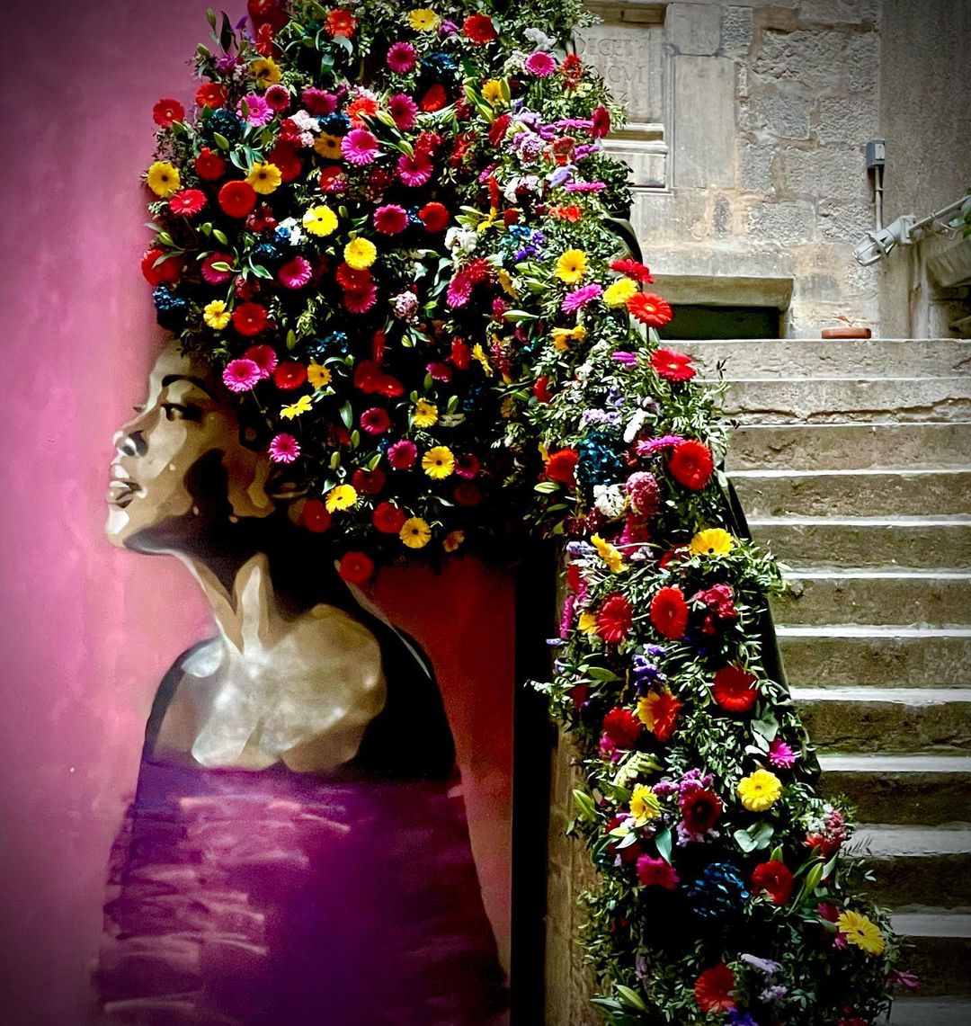
“RAME” by RICE and Flow Creacions for the outdoors arts festival Temps de Flors in Girona, Spain
Content warning: Street Artist RICE "RAME" by RICE and Flow Creacions for the outdoors arts festival Temps de Flors in Girona, Spain. Temps de Flors is a temporary outdoors exhibition held in may. For a couple of weeks art and flowers fill the squares and streets of the c
Street Art in Paleokastritsa, Corfu, Greece
Content warning: More like this: When Street Art meets Nature (35 photo collection) Comments: pic.twitter.com/FnazhMWHVX— STREET ART UTOPIA 🖼️ (@StreetArtUtopia) September 30, 2021
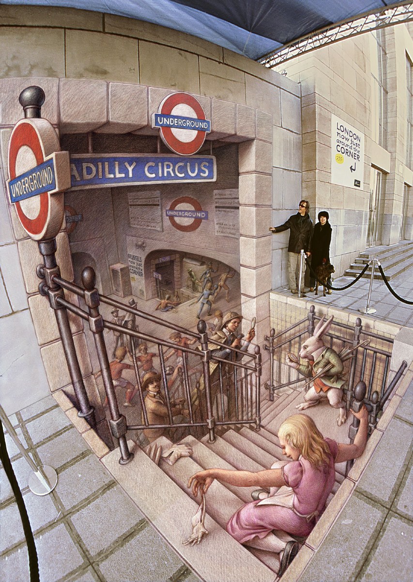
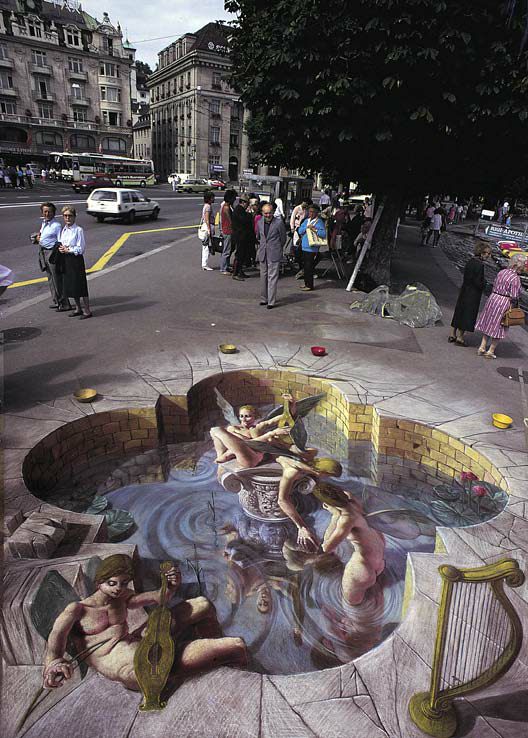
The Belgian Underground (3D street art by Kurt Werner)
Content warning: 3D Street Artist Kurt Werner Hercule Poirot meets Sherlock Holmes in this 3d artwork by Kurt Werner at Eurostar in Brussels, Belgium. More by Kurt Wenner on Street Art Utopia. Kurt Wenner working with a form of perspective, known as anamorphism. It was us
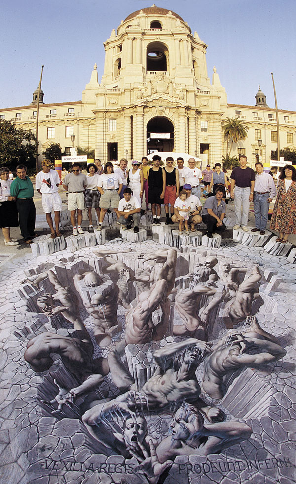


Top Rated 3D Street Art – “This is scary and whoo SO WONDERFULL!!!!!”
Content warning: 3D Artist Kurt Wenner By Kurt Wenner.
7 Photos and Video of “Gravity” by Leon Keer in Wuppertal, Germany
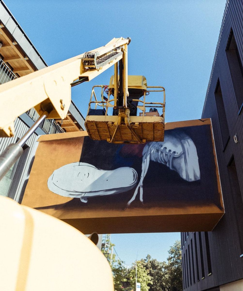
Content warning: 3D Street Artist Leon Keer “Gravity” by Leon Keer in Wuppertal, Germany, for Urbaner KunstRaum Wuppertal (UKW). This captivating image showcases a modern building adorned with a magnificent piece of street art. Painted on a large white canvas-like portion
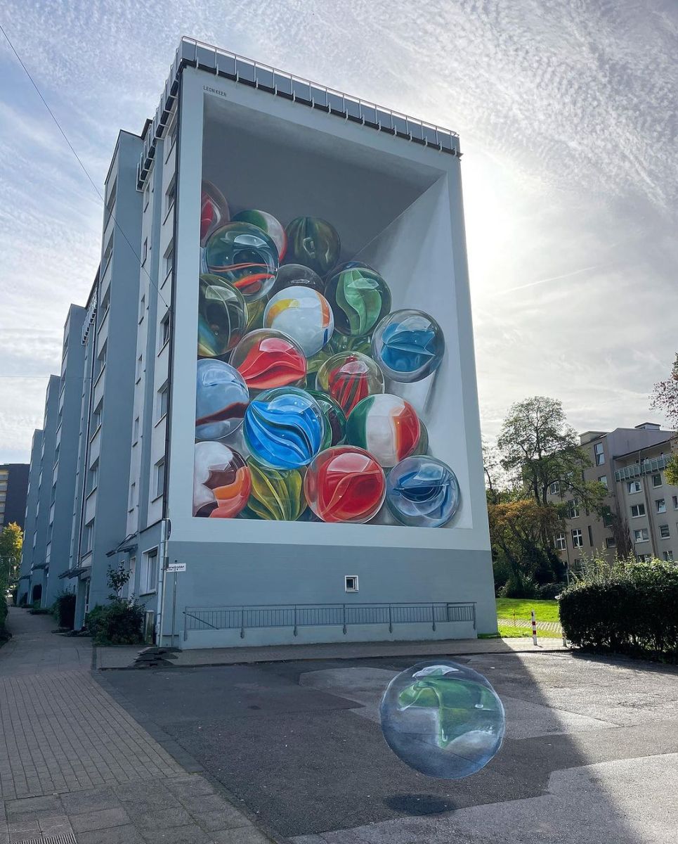
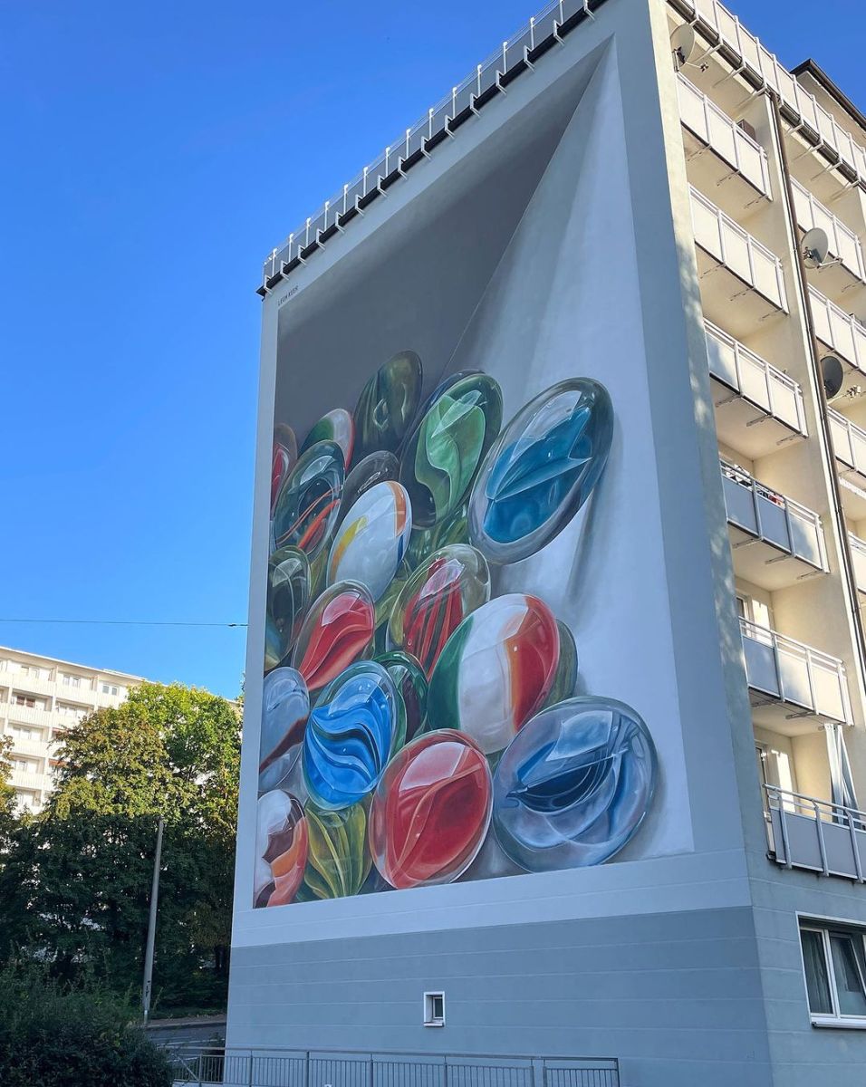
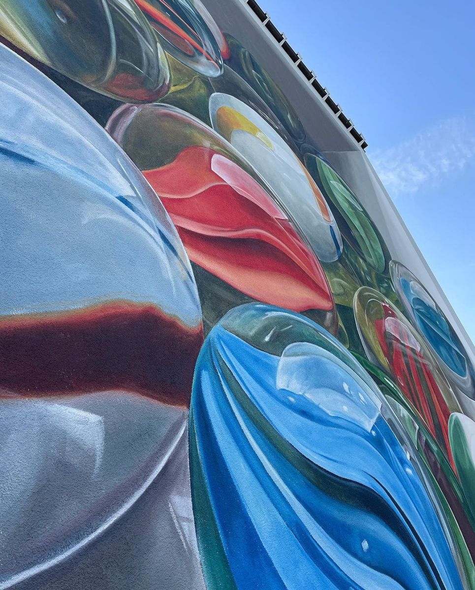
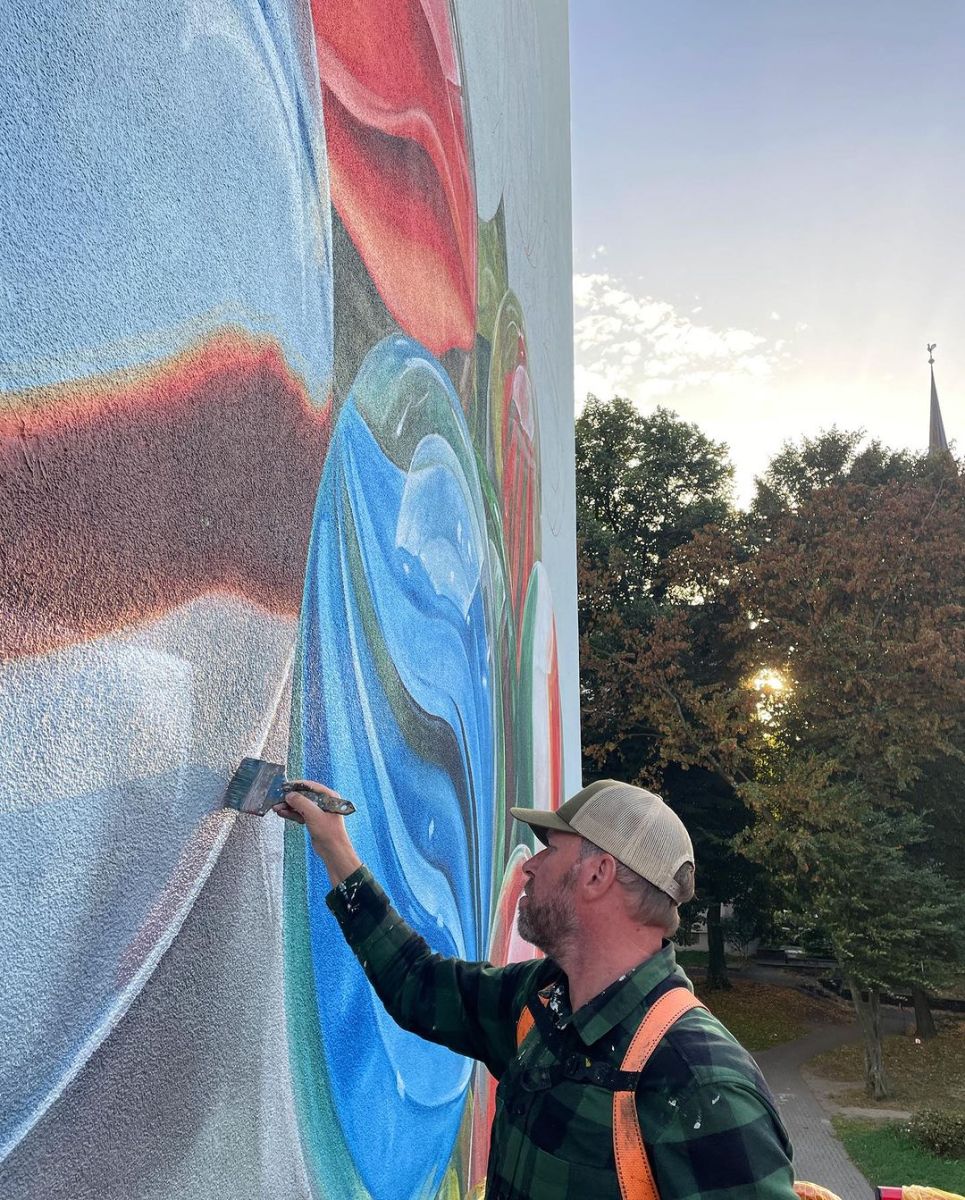
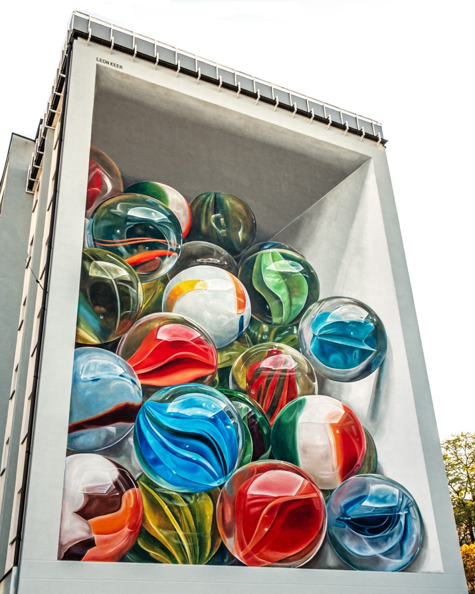 Photo by
 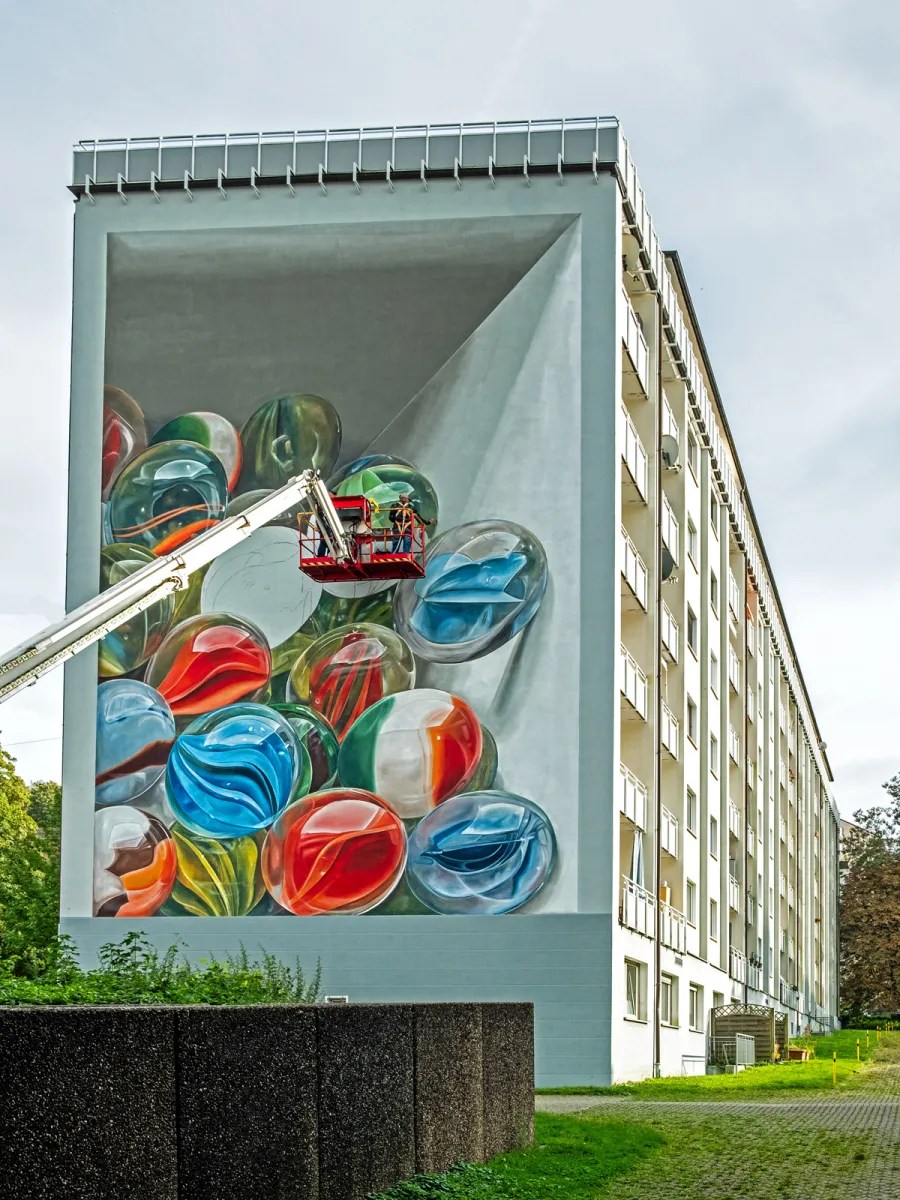 Photo by
 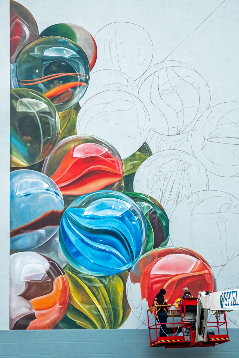 Photo by
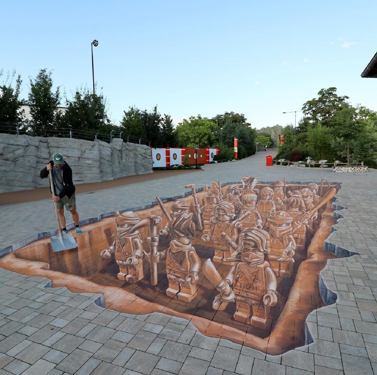
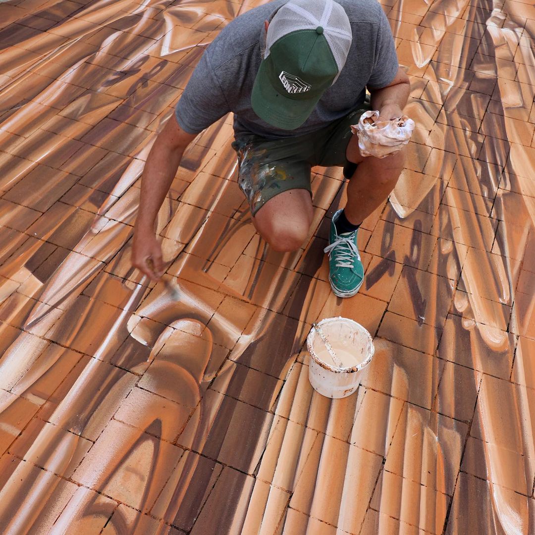
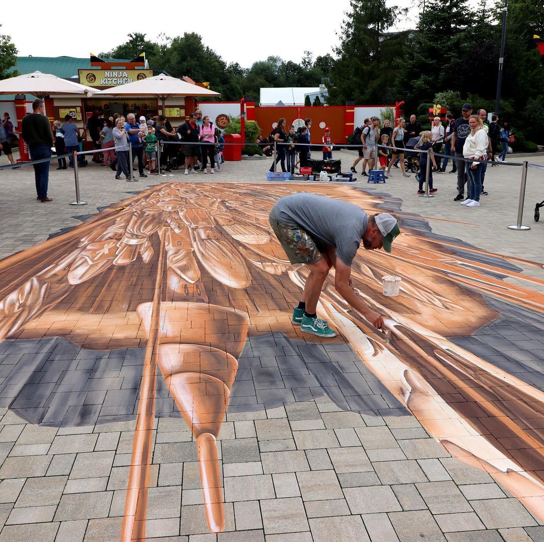
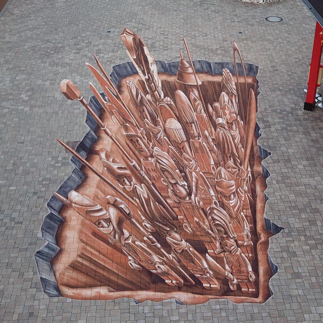
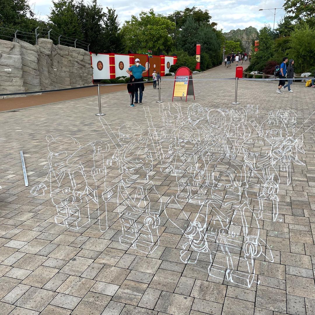
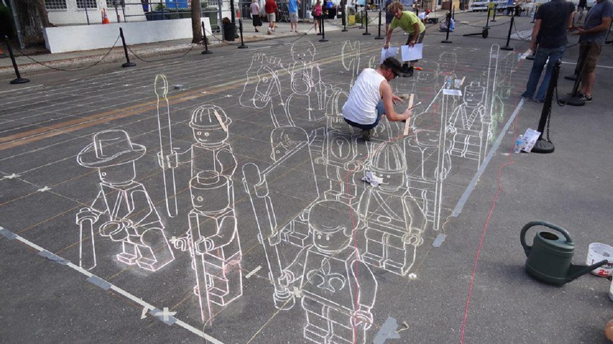
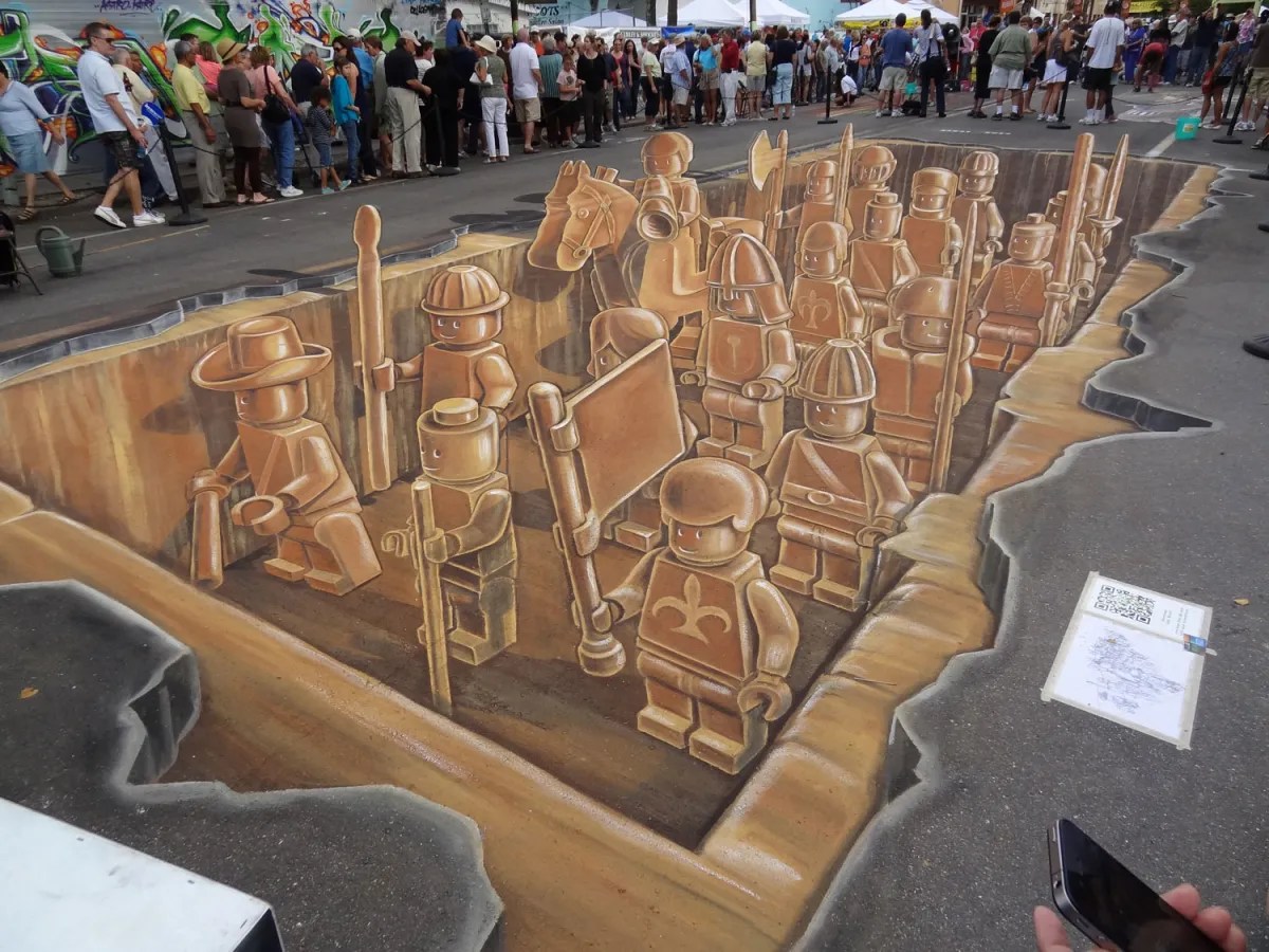
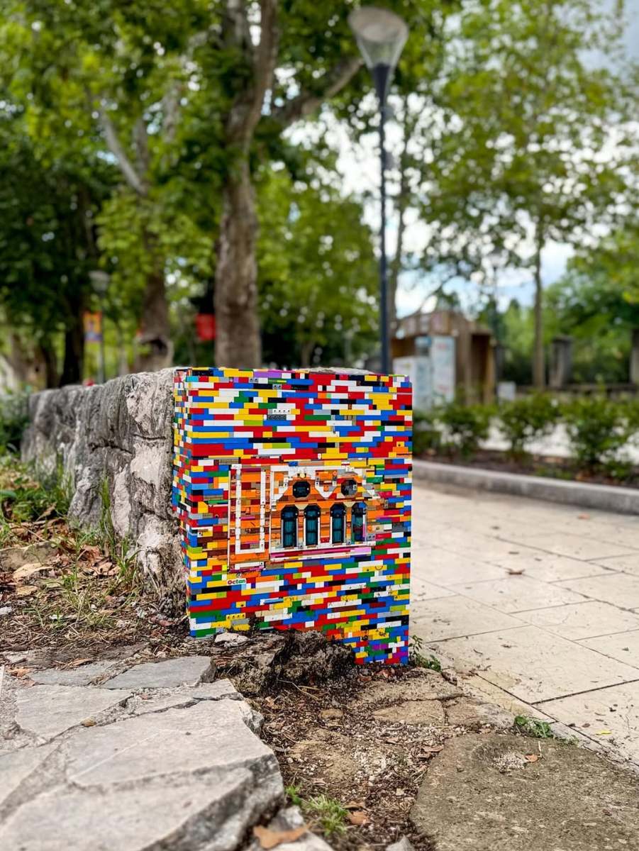
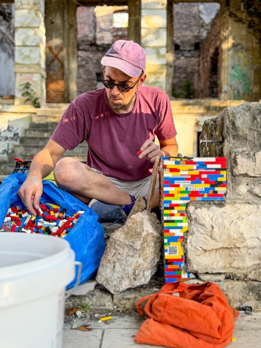
‘Ninjago Terracotta Army’ anamorphic painting in Günzburg Germany
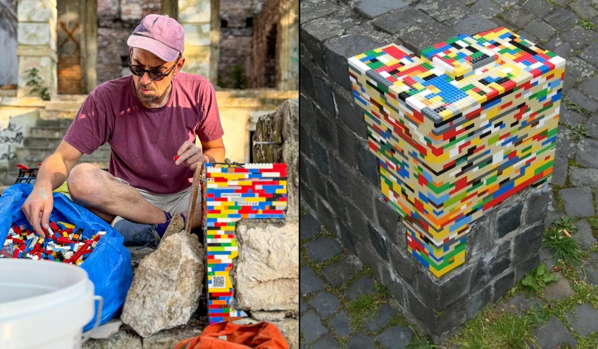
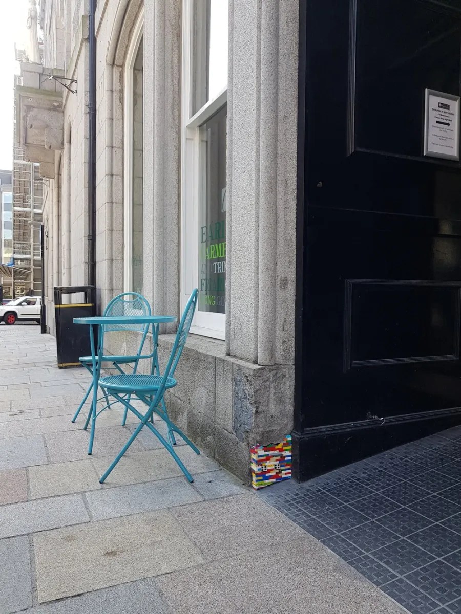
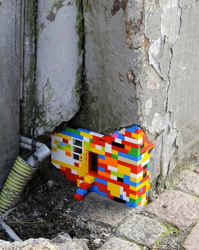
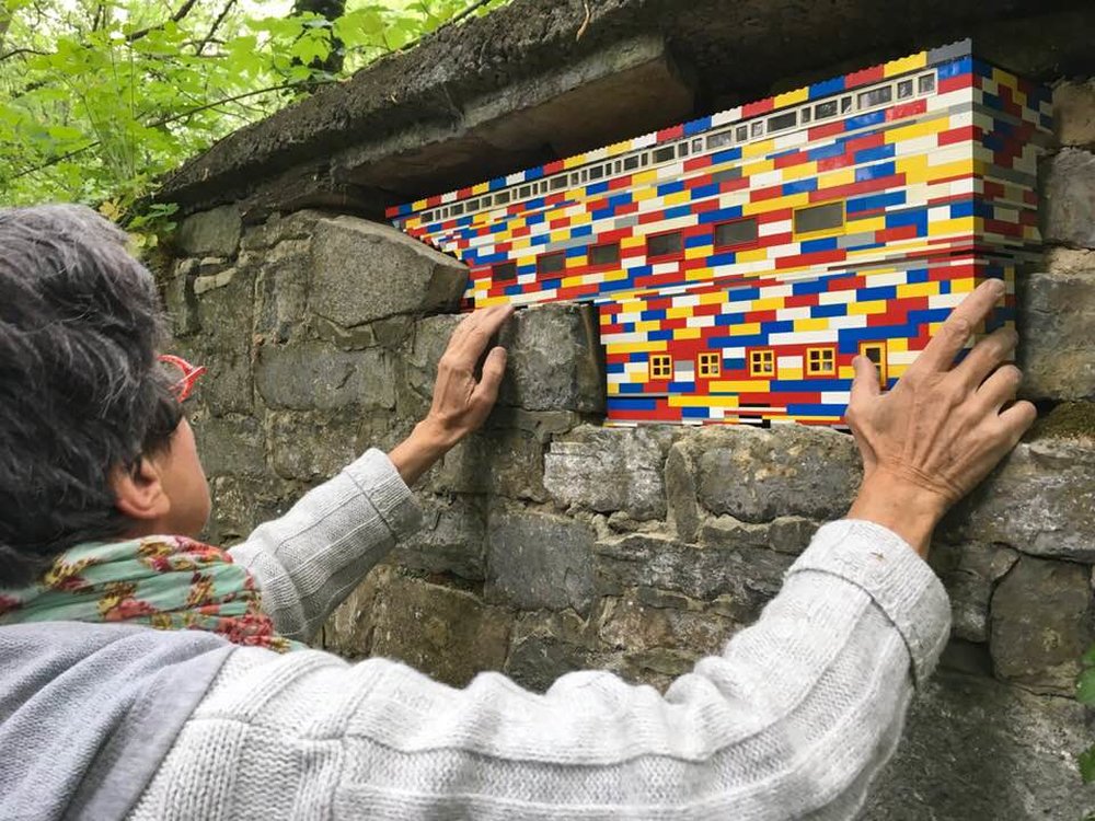
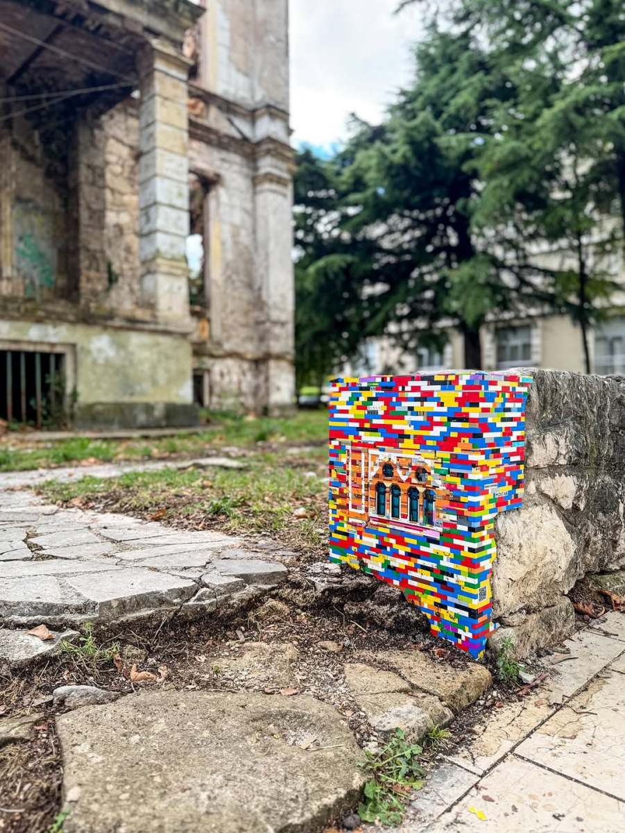
Content warning: Street Artists Leon Keer and Massina By Leon Keer and Massina. A 100 m2 anamorphic street painting in Günzburg of ninja lego warriors named ‘Ninjago Terracotta Army’. More LEGO!: Repairing the World with LEGO: Jan Vormann’s Dispatchwork Project View this


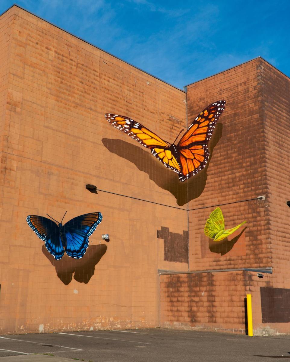
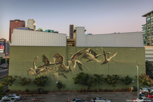
“Butterfly Effect” by CYFI in St. Paul, Minnesota
Content warning: Street Artist CYFI “Butterfly Effect” by CYFI for Wycliff in St. Paul, Minnesota, USA. View this post on Instagram Comments:
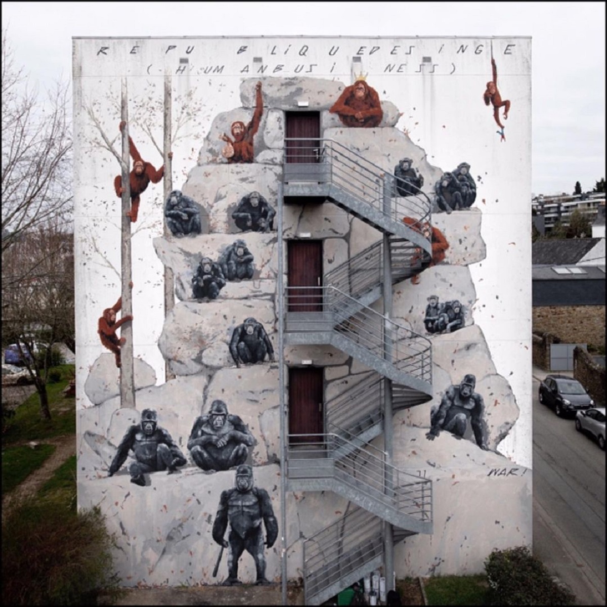
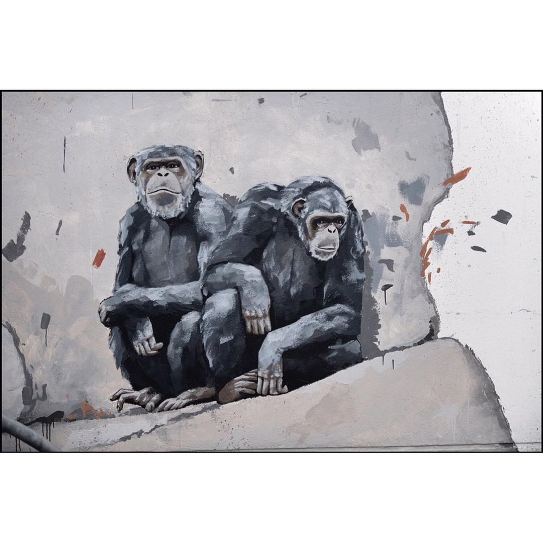
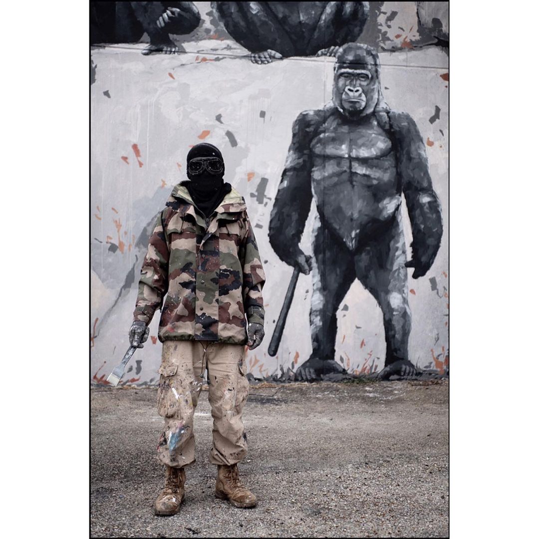
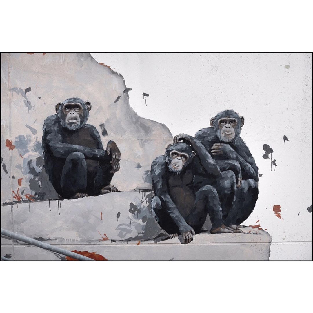
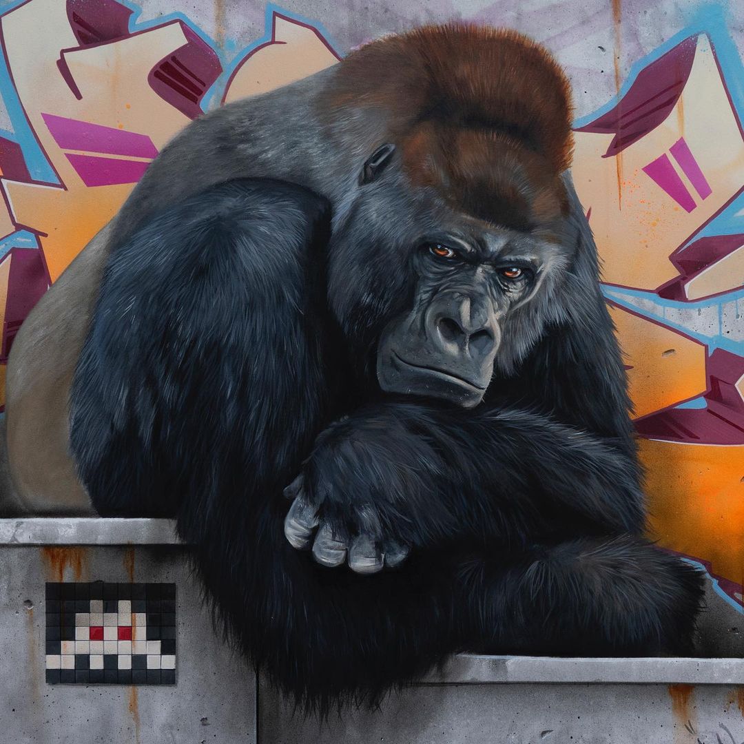
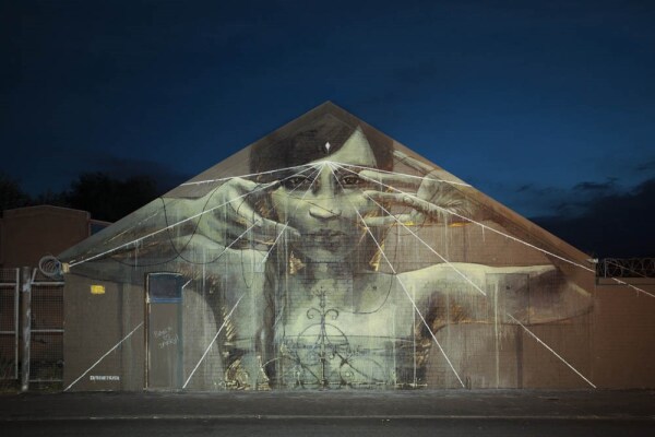
REPUBLIC OF MONKEY human business (by WAR! in Vannes, France)
Content warning: Street Artist WAR! By WAR! in Vannes, France. Photos by Alain Photographie. As in the film "The Planet of the Apes", the Orangutans are the decision makers, the Gorillas the armed wing of power, the Chimpanzees the rest of the people. If monkey money is w


Street Art by MAYE in Nézignan-l’Évêque, France (4 artworks)
Content warning: Street Artist MAYE By MAYE in Nézignan-l'Évêque, France for Nézignan.


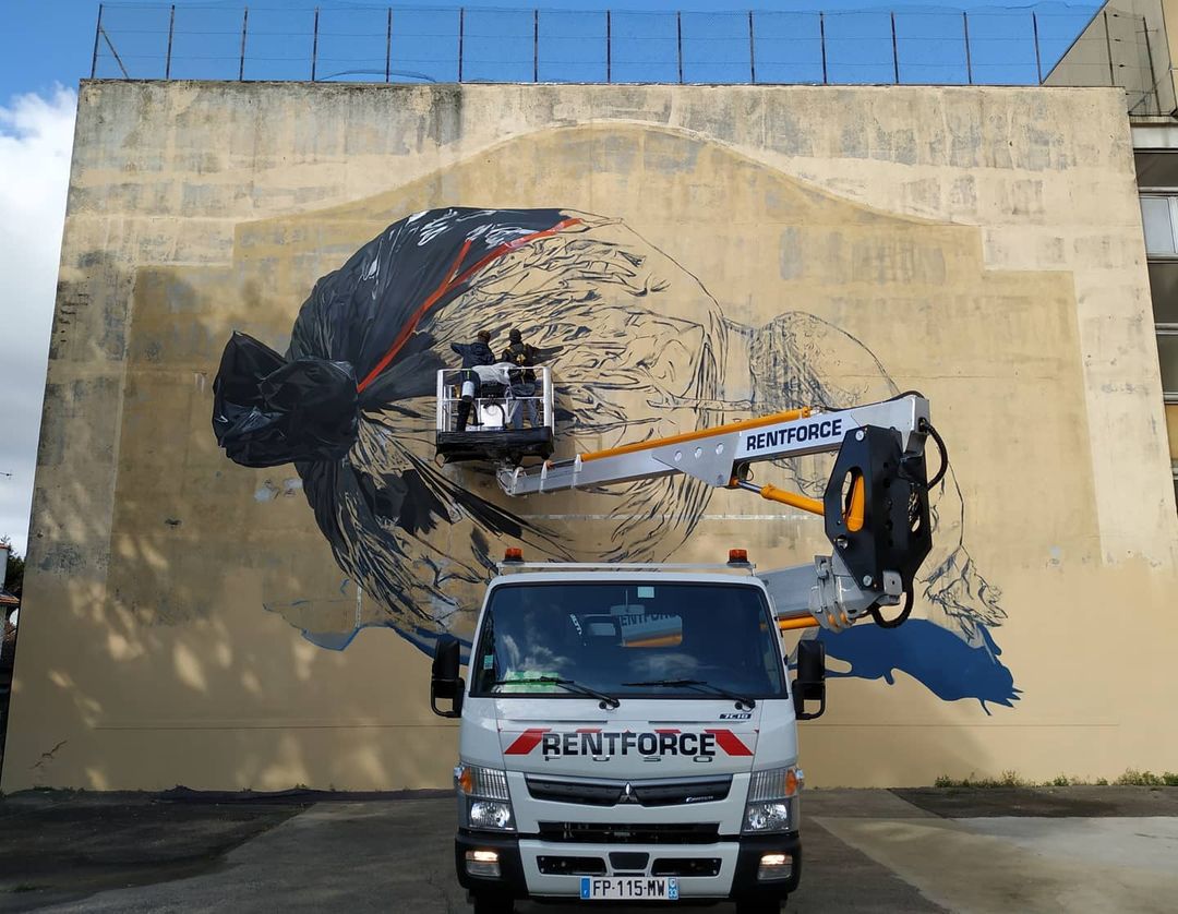
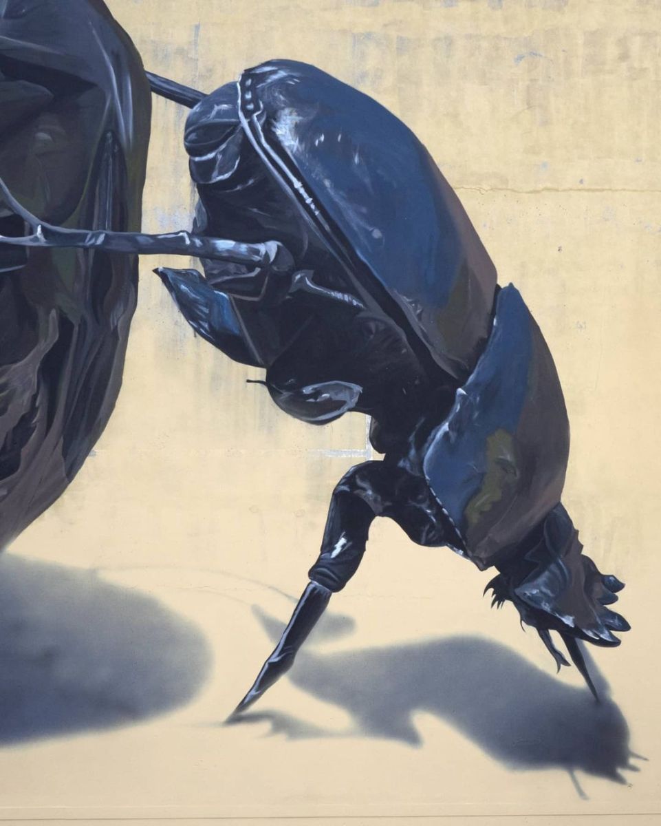
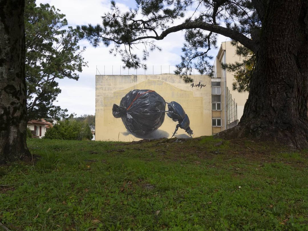
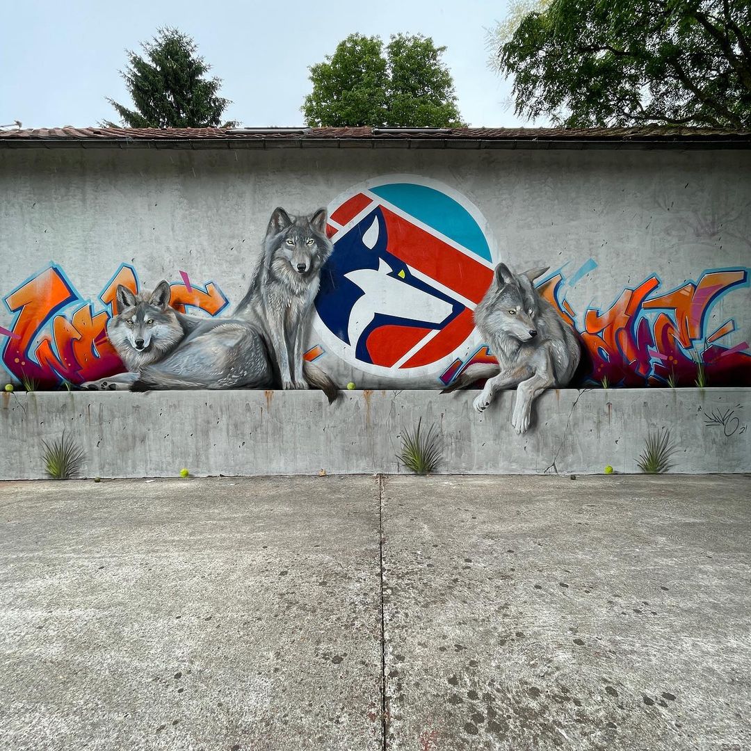
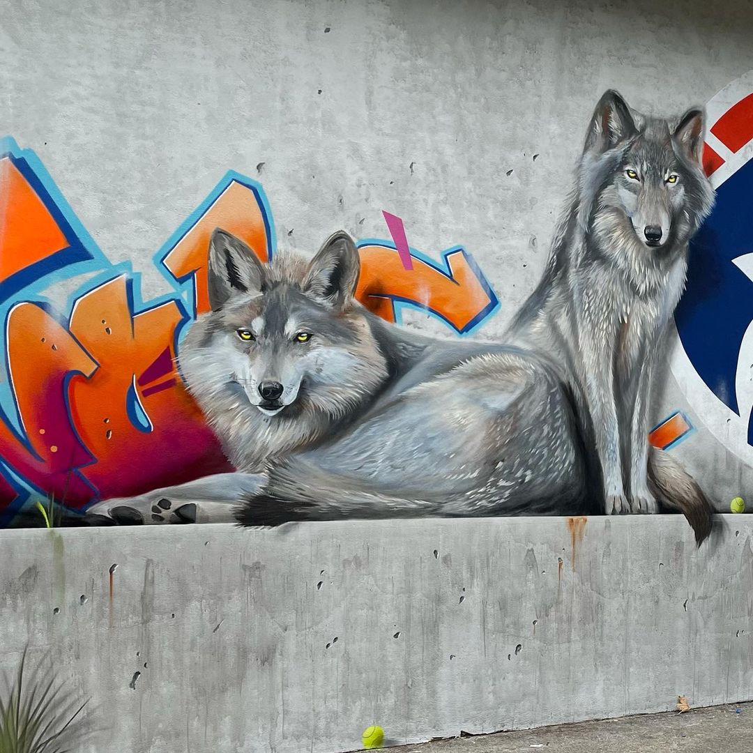
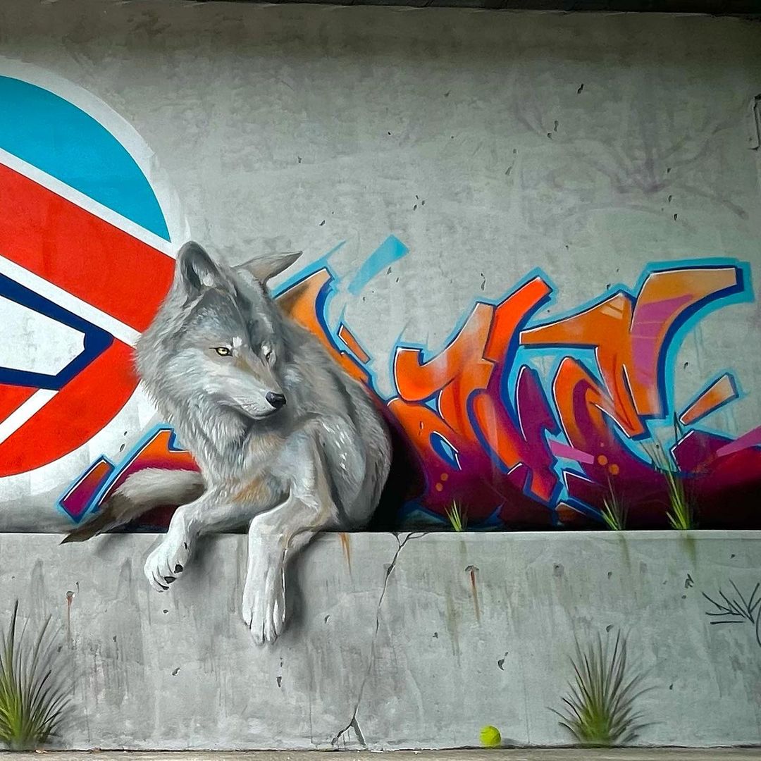
Dung Beetle – Mural on waste recycling
Content warning: Photo by Benedicte PANARIELLO French street artist duo Murmure By Murmure in Stade Didier Deschamps in Bayonne, France for Points de Vue with Spacejunk Bayonne. Murmure: This work questions the importance of waste recycling, and the tendency of developed
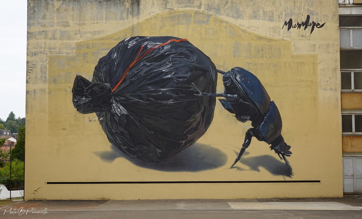 Photo by
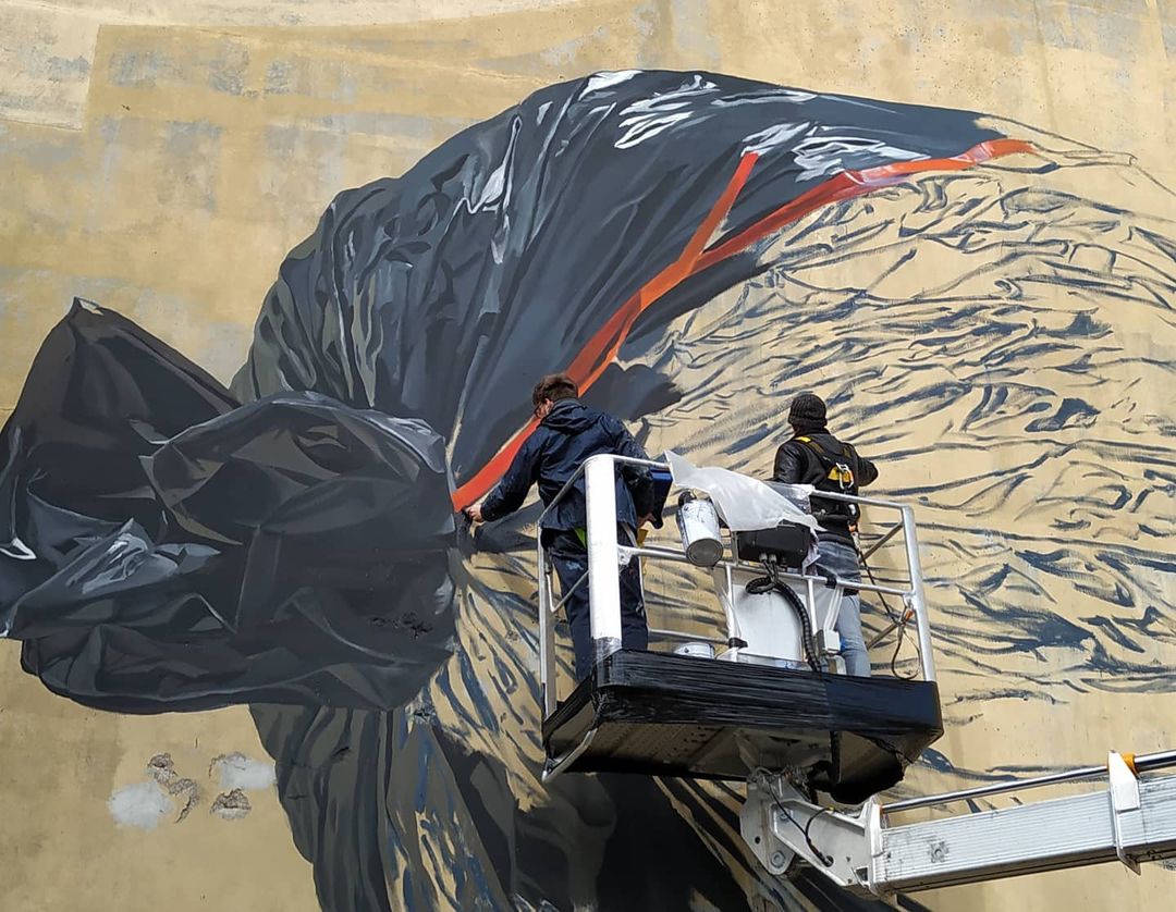

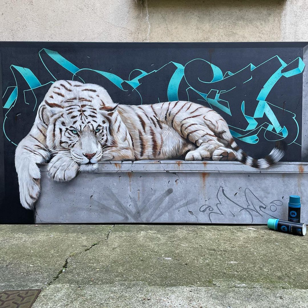
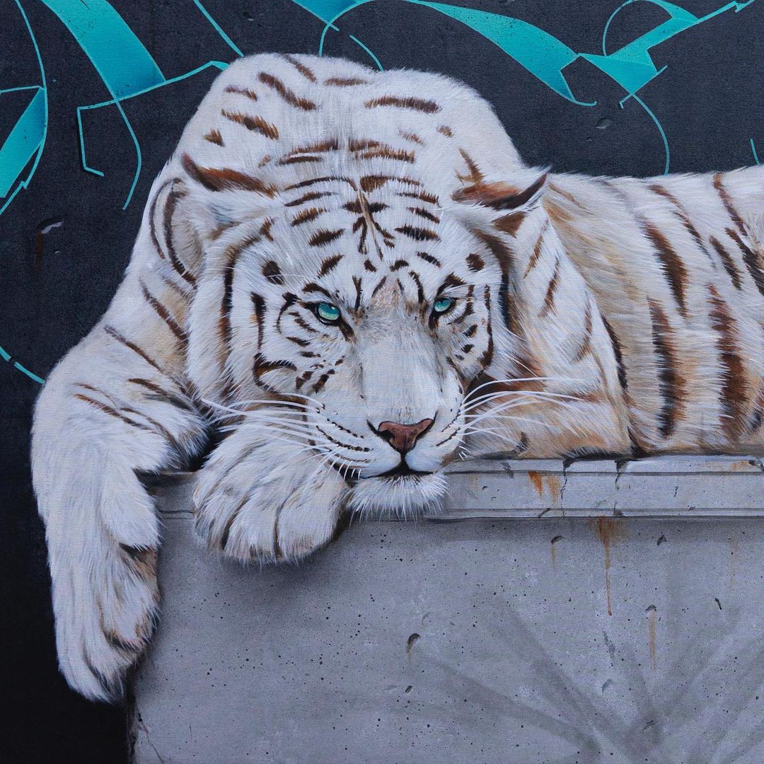
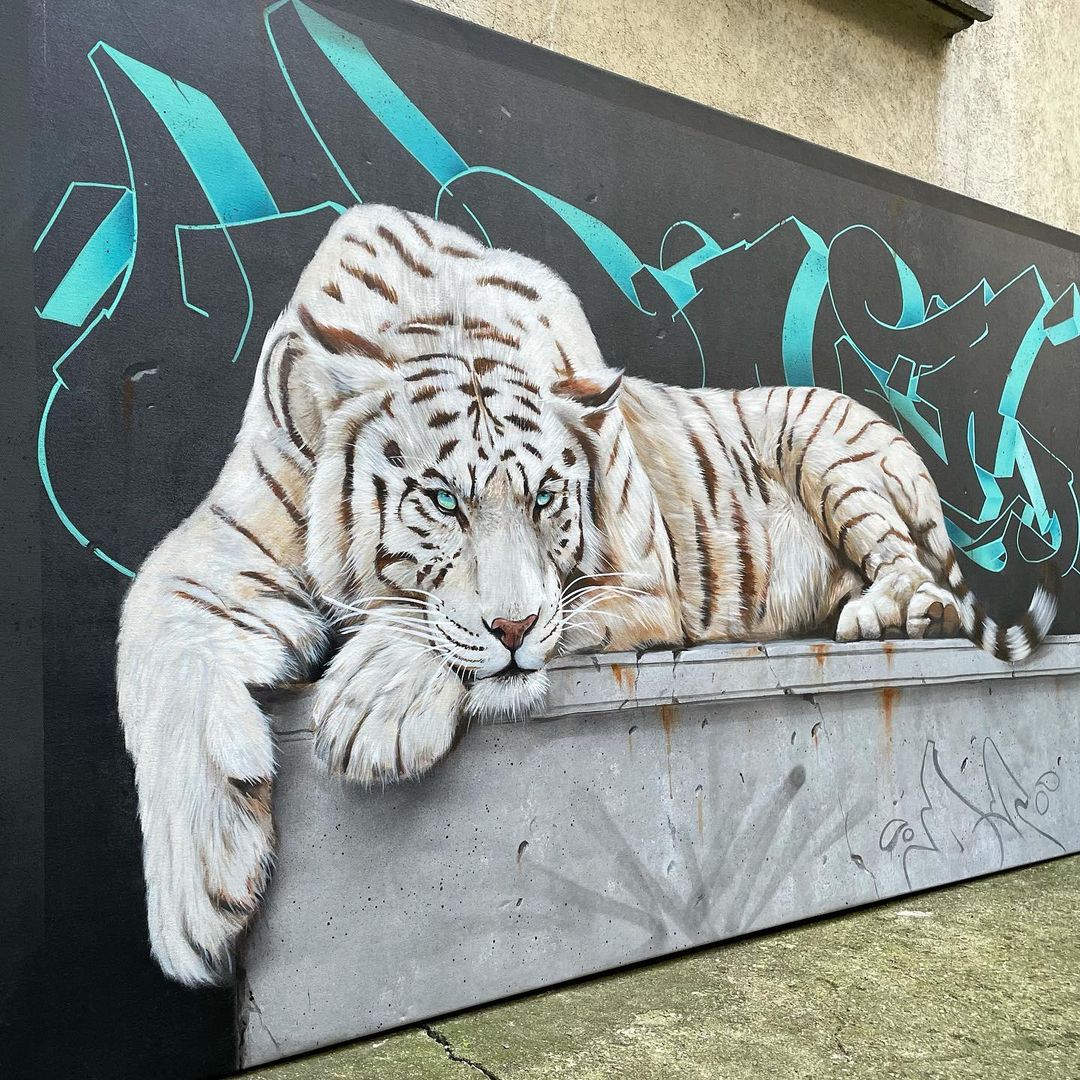
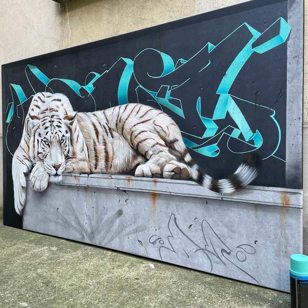
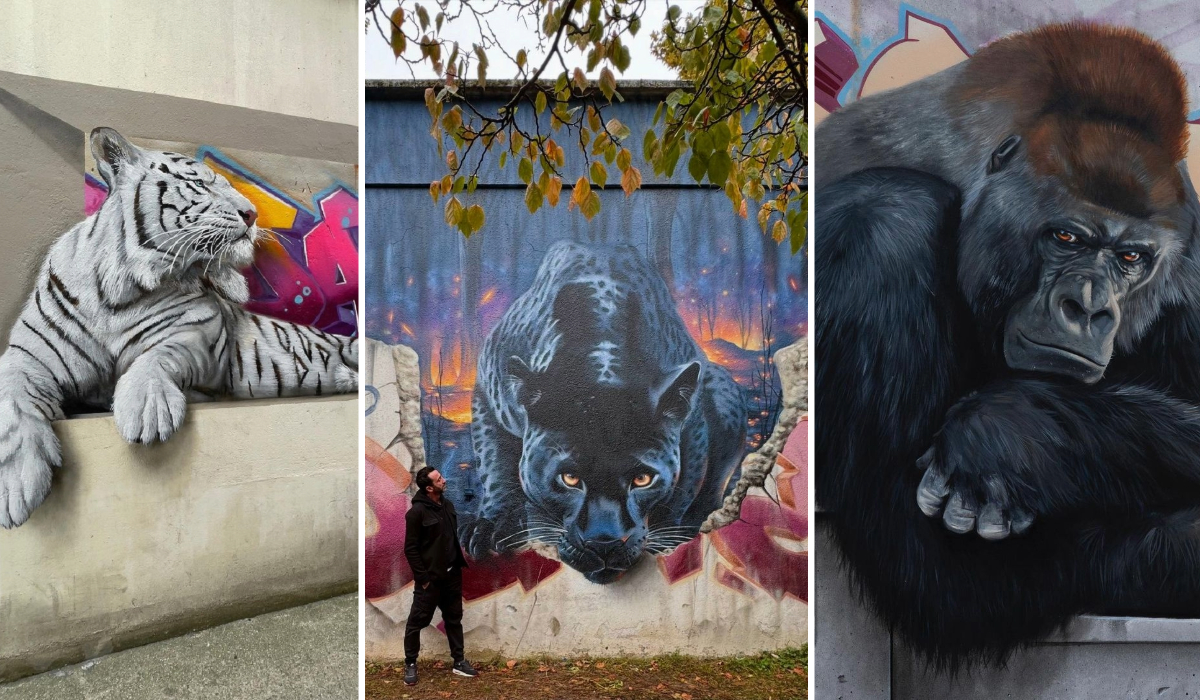
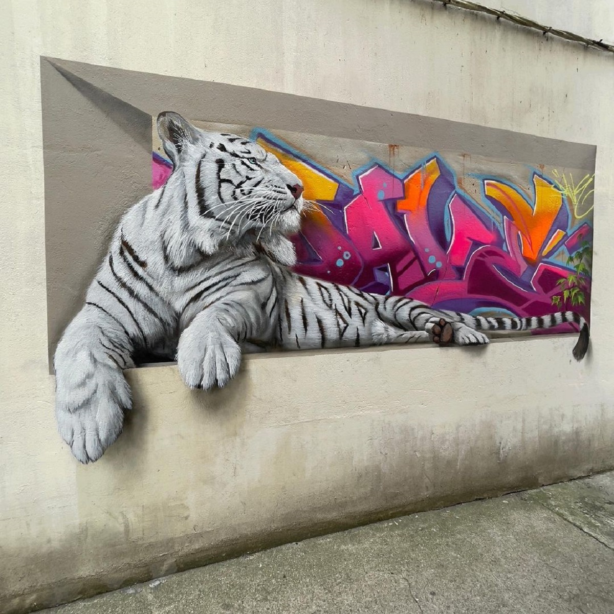
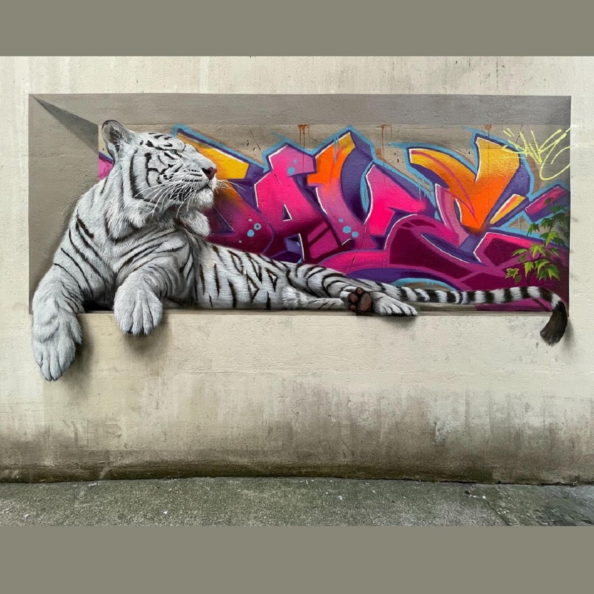
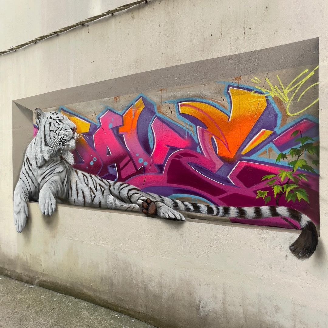
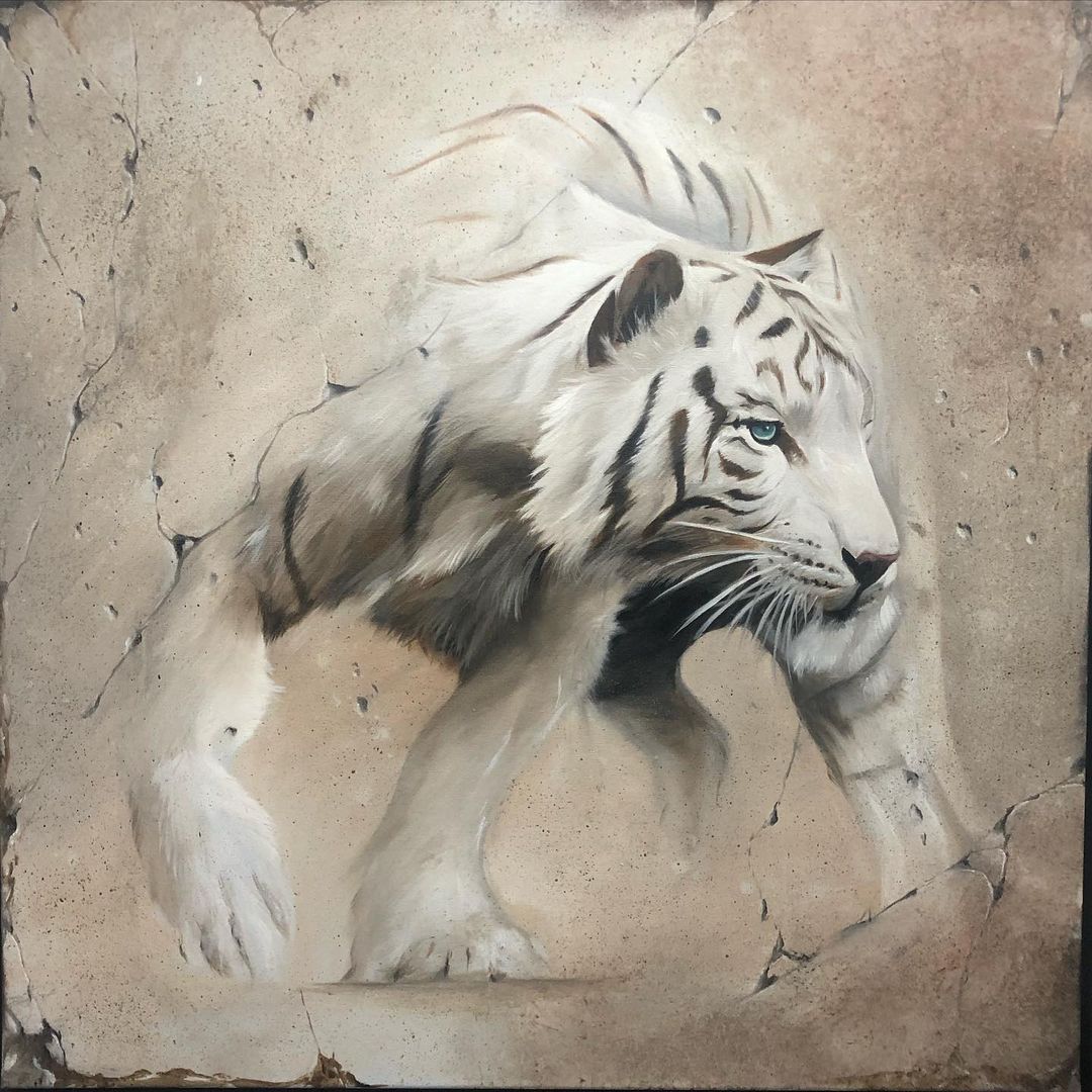
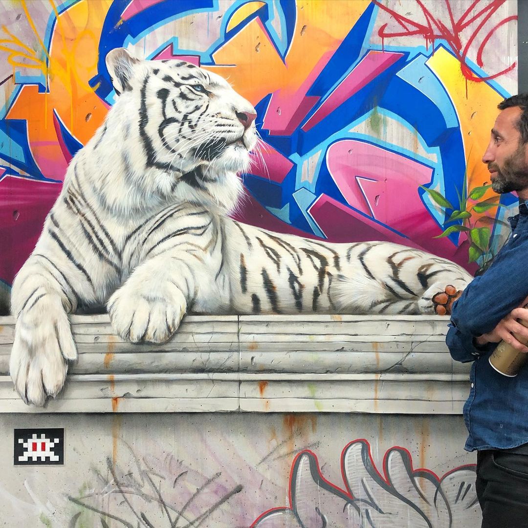
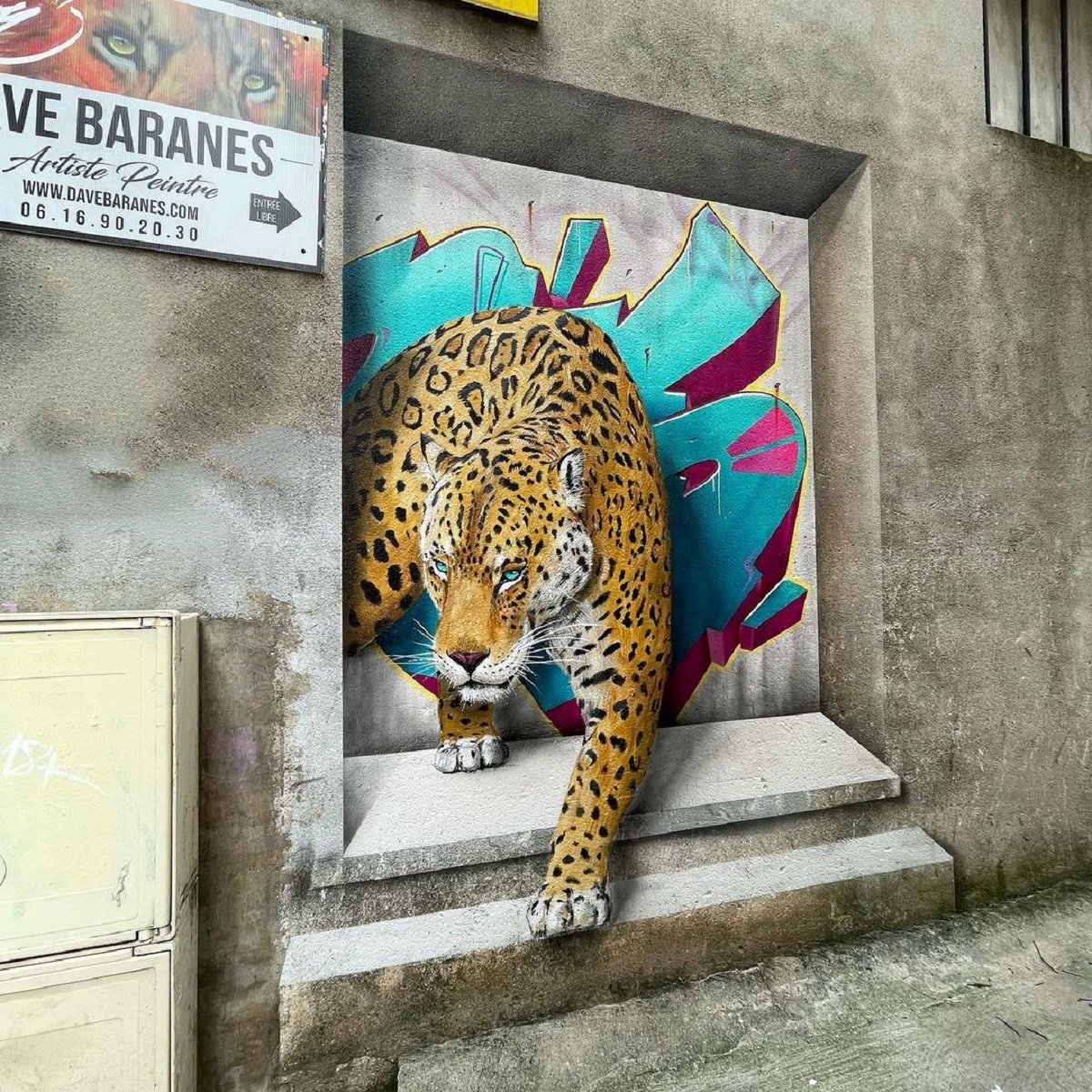
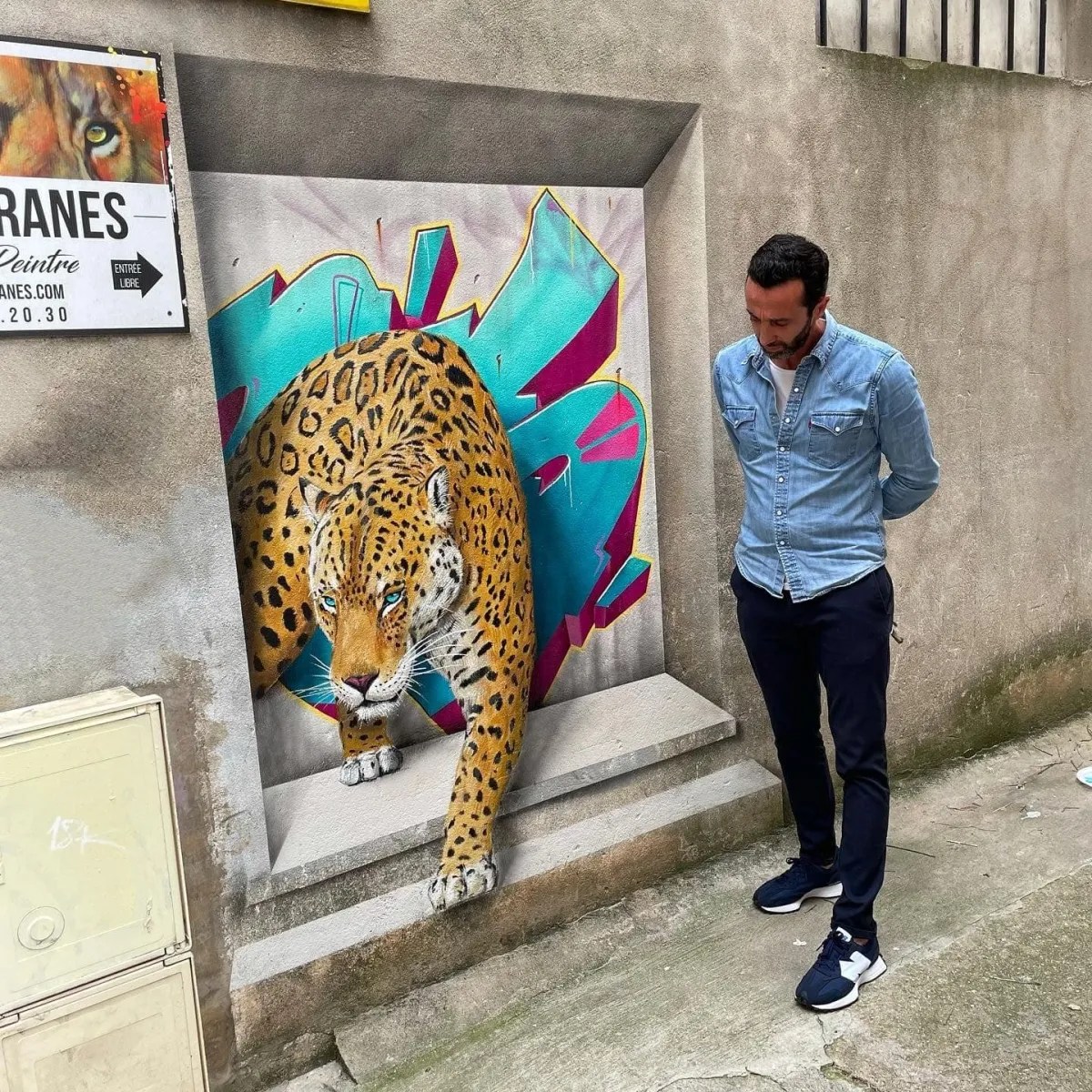
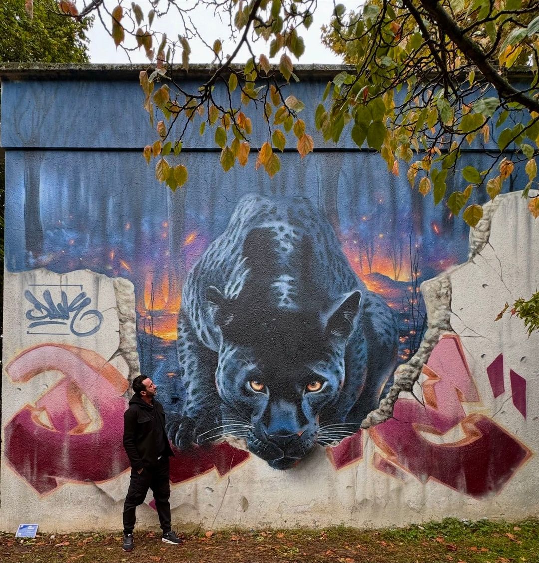
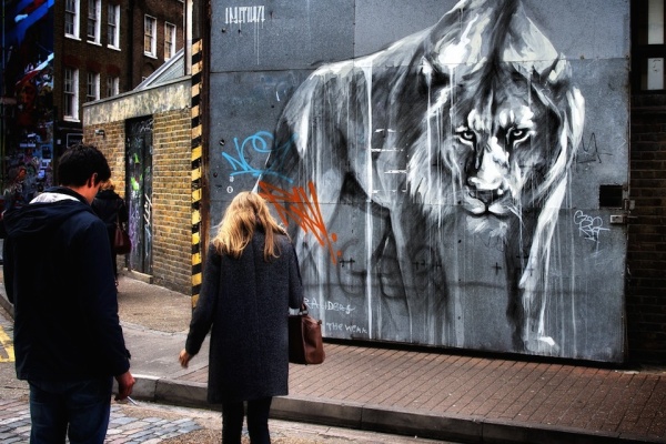
White Tiger by Dave Baranes in Nogent-sur-Marne, France
Content warning: Street Artist Dave Baranes By Dave Baranes in Nogent-sur-Marne, France. More by Dave Baranes: I mainly paint animals threatened with extinction Comments: pic.twitter.com/7DTUSwOfJL— STREET ART UTOPIA 🖼️ (@StreetArtUtopia) October 15, 2021
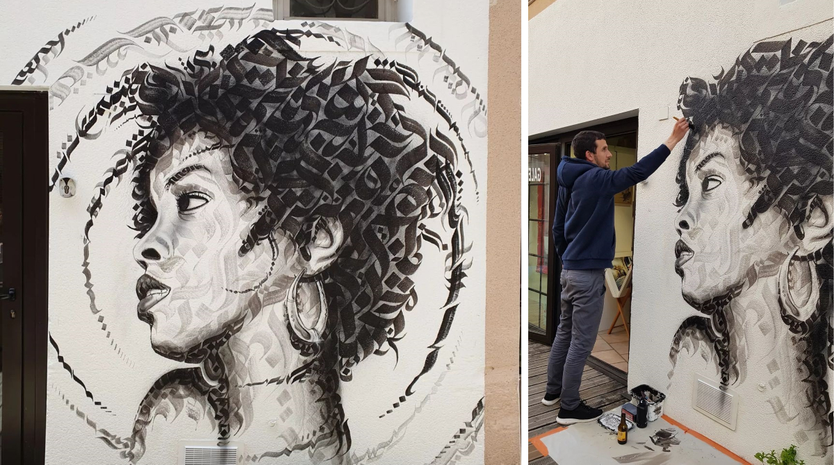
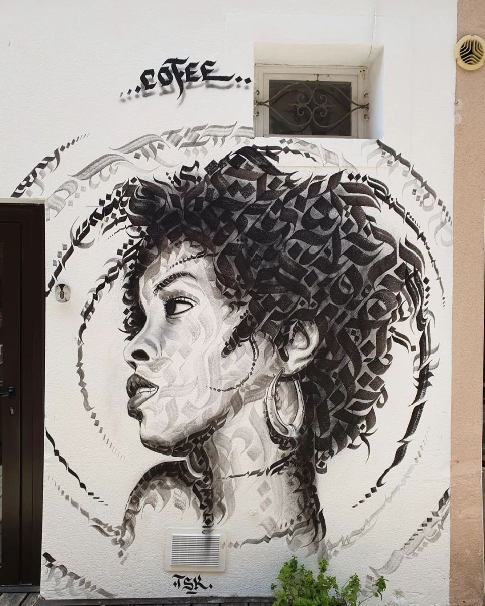
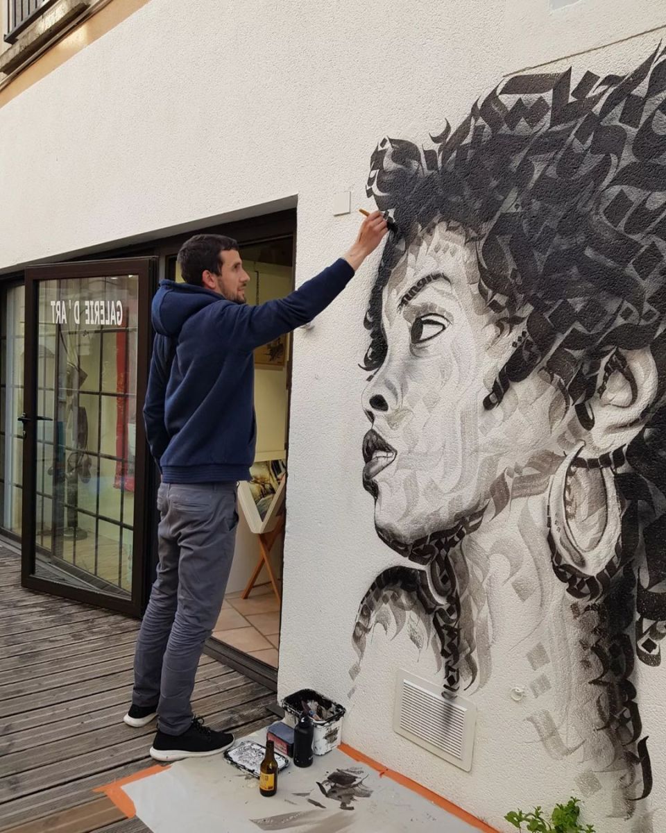
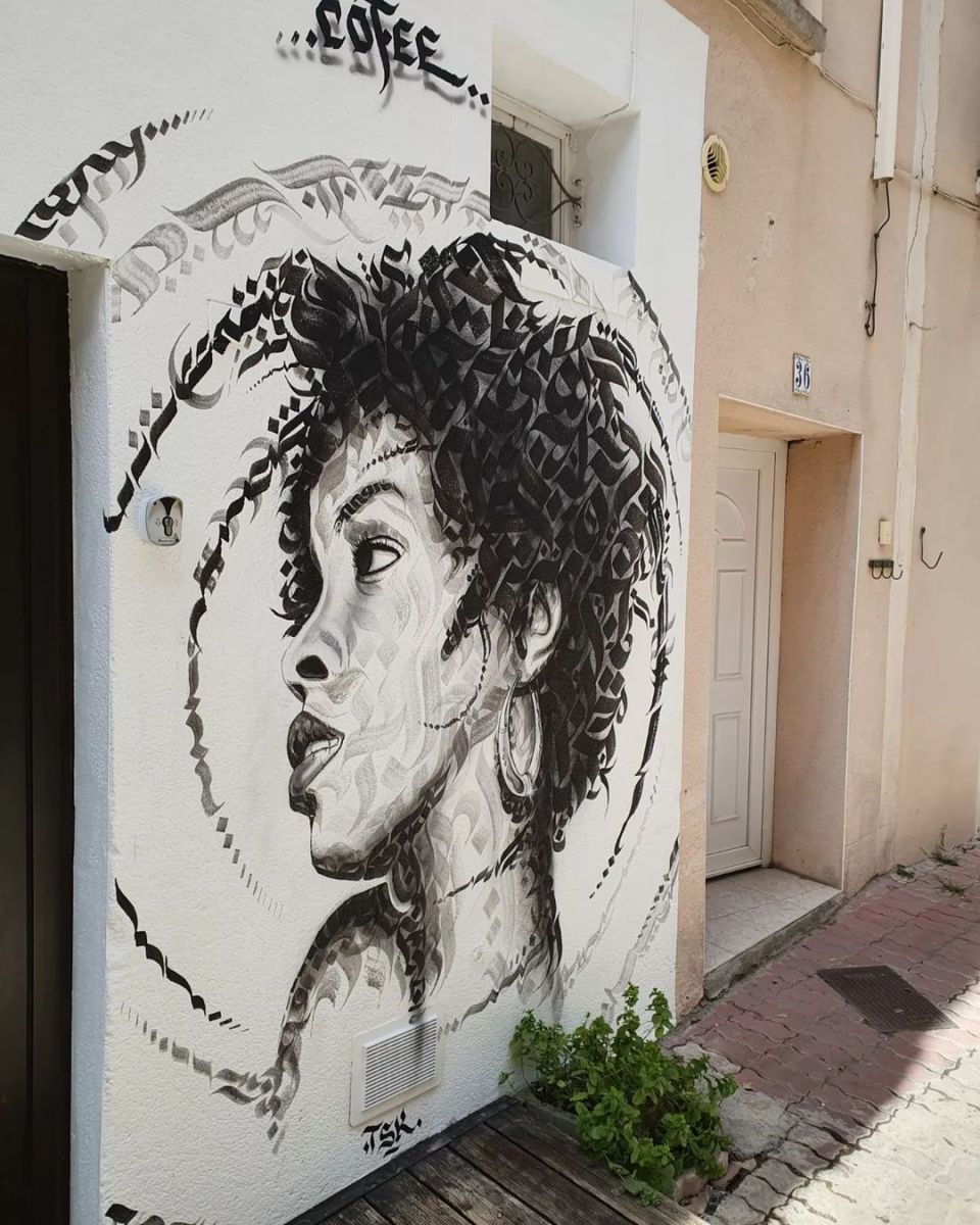
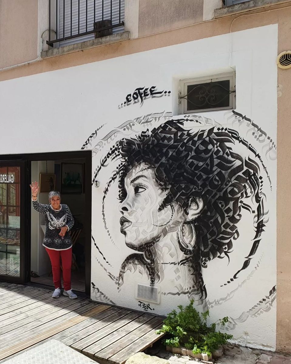
Calligraphy girl by Cofee in Meze, France (5 photos)
Content warning: Street Artist Cofee By Cofee in Meze, France for GALERIE D’ART. Comments: Calligraphy girl by Cofee in Meze, France. 5 photos: https://t.co/a17UonJdnr pic.twitter.com/5ULGVnGMDU— STREET ART UTOPIA: New Street Art and Graffiti (@traintoutopia) January 18,
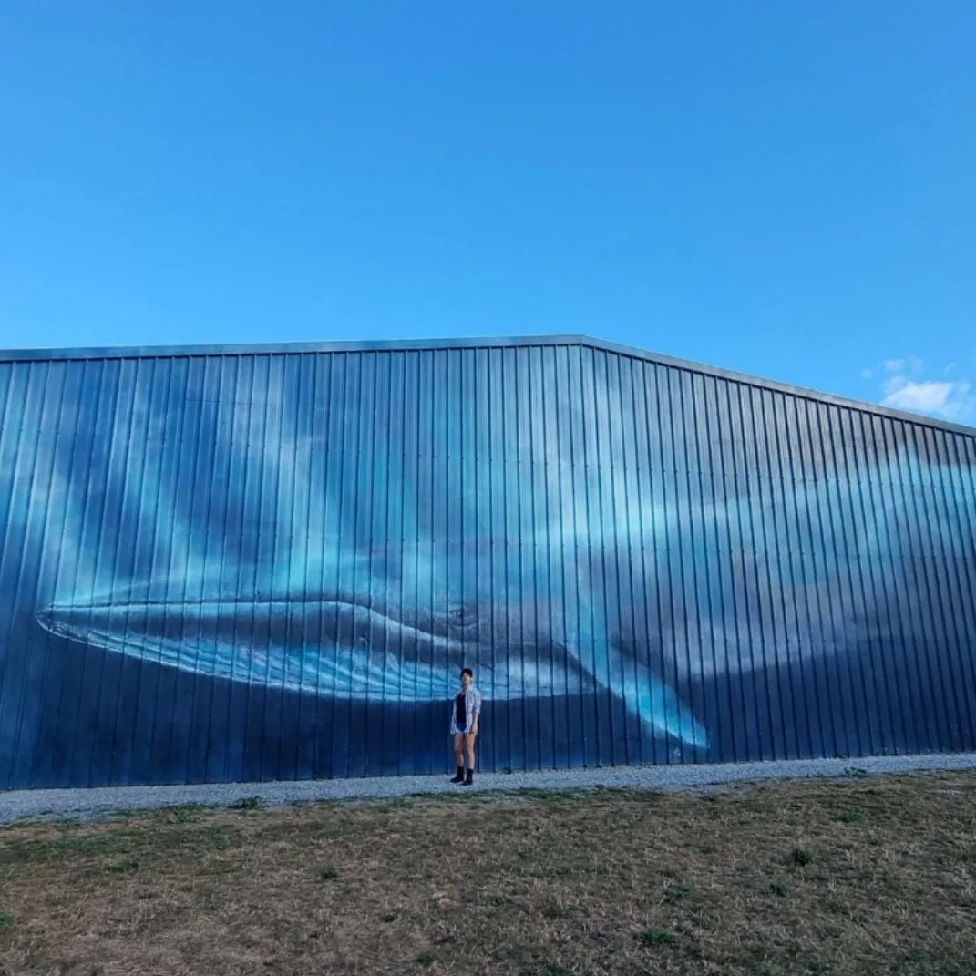
The Whale – La Rochelle Airport, France
Content warning: Street Artist Sandrot By Sandrot at La Rochelle Airport in France. Photos by Olivier Blanchet. Comments: pic.twitter.com/g4cnHtU4vK— STREET ART UTOPIA 🖼️ (@StreetArtUtopia) March 30, 2022
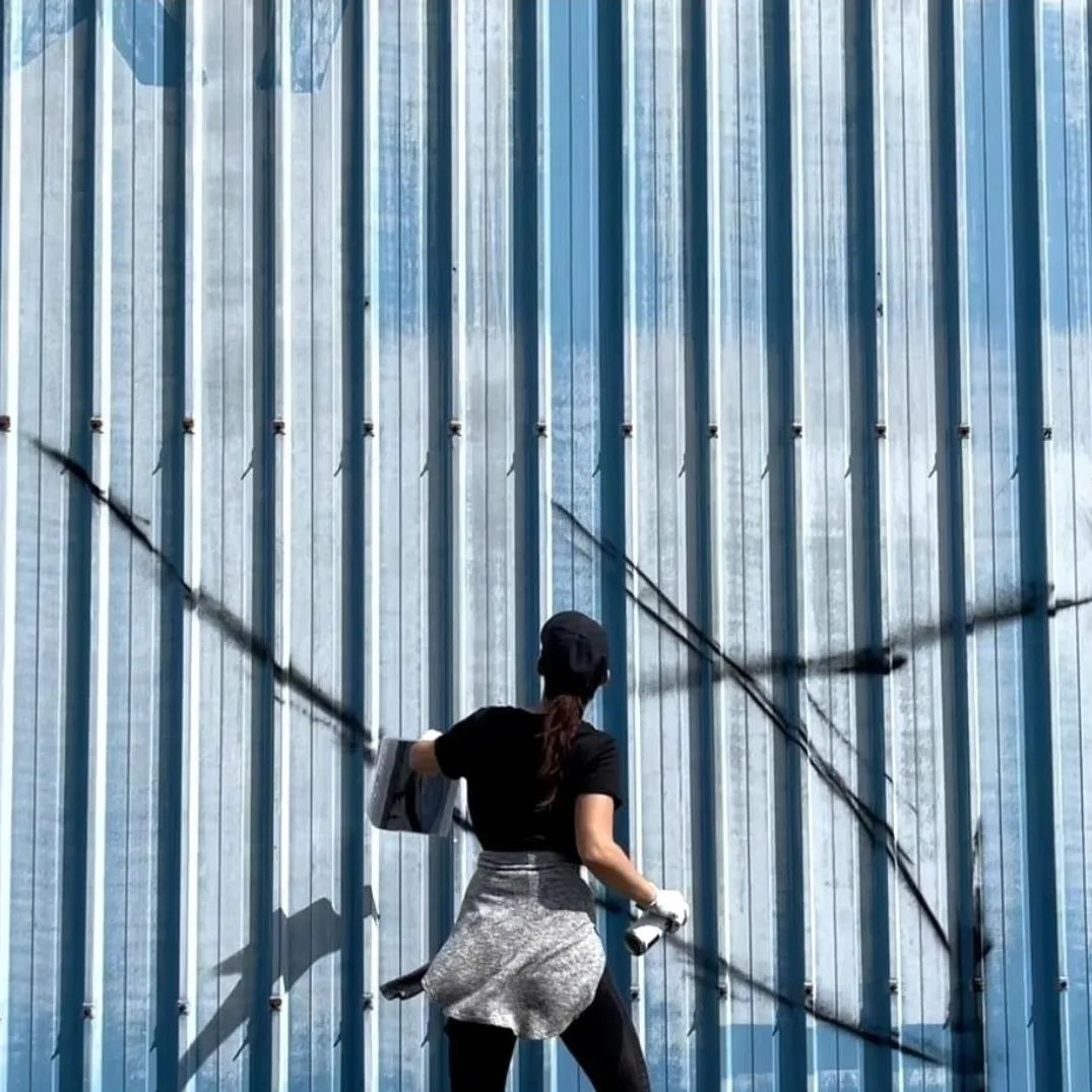
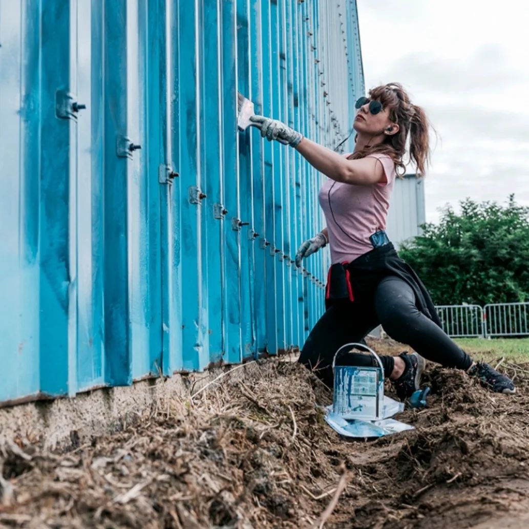
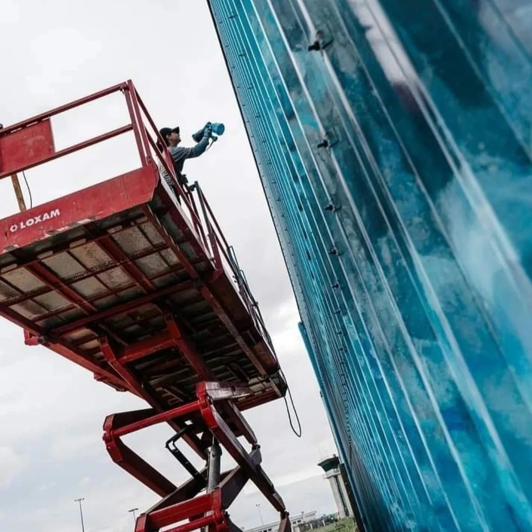

Sunny Moon
Content warning: Street Artists Arsek & Erase “Sunny Moon” by Arsek & Erase in Strasbourg, France for Colors Urban Art and help by stom500. More: Mural by Arsek & Erase in Sofia, Bulgaria (4 photos) Comments: pic.twitter.com/2U4mDtcEc0— STREET ART UTOPIA 🖼️ (@StreetArtUto
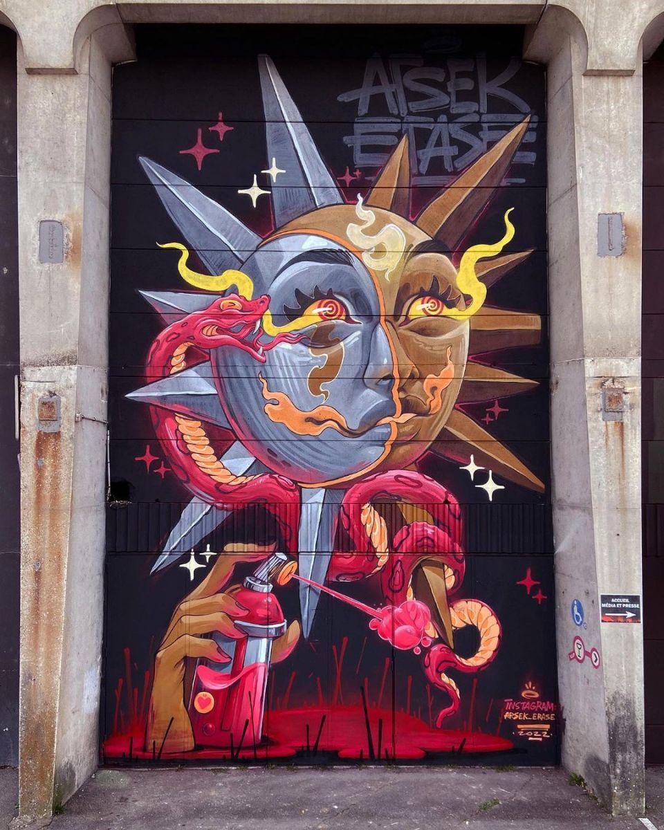
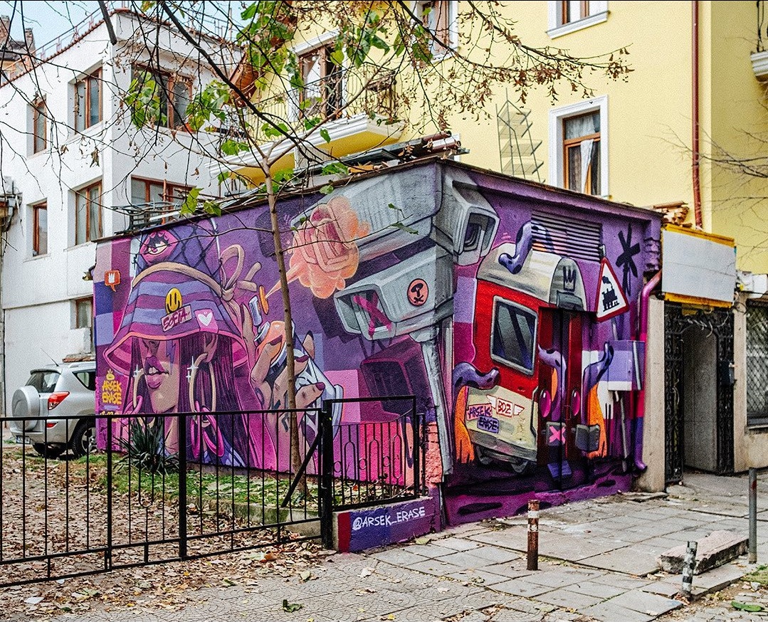
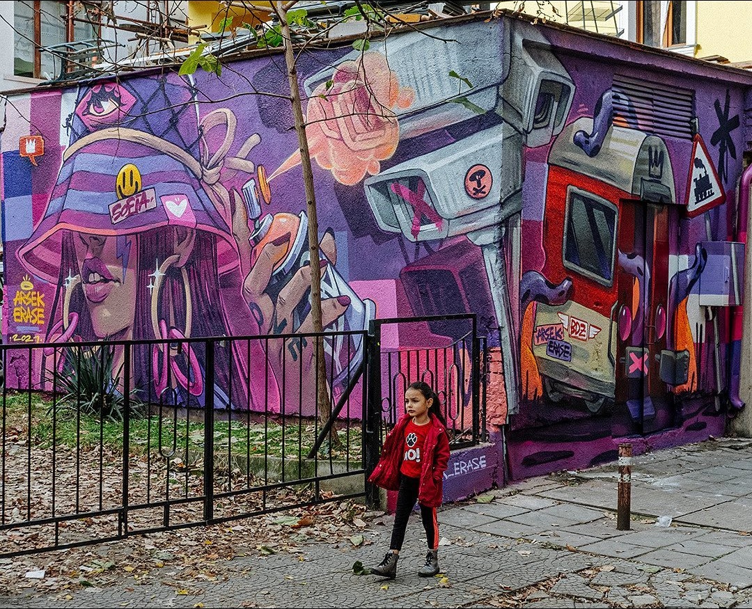
Mural by Arsek & Erase in Sofia, Bulgaria (4 photos)
Content warning: Street Artists Arsek & Erase By Arsek & Erase in Sofia, Bulgaria. It is a part from the project “City Gallery Pirtoska” curated by CITYWISE. Photos by Mihail Novakov. Comments: pic.twitter.com/zcOAW9p0hi— STREET ART UTOPIA 🖼️ (@StreetArtUtopia) January 13
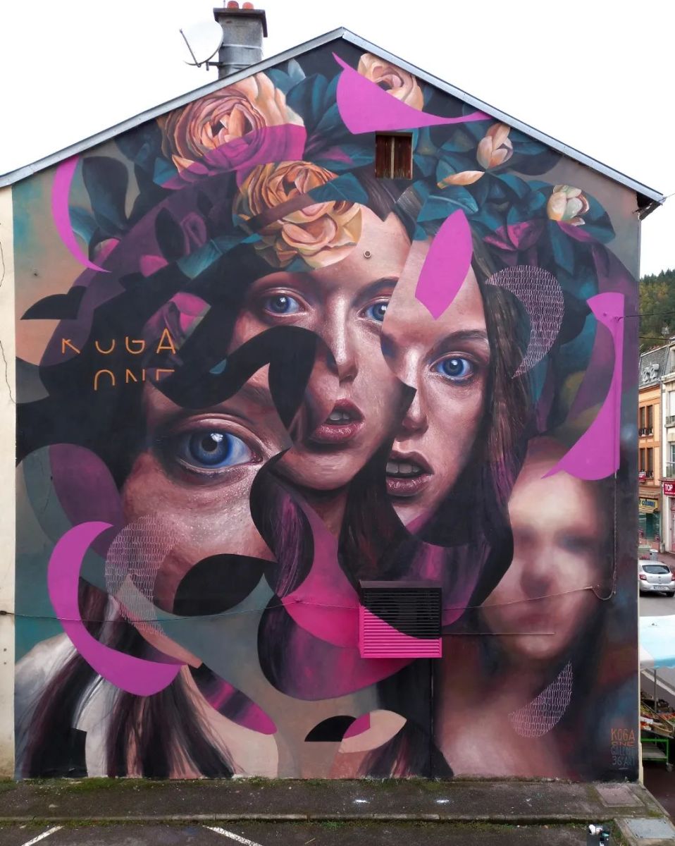
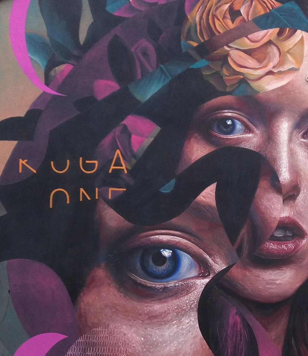
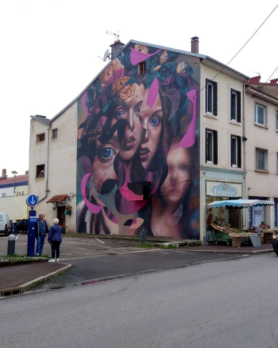
Mural by Matthieu Koga in Raon-l’Étape, France (4 photos)
Content warning: Muralist Matthieu Koga By Matthieu Koga in Raon-l'Étape, France for Galerie 36e Art.

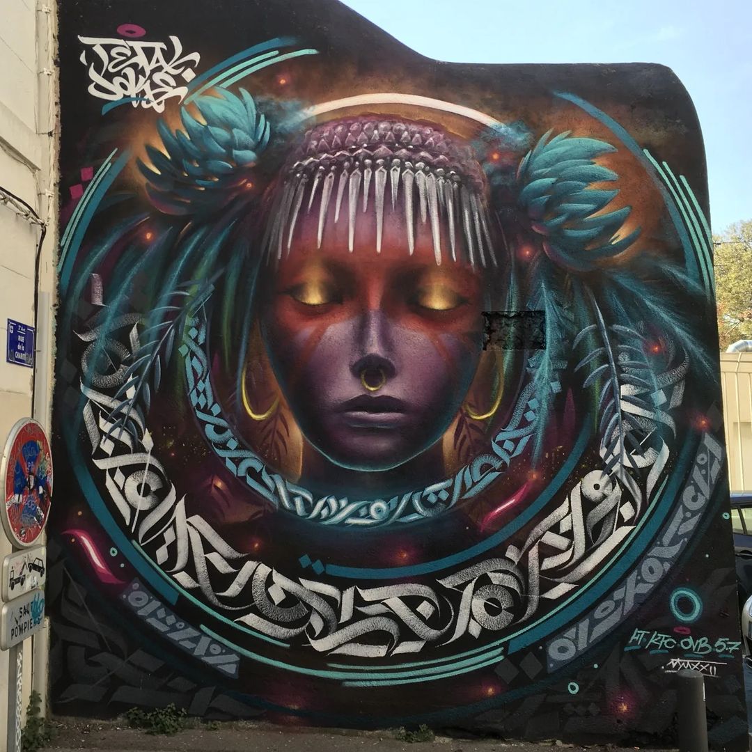
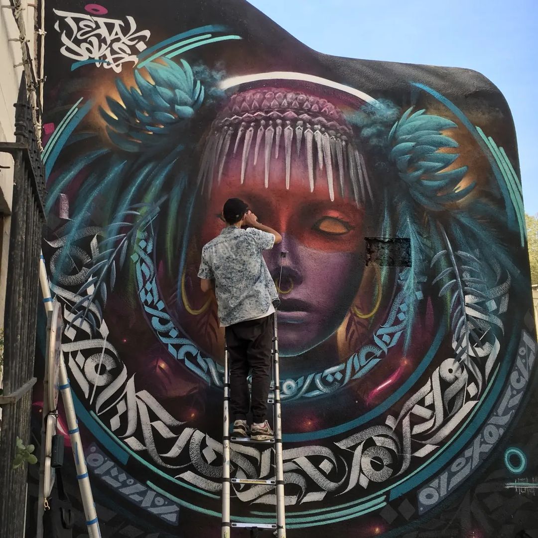
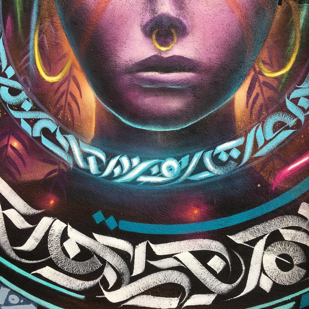
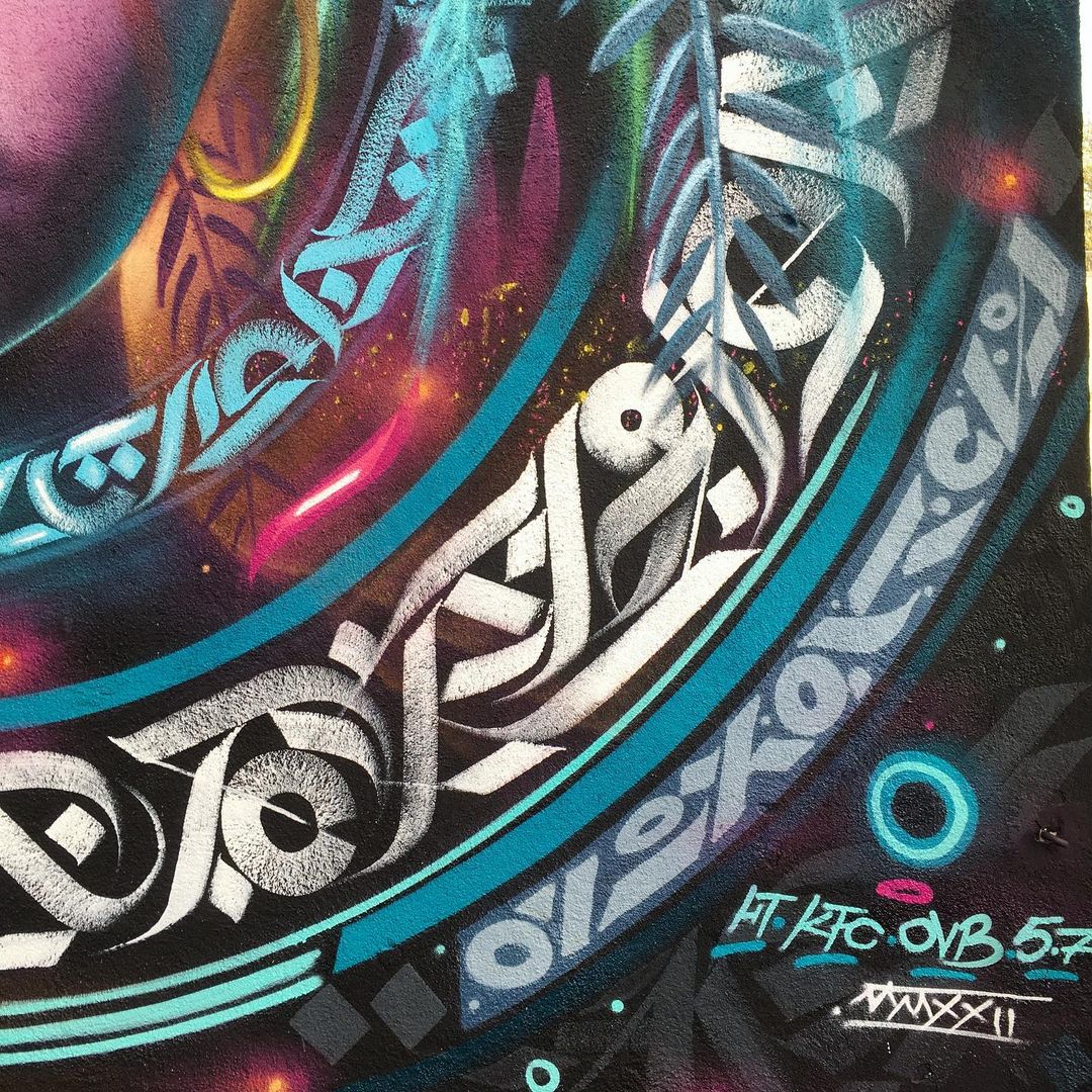
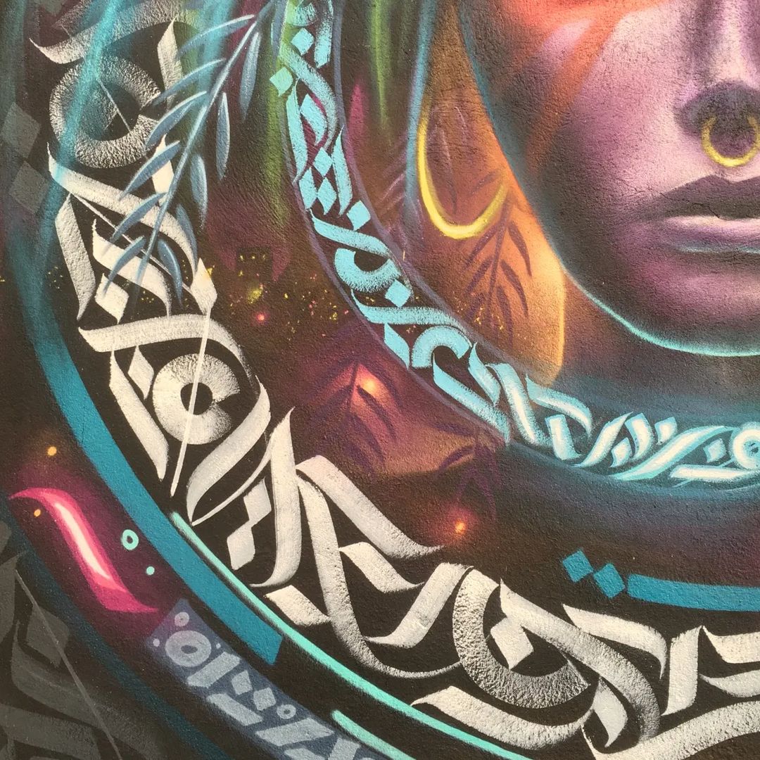
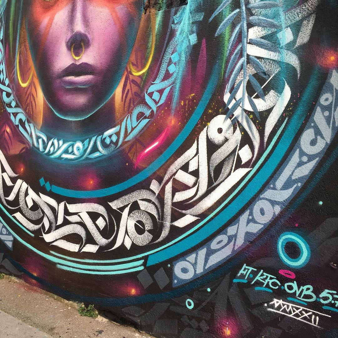
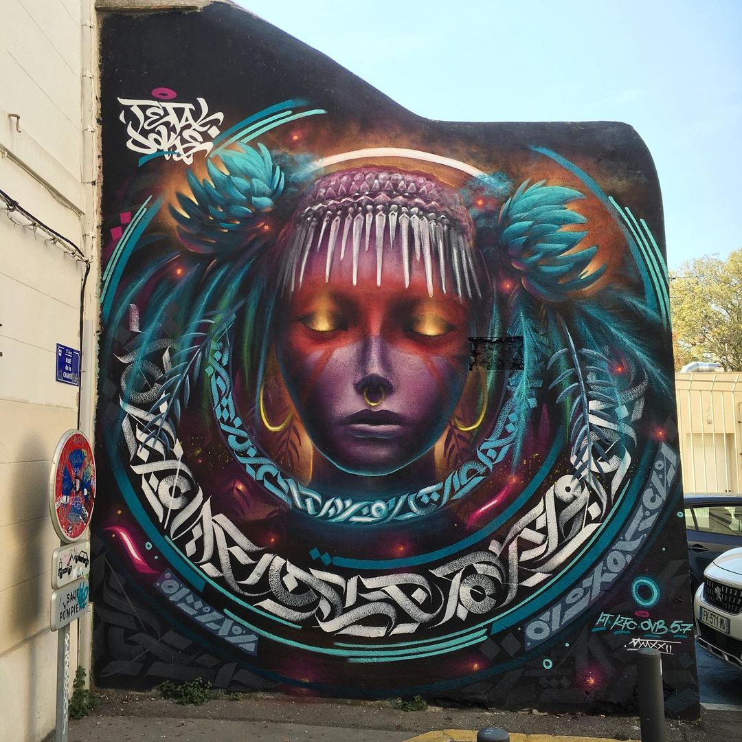
7 pics: Mural by TETAL and Nitram Joke in Marseille, France
Content warning: Street Artists TETAL and Nitram Joke By TETAL and Nitram Joke in Marseille, France. Comments: Mural by TETAL and Nitram Joke in Marseille, France7 pics: https://t.co/SNZ1gmDnQf pic.twitter.com/ZJJmTb7wxc— STREET ART UTOPIA: New Street Art and Graffiti (@t
Street Art by HERA of Herakut in Paris, France for her solo show “Strength of the fragile”
Content warning: Street Artist HERA of herakut By HERA in Paris, France for her solo show “Strength of the fragile” at Galerie Mathgoth. Photos by Elisabeth Cruz. More: HERA – Crafting Stories on Walls Around the World Comments: pic.twitter.com/znAtw1ZoPm— STREET ART UTO
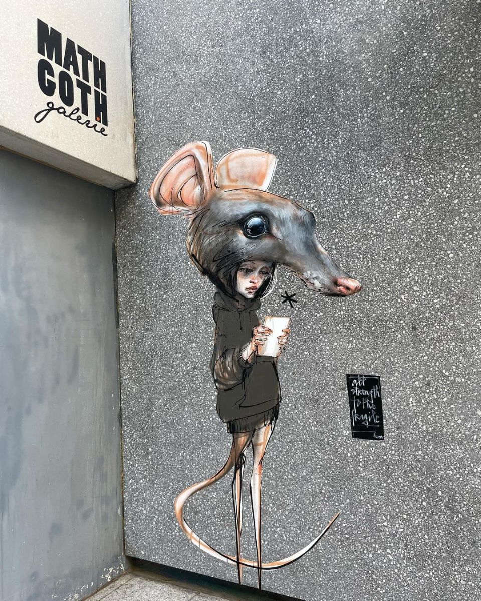
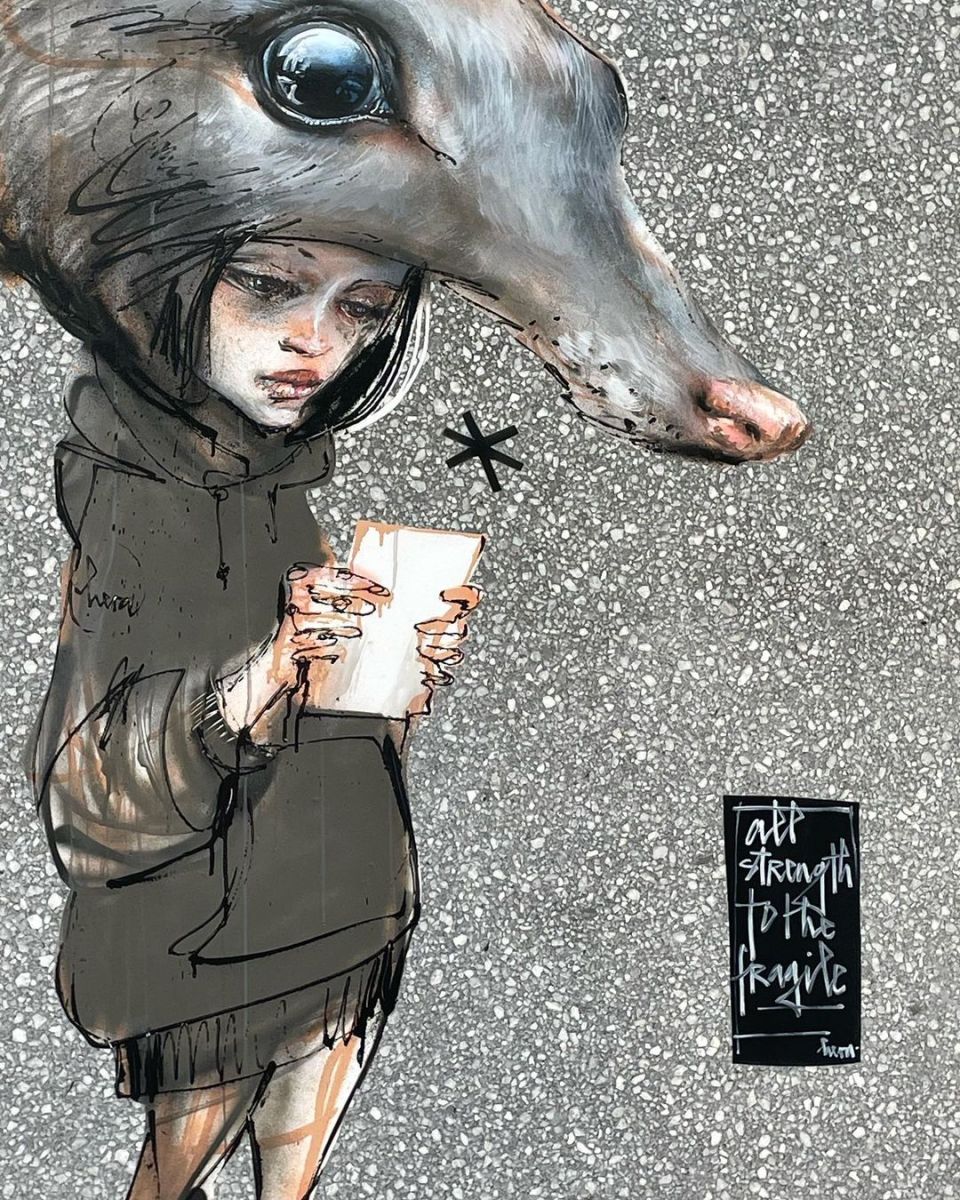
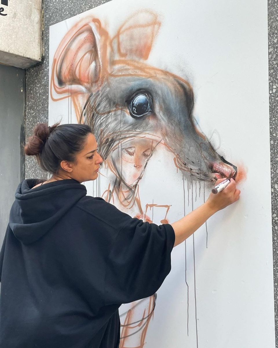
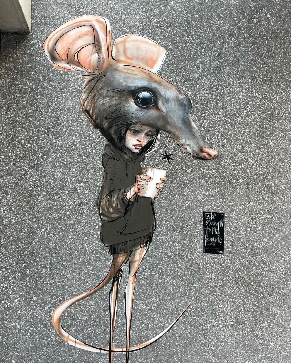
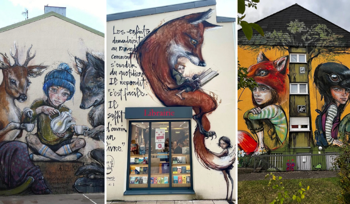
 Photo by
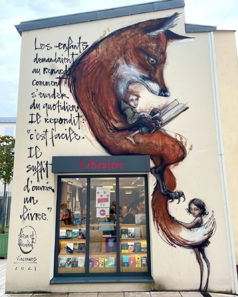
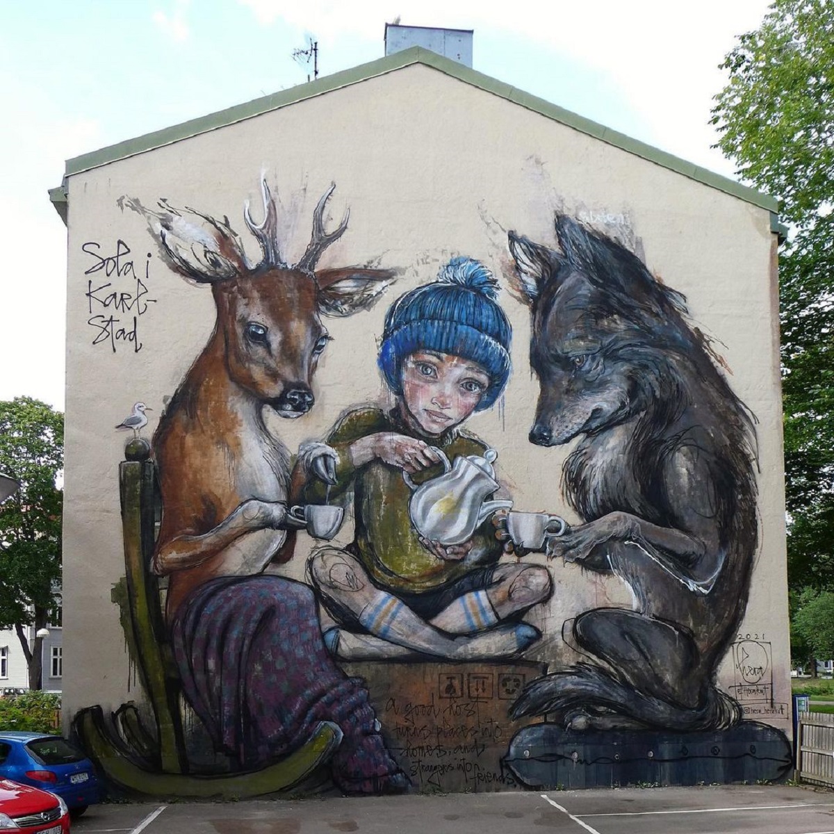 Photo by Strangefruit
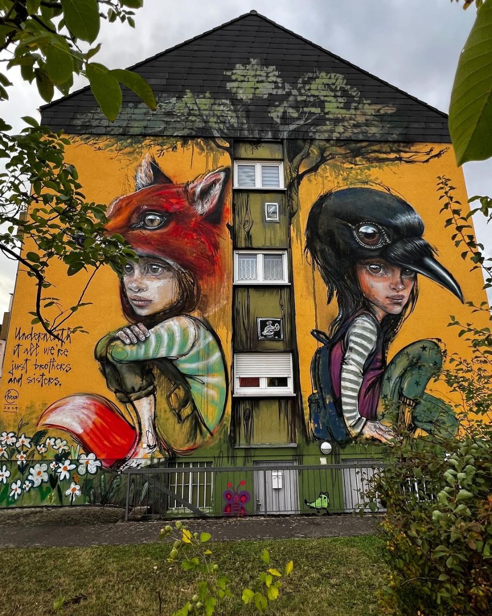
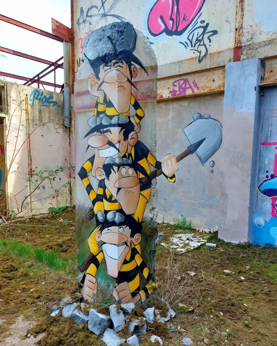
Escape! The Dalton Brothers by Blesea in Cherbourg, France
Content warning: Street Artist Blesea The Dalton Brothers after / before by Blesea in Cherbourg, Normandy, France. Comments: Escape! The Dalton Brothers by Blesea in Cherbourg, France 🇫🇷 https://t.co/LxEyhLh1pR pic.twitter.com/5THeIuFURd— STREET ART UTOPIA: New Street Art
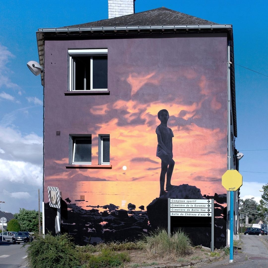
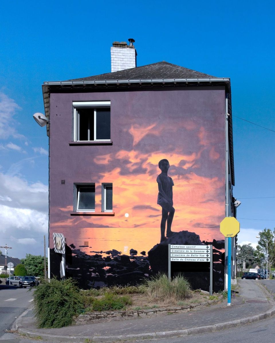
“Solace” by NEAN in Saint-Nicolas-de-Redon, France
Content warning: Street Artist NEAN “Solace” by NEAN at 2 Rue du Parc des Sports in Saint-Nicolas-de-Redon, France for GraffoTransfo – West Graffiti. Photo by Sophie. Comments:
Mural by CASE in Le Mans, France
Content warning: Photo by JUZZ Street Artist CASE By CASE in the park Gué de maulny, in Le Mans, France. At the festival Plein Champ.
 Photo by


FOR(R)EST by AÉRO in Saint-Brieuc, France
Content warning: Spray-paint and graffiti artist AÉRO By AÉRO in Saint-Brieuc, France for Just Do Paint Festival. Photo by JJ22
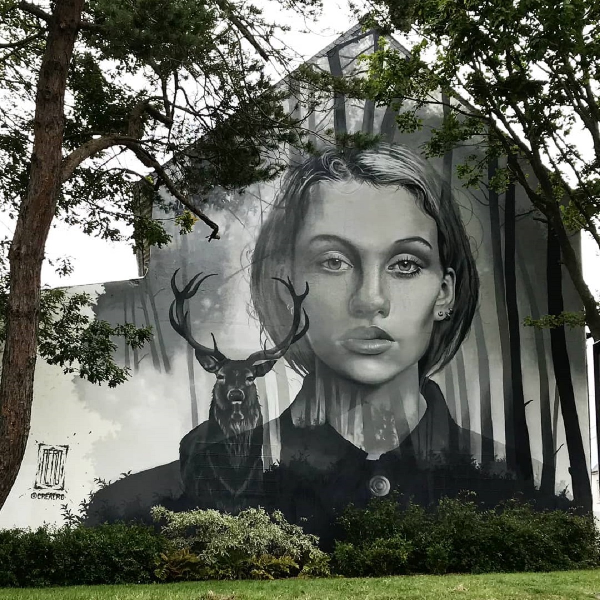
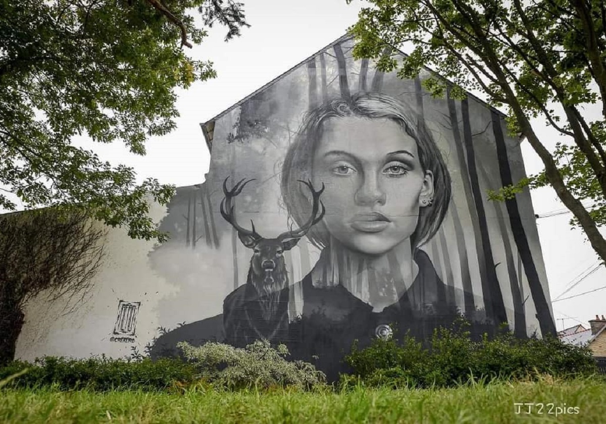 Photo by JJ22
Mural by Kalouf and Cart’1 (Villefontaine, France)
Content warning: Photo by Nicolas Ginet in Villefontaine, France By Kalouf and Cart'1 in Villefontaine, France for Les Roches en Couleur. Photo by Kalouf Photo by Nicolas Ginet in Villefontaine, France Photo by Nicolas Ginet in Villefontaine, France
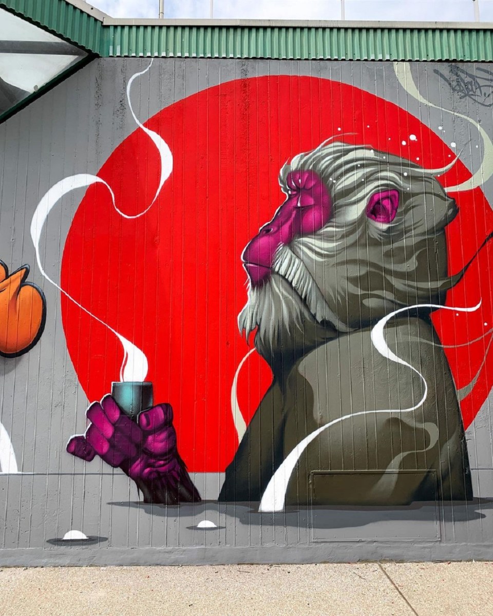 Photo by
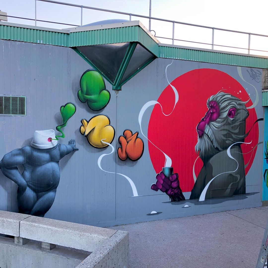 Photo by
  Photo by
 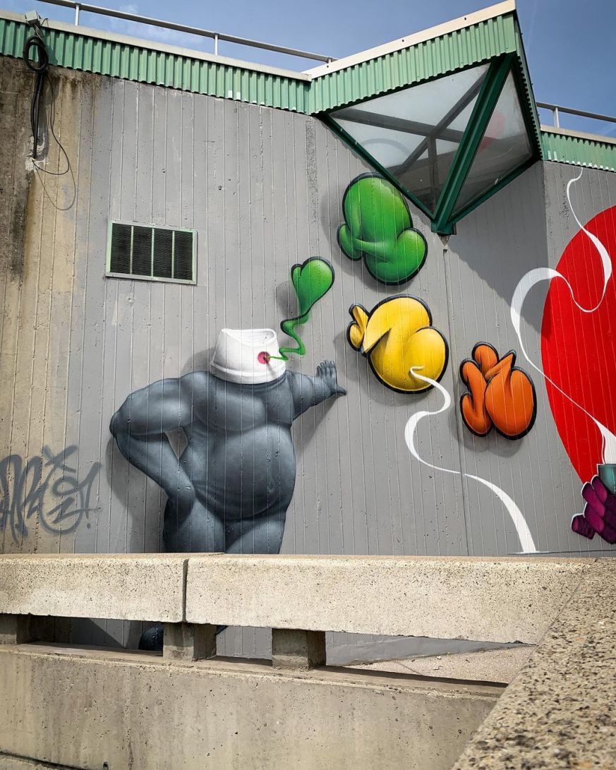 Photo by
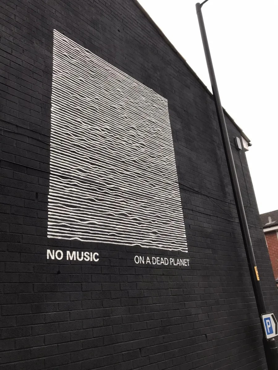
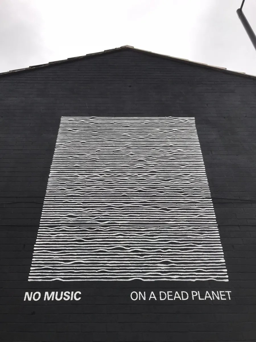
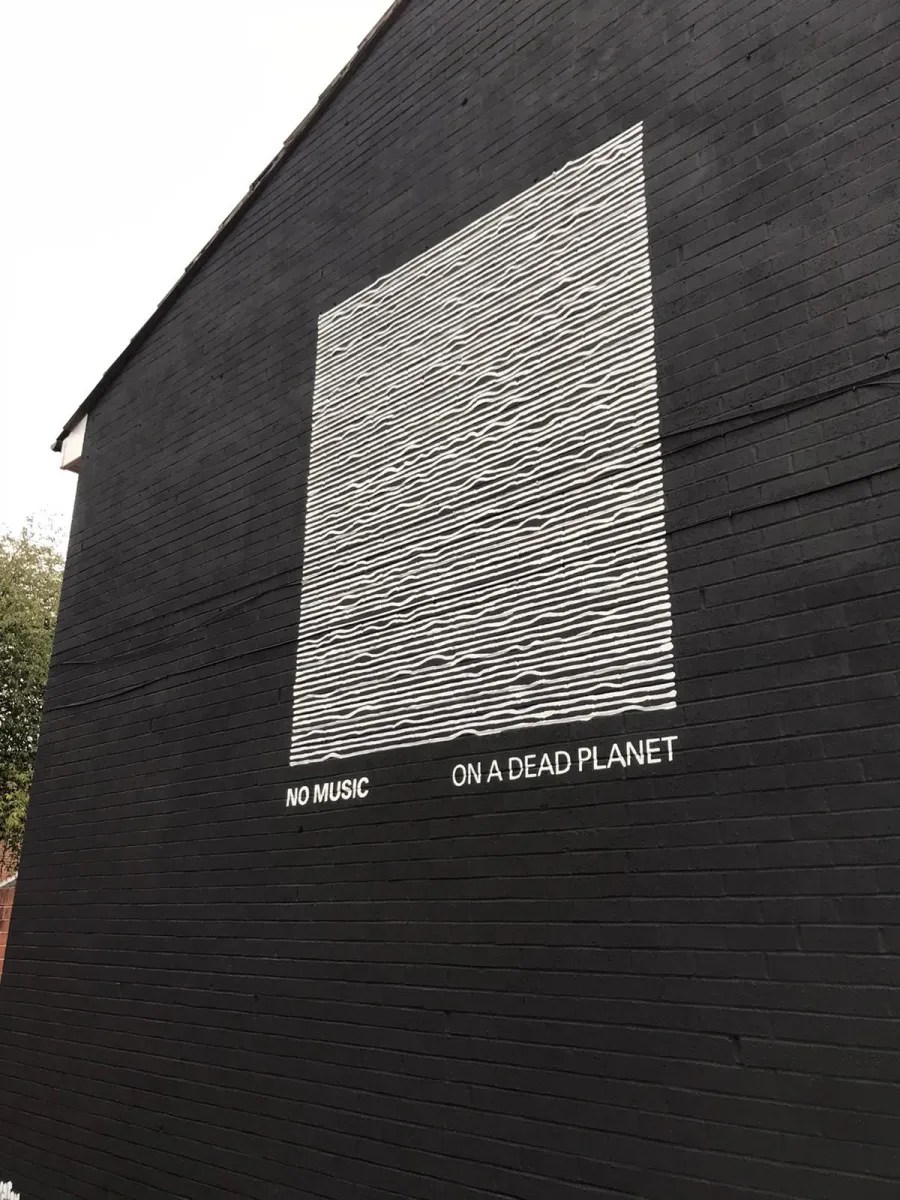
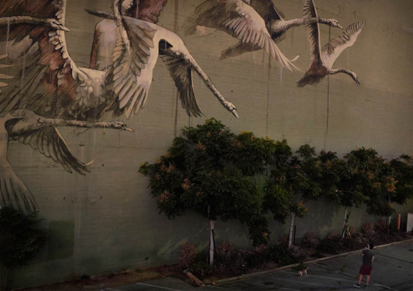
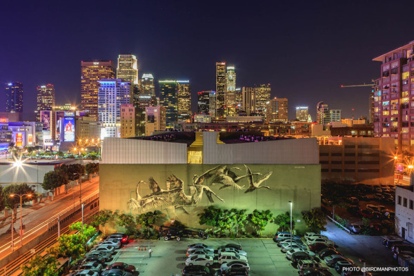
No music on a dead planet – Joy Division album cover as mural on the climate crisis
Content warning: The eternal silence of a dead planet Mural on Peter Saville album cover for Joy Division at Moorfield St in Manchester, UK. Music Declares Emergency said the mural symbolised “the eternal silence of a dead planet”. Music Declares Emergency is a group of a
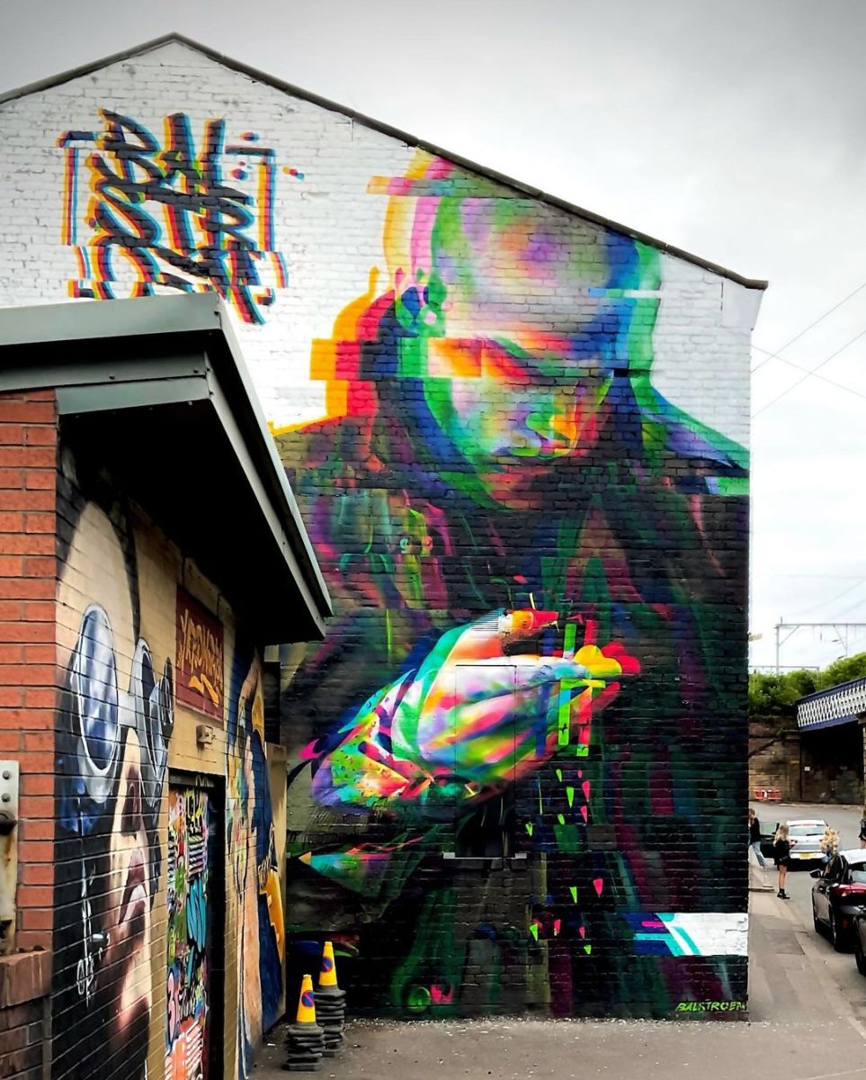
“STIMILUS” by Rasmus Balstrøm in Glasgow, Scotland
Content warning: Street Artist Rasmus Balstrøm “STIMILUS” by Rasmus Balstrøm at Yardworks in Glasgow, Scotland. “STIMILUS” by Rasmus Balstrøm in Glasgow, Scotland 🏴 pic.twitter.com/KARy8z1ctM— STREET ART UTOPIA 🖼️ (@StreetArtUtopia) June 18, 2022


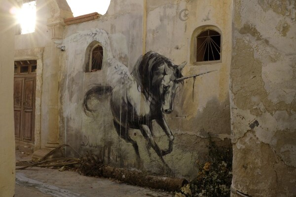
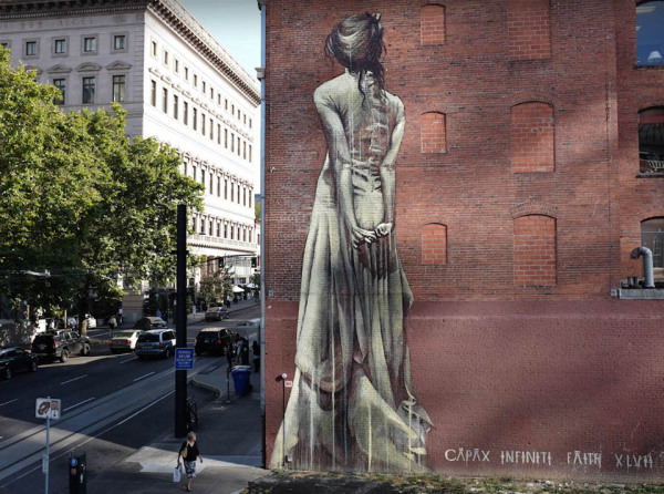
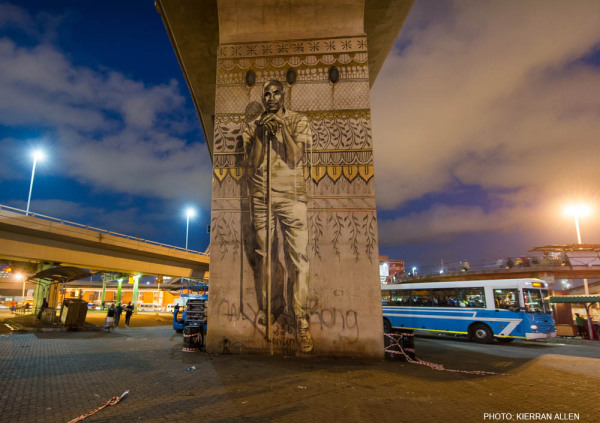
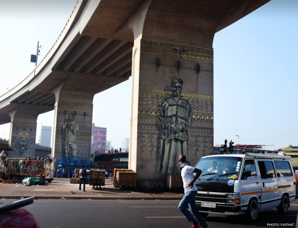
Faith47 – Photos from 2014
Content warning: On Facebook. In Tunisia. ———————————————————————— By Fait47. ———————————————————————— In Los Angeles, USA. In Los Angeles, USA. On Facebook. In Los Angeles, USA. In Portland, USA. In Aalborg, Denmark. Stare Down – In Brick Lane, London, England. Photo by


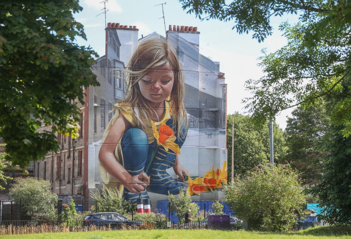
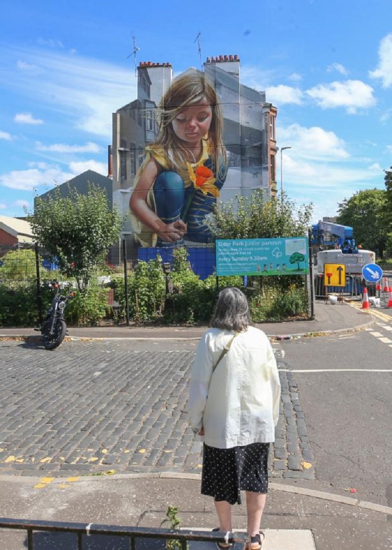
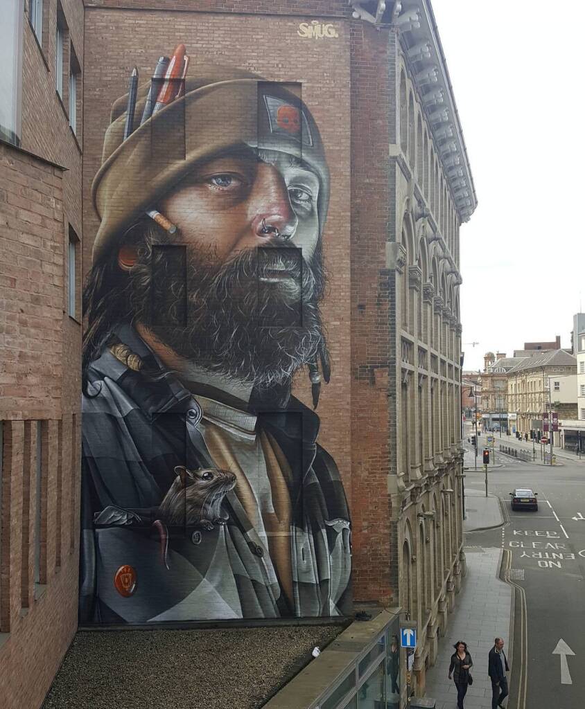
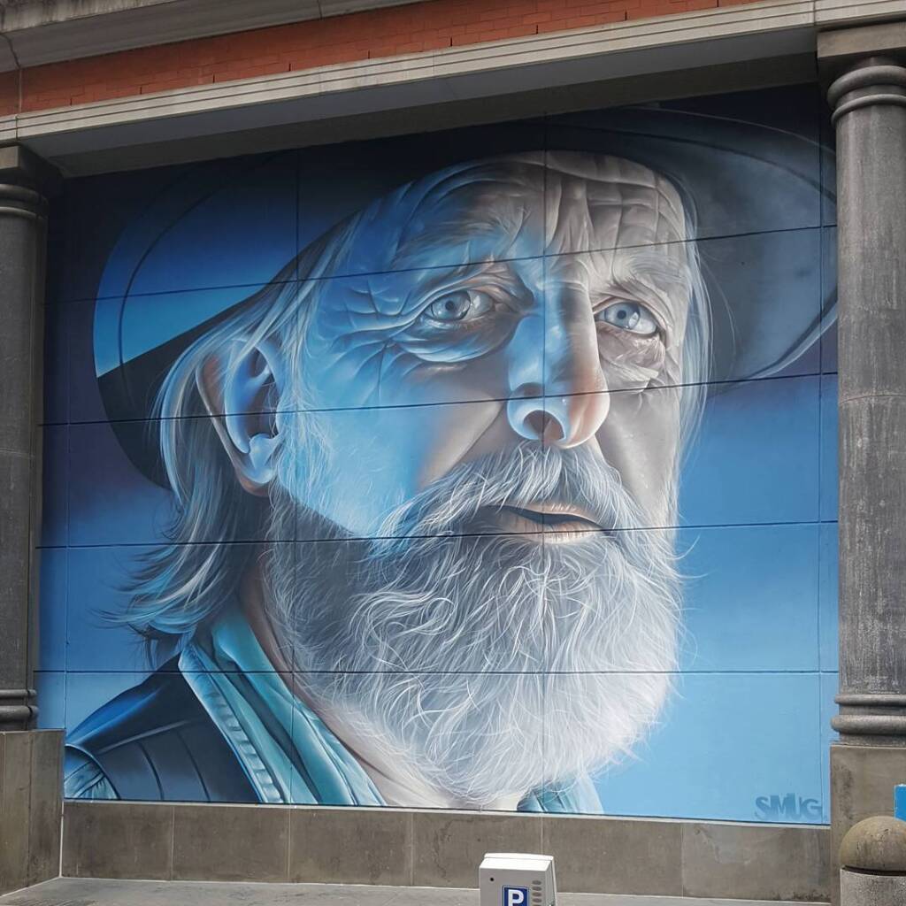
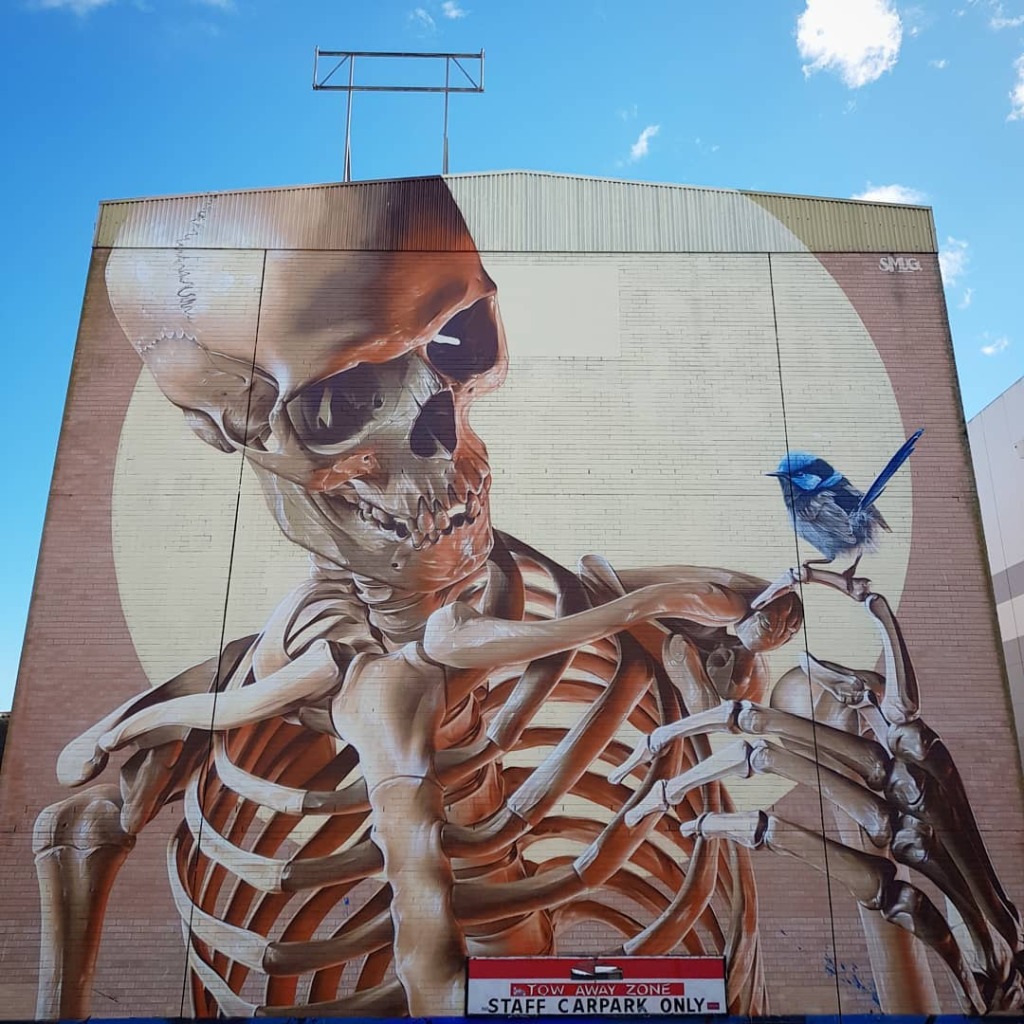
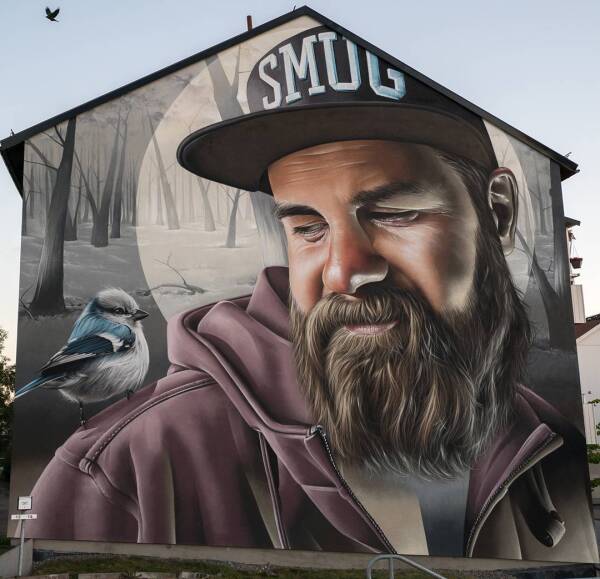
‘Daffodil King’ inspired mural in Glasgow by SMUG
Content warning: Street Artist SMUG By SMUG in Glasgow, Scotland. Photos by Gordon Terris. Glasgow's latest mural by the artist Sam Bates, aka Smug, in collaboration with the Govan Housing Association in honour of its 50th anniversary, inspired by the Govan-born ‘Daffodil