Search
Items tagged with: GIS
1-x Do you marvel at how #OpenStreetMap or #GoogleMaps can show you the street pattern, all the way to individual houses, of any random village?
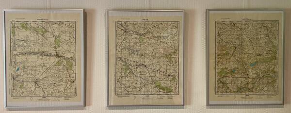
Before the age of internet mapping this required a paper map. As most people did not have easy access to detailed maps (house level maps often not available at all) we had a very different view of the world outside our direct area.
This is why I find the history of how the Soviet Union mapped the world so interesting.
GeoDesk for Python Released
We are excited to announce our first release of GeoDesk for Python: Query, analyze, display and transform OpenStreetMap features using the world’s most popular scripting language — on Windows, Linux and MacOS.GeoDesk
(English below)
Interesse in cartografie en OpenStreetMap? We houden een gezellige avond waar je kan binnenspringen om al je vragen te stellen over OpenStreetMap.
OpenStreetMap is online wereldkaart waar iedereen aan mag bijtekenen en die iedereen mag hergebruiken. Duizenden applicaties gebruiken deze data dan ook, want ondertussen is het een ongeloofelijk gedetailleerde kaart. Iedereen heeft al eens iets gebruikt waarin OpenStreetMap-data zit, al weet je het niet.
Op deze avond komen we samen om over OpenStreetMap te babbelen, tips uit te wisselen over hoe je de kaart zelf kan aanpassen, hoe je openstreetmap-gebaseerde applicaties gebruikt, ... Iedereen is welkom - van hardcore-mapper tot mensen met een lichte computer-fobie.
Deze avond worden we verwelkomd door Linux Living, die binnen Ecoliving past. Ecoliving is een eco-sociaal project die inzet op hergebruik en bewust leven - de benedenverdieping is dan ook een echte tweedehandswinkel en volgestouwd met spullen die een tweede leven zoeken. Daarnaast gaat de Ecoliving ook voedseloverschotten ophalen om deze te herverdelen. Kortom, er is altijd wel een (vervallen) knabbeltje of drankje. Op de eerste verdieping is er plaats voor de Linux Living, een gezellige ruimte waar elke twee weken wordt samengekomen om met Open Source te experimenteren en om oude computers een nieuw leven te geven met Linux. Deze donderdag stellen ze hun deuren open voor de OpenStreetMap-community.
English
Interested in cartography and OpenStreetMap? The Linux User Group Linux Living welcomes the OpenStreetMap-community this thursday. We will gather for an informal talk about everything concerning OSM, such as how to edit it yourself, how to use some applications, ...
Everyone is welcome, from total beginner to expert.
LinuxLiving is a biweekly gathering of OpenSource enthusiasts in Bruges. They operate within EcoLiving, a social and ecological project which strives to reuse as much as possible.
Note that LinuxLiving is normally a Dutch speaking place. However, most do speak English too, we'll switch to English if needed.

