Speaking of micromapping, here's a bonus #30DayMapChallenge for today's theme.

It's not comprehensive, but I want you to know that in Plano, IL, we map out the manholes. There should be a "so far" in the title, I guess.
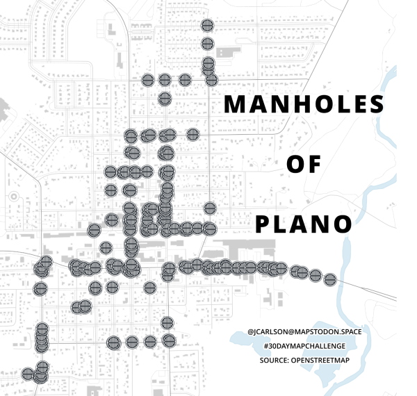
A street map titled "manholes of Plano". Manhole positions are indicated by little manhole lookalike icons.
sidenote: dunno about other countries but in #hungary manholes are the reference points for most public service company mapping purposes (like water, gas, sewer etc.). Their elevation and coordinates are usually good enough for an official building permit.
@grin I wish that were the case over here. The city in this map doesn't even have GIS, so if they have detailed information about their manholes, it'd be in some file cabinet somewhere, if at all.
@grin
the same was the case here. I had to xerox the papers to get the official data back then in 2010. In fact I don't have the accuracy to measure with the required precision even now, when I am using (non-professional-grade) RTK. It is only 10-25 cm precise on XY and I don't know what on the Z axis (especially since there are various zero points for that).